WBBSE solutions For Class 7 Geography Chapter 4 Landforms Topic B Plateaus

Chapter 4 Landforms Topic B Plateaus Analytical Type Questions

Question 1. Classify plateaus with examples.
Answer:

Classification of plateaus:

Based on their origin, plateaus can be classified into three categories. These are-

1. Tectonic plateau:

Tectonic plateaus are formed as a result of tectonic movements that cause an uplift of the crust.

Example: Bolivian Plateau.

2. Volcanic plateau:

Volcanic plateaus are formed due to the solidification of lava which emerges from fissures in the Earth’s crust.

Example: Deccan Plateau of India.

WBBSE Solutions For Class 7 Geography

3. Dissected plateau:

Dissected plateaus are formed due to the continuous process of weathering and erosion.

Example: Chhotanagpur Plateau of India.

Based on their location, plateaus can be classified into another three types.

These are-

1. Intermontane plateau:

An intermontane plateau lies between mountain ranges. This type of plateau extends alongside the mountains and are generally among the highest plateaus of the world.

Example: Tibet Plateau.

2. Piedmont plateau:

A Piedmont plateau lies at the foot of a mountain and is generally bounded on other sides by a plain or an ocean.

Example: Colorado Plateau.

3. Continental plateau:

A continental plateau rises abruptly from the plains. It is formed either by an extensive continental uplift or by the spread of less viscous lava that covers the primary topography entirely to a great depth.

Example: Plateau of Africa.

Question 2. Discuss the influence of plateaus on human life.
Answer:

Influence of plateaus on human life:

Plateaus greatly influence human life in various observable ways. Some of them are discussed below-

1. Source of minerals:

As the plateaus are made up of igneous rocks, they are rich in minerals. So, the plateau regions act as an important natural source of raw materials for different industries.

2. Generation of hydroelectricity:

Rivers while flowing over plateau regions are quite swift and for this reason, hydroelectricity can be generated from these rivers.

3. Difficulty in cultivation:

As the surface of the plateau regions are rugged and stony, cultivation of crops is difficult in these areas. Agricultural activities are carried out only near the banks of the rivers.

4. Moderate population density:

The transport system is more developed and life is much easier in plateau regions than in mountainous regions. So, the population density in these regions is moderate.

5. Development of metal-based industries:

As minerals are abundantly found in plateau regions, metal-based industries have extensively developed in these regions.

6. Development of tourist spots:

The natural beauty of areas around plateaus helps these to be recognised as famous tourist spots.

Chapter 4 Landforms Topic B Plateaus Short Analytical Type Questions

Question 1. What are the causes for the origin of a plateau?
Answer:

Plateaus originate mainly due to three reasons. They are as follows-

1. Tectonic movement:

Due to tectonic movement, the old landmasses on the Earth’s surface get separated from each other and increase in height, forming a plateau.

Example: Deccan Plateau, Arabian Plateau.

2. Natural erosional forces:

The natural erosional forces or exogenic forces like the Sun’s heat, wind, river, glacier, etc. gradually erode the surface of a mountainous region or any other highland to form a flat-topped region resulting in a plateau.

Example: Chhotanagpur Plateau.

3. Deposition of lava:

The magma that comes out from the Earth’s interior is gradually deposited as lava on its surface forming a plateau.

Example: The north-western part of the Deccan Plateau in India is a lava plateau and is known as the Deccan Trap.

Question 2. What are the characteristics of a plateau?
Answer:

The characteristics of a plateau are as follows-

1. Height:

The average height of a plateau is generally 300-600 metres above sea level. However, some plateaus also have higher elevations.

2. Expanse:

Plateaus generally extend over large areas.

3. Flat top:

The top of a plateau is somewhat wavy or flat. It looks mostly like a table i.e. vertical slopes all around with a flat top.

4. Formation of a dissected plateau:

Sometimes a large plateau gets eroded by natural forces like rain, river water, etc. and is divided into a number of smaller plateaus forming a dissected Plateau.

5. Presence of hills:

There are many small hills on top of a plateau.

Example: Rajmahal Hills on Chhotanagpur Plateau.

Question 3. What is an intermontane plateau?
Answer:

Intermontane plateau:

During the formation of fold mountains due to tectonic movement, the region between parallel mountain ranges rises to form a plateau as a result of the lateral pressure.

This type of plateau surrounded by mountains on all sides is called an intermontane plateau.

Example:

Tibetan Plateau (between the Himalayan and Kunlun mountain ranges), Anatolian Plateau (between the Pontic and Taurus mountain ranges), Iranian Plateau (between the Elbrus and Zagros mountain ranges), etc.

WBBSE solutions For Class 7 Geography Chapter 4 Landforms Topic B Plateaus Intermontane plateau

Question 4. What are the characteristics of a laya plateau?
Answer:

The characteristics of a lava plateau are as follows-

  1. Type of rock: A lava plateau is generally formed of black basaltic rocks.
  2. Upper surface: The upper surface or the top of this plateau tends to be plain or a little wavy.
  3. Nature of erosion: These plateaus get less eroded as they are formed by hard igneous rocks.
  4. Associated feature: The margins of a lava plateau gradually descend in the form of steps or stairs. So, the other name of the north-western part of the Deccan Plateau is Deccan Trap. (Here the word ‘trap’ means step or stair).

Question 5. What is a dissected plateau?
Answer:

Dissected plateau:

Different exogenic forces like rivers, wind, glaciers etc. gradually erode the surface of old plateaus resulting in a decrease in their heights.

The rivers, their tributaries and distributaries erode the plateau region along their valleys and divide it into many smaller parts. Thus, when an extensive plateau region gets divided into many narrow valleys, the whole plateau is called a dissected plateau.

Example: Chhotanagpur Plateau, Mysore Plateau of Karnataka etc.

WBBSE solutions For Class 7 Geography Chapter 4 Landforms Topic B Plateaus Dissected plateau

Question 6. Why are plateau regions rich in minerals?
Answer:

Plateau regions rich in minerals:

The plateau regions are rich in minerals, because of the following reasons-

  1. Plateaus are mostly formed of old igneous and metamorphic rocks. These rocks are rich in minerals and so are the plateaus.
  2. Due to intense pressure and temperature, similar types of minerals become recrystallised during metamorphosis and some commercially useful minerals are formed. As the Chhotanagpur Plateau is rich in minerals, it is called the ‘Storehouse of Minerals’ in India.

Chapter 4 Landforms Topic B Plateaus Short Answer Type Questions

Question 1. What is a plateau?
Answer:

Plateau:

An extensive landform which is more than 300 metres high, has steep slopes on all sides and has a flat or slightly wavy plane at the top is called a plateau.

Examples: Tibetan Plateau, Brazilian Plateau, and Chhotanagpur Plateau.

Question 2. Why is a plateau also called ‘tableland’? Or What is a tableland?
Answer:

As the top of a plateau is flat-like or a little wavy with steep slopes and resembles the shape of a table, a plateau is also referred to as a tableland.

Question 3. What is a lava plateau?
Answer:

Lava plateau:

Often magma from the interior of the Earth, emitted from any fissure or weak zone in the crust as a lava flow, gets deposited in layers on the Earth’s surface.

These lava flows gradually cool down, accumulate, solidify and rise in height to form a lava plateau.

Example: Deccan Trap (the north-western part of the Deccan Plateau in India).

WBBSE solutions For Class 7 Geography Chapter 4 Landforms Topic B Plateaus lava plateau

Question 4. What is a continental plateau?
Answer:

Continental plateau:

Sometimes due to the tectonic movement, old landmasses on the Earth’s surface separate from each other forming a continental plateau.

Example: Canadian Shield, Arabian Plateau.

Question 5. Briefly describe the Tibetan Plateau.
Answer:

Tibetan Plateau:

The Tibetan Plateau is the largest intermontane plateau in the world. Its average height is around 3655 metres. This plateau is located in China and lies between the Himalayan and Kunlun mountain ranges.

The plateau extends over an area of about 25 lakh square km.

Question 6. Give a brief description of the Pamir Plateau.
Answer:

Pamir Plateau:

The Pamir Plateau is mostly situated in Tajikistan in Central Asia. This plateau has approximately flat top and vertical slopes all around. (i.e. resembles the shape of the roof of a house).

The average height of this plateau is nearly 4873 metres. Pamir Plateau is also known as the ‘Roof of the World’ because it is the highest plateau in the world.

Chapter 4 Landforms Topic B Plateaus Multiple Choice Questions Choose The Correct Option

Question 1. An area of highland with a steep slope and flat terrain, resembling the shape of a table is called a-

  1. Plain
  2. Plateau
  3. Mountain

Answer: 2. Plateau

Question 2. A plateau is also referred to as a

  1. Tableland
  2. Hinterland
  3. Polderland

Answer: 1. Tableland

Question 3. Chhotanagpur Plateau is an example of a/an-

  1. Intermontane Plateau
  2. Lava Plateau
  3. Dissected Plateau

Answer: 3. Dissected Plateau

Question 4. The lava plateau in Maharashtra is also known as the-

  1. Malwa Plateau
  2. Bundelkhand Plateau
  3. Deccan Trap

Answer: 3. Deccan Trap

Question 5. The Tibetan Plateau is an example of a/an-

  1. Dissected Plateau
  2. Lava Plateau
  3. Intermontane Plateau

Answer: 3. Intermontane Plateau

Question 6. Which plateau is also known as the ‘Roof of the World’?

  1. Ladakh Plateau
  2. Tibetan Plateau
  3. Pamir Plateau

Answer: 3. Pamir Plateau

Question 7. The largest plateau in the world is the-

  1. Pamir Plateau
  2. Tibetan Plateau
  3. Arabian Plateau

Answer: 2. Tibetan Plateau

Question 8. The height of the Pamir Plateau is-

  1. 4873 m
  2. 8848 m
  3. 2000 m

Answer: 1. 4873 m

Question 9. Which of the following is a plateau of northern India?

  1. Chhotanagpur Plateau
  2. Ladakh Plateau
  3. Malwa Plateau

Answer: 2. Ladakh Plateau

Chapter 4 Landforms Topic B Plateaus Very Short Answer Type Questions Fill In The Blanks

Question 1. A plateau is also known as a ________.
Answer: Tableland

Question 2. The top of a plateau is ________.
Answer: Flat

Question 3. The largest intermontane plateau in the world is the ________ Plateau.
Answer: Tibetan

Question 4. ________ plateau is situated between Kunlun and the Himalayan mountain range.
Answer: Tibetan

Question 5. Greenland is occupied by ________ plateaus.
Answer: Continental

Question 6. Lava plateau is formed due to ________ eruption.
Answer: Fissure

Question 7. Malwa Plateau is a type of ________ plateau.
Answer: volcanic

Question 8. The plateau which has been divided by several river valleys is called a ________ plateau.
Answer: Dissected

Question 9. The world’s largest plateau is the ________ Plateau.
Answer: Tibetan

Question 10. The ________ Plateau is also known as the ‘Roof of the World’
Answer: Pamir

Write True Or False

Question 1. A plateau is also referred to as a tableland.
Answer: True

Question 2. The highest plateau in India is the Pamir Plateau.
Answer: True

Question 3. The Tibetan Plateau is an example of an intermontane plateau.
Answer: True

Question 4. Deccan Trap is an example of a lava plateau.
Answer: True

Question 5. The Arabian Plateau is an example of a continental plateau.
Answer: True

Question 6. Mining activities have developed in the plateau regions.
Answer: True

Question 7. Plateaus are generally over 600m high.
Answer: False

Question 8. Dissected plateaus are formed due to the continuous process of weathering and erosion.
Answer: True

Question 9. The plateau region of West Bengal is a part of the Malwa Plateau.
Answer: False

Chapter 4 Landforms Topic B Plateaus Match The Columns

1. WBBSE solutions For Class 7 Geography Chapter 4 Landforms Topic B Plateaus Match the columns

Answer: 1. D, 2. C, 3. B, 4. A

Answer In One Or Two Words

Question 1. What is a flat-topped highland with a steep slope known as?
Answer: Plateau.

Question 2. What is a tabular landform surrounded by mountains on all sides known as?
Answer: Intermontane plateau.

Question 3. Name the tabular landform located between the Himalayan range in the south and Kunlun range in the north.
Answer: Tibetan  Plateau.

Question 4. What is the name given to a tabular landform that undergoes severe erosional activity for a long time, resulting in sharp relief and transforming into several hills?
Answer: Dissected plateau.

Question 5 Which exogenetic force acts the most to form dissected plateaus?
Answer: River.

Question 6 Which type of plateau forms due to volcanic eruption?
Answer: Lava plateau or volcanic plateau.

Question 7. Which is the largest plateau in India?
Answer: Deccan Plateau.

Question 8. Which is the highest plateau in India?
Answer: Ladakh Plateau.

Question 9. Which highland is known as the ‘Roof of the World’?
Answer: Pamir Plateau.

WBBSE Solutions For Class 7 Geography Chapter 2 Determination Of The Location Of A Place On The Earths Surface Topic B Meridians Of Longitude

Chapter 2 Topic B Meridians Of Longitude Analytical Type Questions

Question 1. How do we determine the exact location of a place on the Earth’s surface? Or, Determine the location of a place on the Earth’s surface with the help of latitude and longitude. Or, How do you determine the location of a place on the Earth’s surface with a suitable diagram?
Answer:

Determination of the location of a place on the Earth’s surface with the help of latitude and longitude:

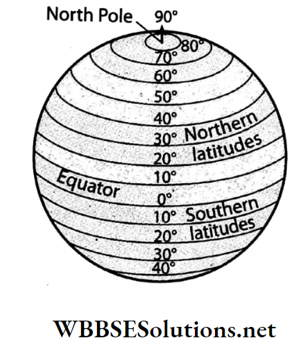
Our Earth is a spherical body and to determine the location of any place on its surface, we have to determine the angular distance of the parallel i.e. latitude and angular distance of the meridian, i.e longitude of that place from the centre of the Earth.

The parallels are imaginary circular lines drawn horizontally around the Earth, oriented in an east-west direction, while the meridians are imaginary semi-circular lines extending from north to south.

WBBSE Solutions For Class 7 Geography

So the parallels and meridians intersect each other perpendicularly forming a geographic coordinate system. The location of any place on the Earth’s surface can be determined with the help of this grid or geographic coordinate system.

Example-The location of Kolkata is (22°34’N, 88°30’E) i.e. the intersection point of 22°34′ north parallel and 88°30′ east meridian is the actual location of Kolkata on the Earth’s surface.

WBBSE Solutions For Class 7 Geography Chapter 2 Topic B Meridians Of Longitude Location of a [place using latitude and Longitude

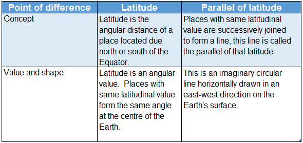
Question 2. Differentiate between the parallels of latitude and meridians of longitude. Or, Compare and contrast between the parallels of latitude and meridians of longitude.
Answer:

Difference between the parallels of latitude and meridians of longitude:

The difference between the parallels of latitude and meridians of longitude are-

WBBSE Solutions For Class 7 Geography Chapter 2 Topic B Meridians Of Longitude Differences between parallels of latitude And Meridians of longitude

Question 3. Determine the relationship between the lines of longitude and time.
Answer:

Relation between the lines of longitude and time:

Determination and calculation of time is dependent on the lines of longitude to a great extent. The reasons are discussed below-

1. Determination of noon and local time:

The Earth’s rotation causes all the lines of longitude to experience the Sun overhead at some point of the day. This overhead position of the Sun is considered as noon for that place.

The time for that particular longitude is calculated based on this noon time or 12 o’clock, midday.

2. Determination of time difference based on longitudinal difference:

The Earth covers 360° as it completes one full rotation. So, the Earth covers 360° in 24 hours, i.e., (360°/24)= 15° in 1 hour or 60 minutes. This means for every 1° difference in longitude, we experience a time difference of (60/15) 4 minutes.

Therefore, it is established that each longitude experiences a different local time.

3. Time difference with GMT:

Time is always ahead of Greenwich Mean Time towards the east and behind towards the west.

4. Calculation of time and longitude:

The longitudinal difference of the two places can be easily determined if the time difference between those two places is known.

Moreover, if the longitudes of any two places are known along with the local time of any one place, the time of the other place can be easily calculated.

Apart from this, if the local times of any two places are known along with the longitude of any one place, the longitude of the other place can be easily calculated.

Question 4. The opening ceremony of a game in New York (74°W) had been telecast at 3:44 p.m. in Karachi (67°E). At what time did the ceremony actually start in New York?
Answer:

The opening ceremony of a game in New York (74°W) had been telecast at 3:44 p.m. in Karachi (67°E).

Step 1: The calculation of longitudinal difference.

The longitudinal difference between New York and Karachi is (74°+67°) = 141°

Step 2: The calculation of the time difference. We know,

For 1° longitudinal difference, the time difference is 4 minutes

Therefore, for 141° longitudinal time difference is (141 x 4) = 564 minutes or 9 hours 24 minutes

So, the total time difference is 9 hours and 24 minutes.

Step 3: The time in New York would be behind the time of Karachi, as New York is located to the west of Karachi.

Step 4: So the time of New York would be 3:44 p.m. or 15 hours 44 minutes 9 hours 24 minutes = 6 hours 20 minutes or 6:20 a.m. Therefore, the opening ceremony of the game in New York started at 6:20 a.m. local time.

Question 5. The live telecast of the inauguration ceremony of the London Olympics started at 11:30 p.m. in India. When did the programme start in London?
Answer:

The live telecast of the inauguration ceremony of the London Olympics started at 11:30 p.m. in India.

The longitude of London = 0° Standard Meridian for Indian Standard Time = 82°30’E

Step 1: The calculation of the difference in longitude. The difference in longitude between the two places is = (82°30′- 0) = 82°30′

Step 2: The calculation of the time difference between the two places. We know,

For 1° longitudinal difference, the time difference is 4 minutes

For 82° longitudinal difference, time difference is = 82 x 4 minutes = 328 minutes

For 30′ or 30 minutes longitudinal difference, the time difference is 2 minutes

∴ The total difference in time

= 328 minutes + 2 minutes
= 330 minutes
= 5 hours 30 minutes

Step 3: The local time in London will be behind that of India because London is located due west of India.

Step 4: If the local time in India is 23 hours 30 minutes, then, the local time in London will be: 23 hours 30 minutes 5 hours 30 minutes = 18 hours or 6 p.m.

Therefore, the programme started at 6 p.m. in London.

Chapter 2 Topic B Meridians Of Longitude Short Analytical Type Questions

Question 1. What is the method for determining the longitude of a place on the Earth?
Answer:

Longitude of a place on the Earth:

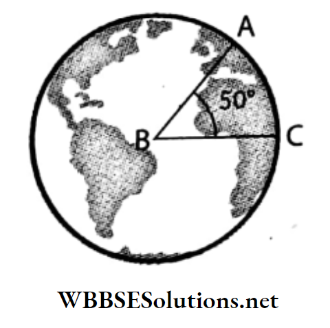
To determine the longitude of a place, for example, we have to draw a line from the point of intersection (of the Equator and the meridian of that place.) i.e., B, to the Earth’s centre (O).

WBBSE Solutions For Class 7 Geography Chapter 2 Topic B Meridians Of Longitude Determinig the longitude of a place

Similarly, another line from the intersection point (of Prime Meridian and the Equator) A to the centre of the Earth, O is drawn. The angle ZAOB formed between these two lines on the equatorial plane is the longitude of point Z.

According to the diagram, the angular distance is 80°. As point Z is located due east of the Prime Meridian, the longitude of that point is 80°E.

Question 2. What is the importance of Prime Meridian?
Answer:

The importance of Prime Meridian are-

1. Determining the hemisphere in which a place is located:

The Prime Meridian divides the Earth into two equal halves- the Eastern Hemisphere and the Western Hemisphere.

Places located due east of the Prime Meridian are in the Eastern hemisphere and those due west of the Prime Meridian are in the western hemisphere.

2. Determining the longitude of a place:

The longitude of a place on the Earth’s surface is determined by its angular distance east or west of the Prime Meridian.

3. Determining the standard time of a place:

For convenience in carrying out activities at an international level, all the countries across the globe calculate their standard time with reference to the local time of Prime Meridian i.e. the Greenwich Mean Time.

WBBSE Solutions For Class 7 Geography Chapter 2 Topic B Meridians Of Longitude Prime Meridian

Question 3. State the importance of the meridians of longitude.
Answer:

The importance of the meridians of longitude are-

1. Determining the location of a place:

The location of a place is determined by its angular distance from the centre of the Earth, east or west of the Prime Meridian.

2. Determining the local time of a place:

All the places located on a meridian experience sunrise, noon and sunset at the same time. So, the local time of a place can be easily determined with the help of a meridian.

3. International Date Line:

The imaginary line more or less the same as the 180° meridian but not a straight line is known as the International Date Line.

If we cross the date line from the eastern hemisphere to the western hemisphere, we subtract a day from our calendar while we add a day to it when we cross the date line from the western hemisphere to the eastern hemisphere.

Question 4. Narrate the experience of travelling around the Earth along the Equator and any meridians.
Answer:

Travelling around the Earth along the Equator:

The Earth rotates around its axis from west to east and it completes one rotation or 360° in 24 hours or 1 day. If an observer travels around the Earth along the Equator, he/she has to cross the meridians.

The difference in time for 1° longitude is 4 minutes due to the Earth’s rotation. So, the observer will gain an experience of change in time while travelling around the Earth along the Equator.

Travelling around the Earth along any meridian:

As the intensity of the sun rays gradually decreases from the Equator towards the Poles, the weather becomes cooler. Thus if we travel from the Equator to the Poles along any meridian, a change in weather (from hot to cold) is observed.

Question 5. What is the time difference for 1° longitude?
Answer:

Time difference for 1° longitude:

The time difference for 1° longitude is 4 minutes. As our Earth is a sphere, the sum total of the angular measures of all the meridians is 360°. It takes 24 hours (24 x 60 minutes) or 1440 minutes to complete one rotation.

So, to cover an angular distance of 1° it takes 4 minutes (1440 minutes ÷ 360).

Question 6 What is meant by local time?
Answer:

Local time:

The time in a particular place calculated by the Sun’s transit over the meridian passing through that place is referred to as its local time.

This local time is also known as the Sun time because it is calculated with respect to the Sun being overhead at a particular meridian, which is the noon for that meridian. Places located on different meridians have different local times.

Question 7. What is meant by standard time?
Answer:

Standard time:

Places situated on different meridians have different local times. A number of meridians pass through every country. If their local time are considered then the proper functioning of the national services like railways, airways, and postal department in the country would get hindered.

So, to remove this hindrance, the local time of a central meridian is taken as the time for the whole country. This meridian passes more or less through the Middle of the country and its local time is referred to as the standard time of that country.

Example: The central meridian of India, 82½° E passes through the city of Allahabad and its local time is known as the Indian Standard Time (IST).

Question 8. What is Greenwich Mean Time or International Standard Time?
Answer:

Greenwich Mean Time or International Standard Time:

Greenwich Mean Time (GMT) is the local time of the meridian passing through Greenwich near London. As different countries have different standard times, it becomes difficult to carry out international communications.

To avoid this problem, Greenwich Mean Time is followed across the globe as the International Standard Time. Countries located due east of the Prime Meridian are ahead of the GMT while those due west are behind GMT.

Question 9. What is meant by Indian Standard Time (IST)?
Answer:

Indian Standard Time (IST):

India, a country in the eastern hemisphere has a vast longitudinal extension i.e. from 68°07’E to 97°25′ E. 30 meridians each having their own local time passes through this country.

As a result, it becomes difficult to carry out activities or services on a national scale. To avoid this problem, the local time of the meridian 821⁄2° E that passes through the city of Allahabad which is more or less in the middle of the country is followed as its standard time.

This local time is known as the Indian Standard Time (IST).

WBBSE Solutions For Class 7 Geography Chapter 2 Topic B Meridians Of Longitude Standard Meridian of india

Question 10. What is the difference in local time
Answer:

Difference in local time:

The longitude of Kolkata is 88°30′ East. The longitude of Dhaka is 90° East.

∴ The longitudinal difference between Kolkata and Dhaka is (90°-88°30′)= 1°30′ We know, for 10 or 60′ longitudinal difference, a time difference of 4 minutes occurs.

∴ For 1′ longitudinal difference, the time difference will be 4 seconds.

∴ For 30′ longitudinal difference, the time difference will be 30 x 4 seconds = 120 seconds 2 minutes.

∴ For a 1°30′ longitudinal difference, the total time difference will be (4+2) minutes = 6 minutes.

Question 11. Define time zone.
Answer:

Time zone:

Countries with wide east-west extensions have a large number of meridians passing through them which results in difficulty in administration according to the local time of any one meridian.

To solve this inconvenience, the Earth has been divided into 24 zones of a 1-hour time span at every 15° interval. These are called time zones. For example, the United States of America and Russia have 4 and 11 time zones respectively.

Question 12 The parallels of latitude are parallel to one another but the meridians of longitude are not.-Explain.
Answer:

The parallels of latitude are parallel to one another but the meridians of longitude are not.

The set of imaginary circular lines drawn horizontally between the Poles parallel to the Equator and to one another are called the parallels of latitude. They never meet one another.

Whereas, the meridians of longitude are a set of imaginary lines drawn vertically from the North Pole to the South Pole. These imaginary lines are semi-circular in shape converging at the Poles.

Thus, they are not parallel to one another irrespective of their lengths being equal.

WBBSE Solutions For Class 7 Geography Chapter 2 Topic B Meridians Of Longitude Parallel to one another but the meridians of langitude are not

Chapter 2 Topic B Meridians Of Longitude Short Answer Type Questions

Question 1. When we look at a globe or a map in the atlas, we find some horizontal and vertical lines on the map. Now what are these lines?
Answer:

On the globe or on a map in the atlas, the. horizontal lines are called parallels of latitude and the vertical lines are called meridians of longitude.

Question 2. What is meant by meridians of longitude?
Answer:

Meridians of longitude:

Meridians of longitude are half circles drawn vertically from the North Pole to the South Pole, joining all places within the same longitudinal value. A meridian is half of a great circle.

All meridians are perpendicular to all parallels of latitude. All meridians are equal in length. The meridian of longitude passing through Greenwich with an angular measure of 0° with the Earth’s centre is called the Prime Meridian.

WBBSE Solutions For Class 7 Geography Chapter 2 Topic B Meridians Of Longitude Meridians of longitude

Question 3. What is Prime Meridian?
Answer:

Prime Meridian:

The meridian passing through the Royal Observatory at Greenwich near London, having an angular measure of 0° is called the Prime Meridian. It divides the Earth in two equal halves-the eastern hemispheres and the western hemisphere.

Question 4. What are the three important characteristics of the Prime Meridian?
Answer:

The three important characteristics of the Prime Meridian are-

1. Orientation: The Prime Meridian runs from the North Pole to the South Pole.

2. Shape: The Prime Meridian is semi-circular.

3. Hemisphere: The Prime Meridian divides the Earth into two equal halves-the eastern and the western hemispheres.

Question 5. What are longitudes?
Answer:

Longitudes:

The longitude of a place is the angular distance of that place east or west of the Prime Meridian from the centre of the Earth.

All the longitudes to the east of the Prime Meridian are denoted by the letter E, while those on the west are denoted by the letter W.

Question 6. Why are the lines of longitudes also known as the ‘meridians’?
Answer:

The lines that connect all the points on the surface of the Earth that are equidistant from the Prime Meridian having the same longitudinal values are called meridians or ‘lines of longitude’.

This word originates from the Latin word ‘meridian’ meaning ‘noon’. This is because the Sun is directly overhead a meridian at noon.

Noon time at a particular line of longitude is the reference point for determining the local time at that place. So, they are also called ‘meridians’.

Question 7. What are the important characteristics of meridians?
Answer:

The important characteristics of meridians are-

  1. Orientation: The meridians run from the North Pole to the South Pole.
  2. Shape: Each and every meridian is a half circle.
  3. Length: All the meridians are equal in length.
  4. Angular measurement: Each meridian forms an angle of 180°.

Question 8. Categorise the lines of meridians.
Answer:

The different lines of meridians are-

  1. Meridians towards the east: The meridians extend from the Prime Meridian (0°) to 180° (eastwards).
  2. Meridians towards the west: The meridians extend from the Prime Meridian (0°) to 180° (westwards).
  3. 180° meridian: The 180° east and the 180° west meridians are actually the same meridian.

Question 9. At which place can a person stand on both the eastern and the western hemispheres simultaneously? Or, Where can you see the eastern and the western hemispheres simultaneously?
Answer:

At Greenwich, a person visiting the British Royal Observatory can stand on both the eastern and the western hemispheres simultaneously by placing his feet on either side of the Greenwich Mean Line (0°).

Similarly, both hemispheres can be seen if one stands on the 180° meridian.

Question 10. The longitude of Kolkata is 88°30′ east. -Explain.
Answer:

The longitude of Kolkata is 88°30′ east:

The longitude of a place is its angular distance east or west of the Prime Meridian as measured from the centre of the Earth.

The angular distance of the longitude passing through Kolkata with respect to the Prime Meridian is 88°30′ east, i.e. Kolkata is located in the eastern hemisphere. Hence, we say that the longitude of Kolkata is 88°30’E.

Question 11. “The location of a place is 30°20′ east and 18°22′ south.”-What do you mean by this?
Answer:

“The location of a place is 30°20′ east and 18°22′ south.”:

The location of a place is 30°20′ east and 18°22′ south means that the location of that place on the Earth’s surface is at the intersection point of the meridian situated 30°20′ due east of the Prime Meridian and the parallel situated 18°22′ due south of the Equator.

This intersection point lies in the southeastern hemisphere.

Question 12. What do a.m. and p.m. mean?
Answer:

a.m. and p.m.:

A.M. (Ante Meridian i.e. ‘before midday’) and p.m. (Post Meridian i.e. after midday) are suffixes used to denote the time from 12 o’clock at midnight to 12 o’clock at noon and from 12 o’clock at noon to 12 o’clock at midnight respectively.

Question 13. What is the time difference between the Greenwich Mean Time and the Indian an Time and Standard Time?
Answer:

The angular measure of the meridian passing through Greenwich near London is 0° and that of the standard meridian of India is 82°30′ east.

Therefore India being located 82°30′ east of the Greenwich Meridian (0°) will be ahead of the Greenwich Mean Time (GMT) by 330 minutes i.e., 330÷60 = 5 hours 30 minutes.

So, there is a time difference of 5 hours and 30 minutes between the Greenwich Mean Time and the Indian Standard Time.

Question 14. Why is the local time of all places same on the same meridian?
Answer:

The Earth takes 24 hours to rotate around its axis, from west to east. As a result, each meridian receives vertical sun rays when it comes in front of the Sun.

This is the time when the Sun is directly overhead at all the places on that meridian and the local time becomes 12 noon. Hence, the local time is the same places at all on the same meridian.

Example: The local time of all the places on the 82°30’E meridian is the same.

Question 15. There is a change in local time with the change in meridian.- Why?
Answer:

There is a change in local time with the change in meridian:

The meridians are imaginary semi-circular lines oriented in a north-south direction. As the Earth completes one rotation in 24 hours, all the meridians are brought under the Sun in succession in this specified time interval.

The Sun’s transit over a meridian determines the local noon time of all the places located on it. So as every meridian experiences noon at a different times in 24 hours, there is a change in local time with the change in meridian.

Question 16. On which direction of the Earth, does the time increase and why?
Answer:

The Earth rotates from west to east. So, the Sun rises in the east and sets in the west. That is why, places that are located due east, experience sunrise, noon and sunset in advance.

As a result, out of two places, the place which is due east to the other place is ahead of time. Hence we can say that towards the eastern direction of the Earth, the time increases.

Question 17. Ram      Shyam     Yadu
                       0°  ←      10° E   → 20° E
                      ?      ←     Noon  → ?
Who is ahead in time with respect to Shyam? Explain.
Answer:

Yadu is ahead in time with respect to Shyam and Ram, because he is at a position due east of Shyam and Ram. Whereas Ram’s position being west with respect to Shyam and Yadu is behind in time.

Chapter 2 Topic B Meridians Of Longitude Multiple Choice Questions Choose The Correct Option

Question 1. divides the Earth into the eastern and the western hemispheres.

  1. The Antarctic Circle
  2. The Arctic Circle
  3. The Prime Meridian

Answer: 3. The Prime Meridian

Question 2. Every meridian of longitude is a-

  1. Semi-Circle
  2. Circle
  3. Ellipse

Answer: 2. Semi-Circle

Question 3. The 0° longitude is also known as-

  1. The Parallel Of Latitude
  2. The Equator
  3. The Central Meridian

Answer: 3. The Central Meridian

Question 4. The Prime Meridian passes through-

  1. Delhi
  2. Amsterdam
  3. Greenwich

Answer: 3. Greenwich

Question 5. The Greenwich Meridian is a meridian whose longitudinal value is-

  1. 23°
  2. 90°

Answer: 3. 0°

Question 6. The angular measure of the meridian opposite to the Prime Meridian in a 360° system is-

  1. 180°
  2. 90°

Answer: 1. 180°

Question 7. The total number of meridians across the globe is-

  1. 359
  2. 360
  3. 361

Answer: 2. 360

Question 8. The time difference for 1° longitude is-

  1. 3 minutes
  2. 4 minutes
  3. 5 minutes

Answer: 2. 4 minutes

Question 9. Which longitude has been adopted as the Standard Meridian of India for calculating Indian Standard Time (IST)?

  1. 82° E
  2. 82°30′ E
  3. 83°30′ E

Answer: 2. 82°30′ E

Question 10. The difference in standard time between Kolkata and Dhaka is-

  1. 30 minutes
  2. 60 minutes
  3. 24 minutes

Answer: 1. 30 minutes

Question 11. South America is located entirely in the-

  1. Western hemisphere
  2. Eastern hemisphere
  3. Northern hemisphere

Answer: 1. Western hemisphere

Question 12. The clock determining the time at Greenwich is called-

  1. Chronometer
  2. Barometer
  3. Anemometer

Answer: 1. Chronometer

Question 13. helps in determining one’s location in the northern hemisphere.

  1. Hadley’s Octant
  2. Proxima Centauri
  3. Pole Star

Answer: 3. Pole Star

Question 14. helps in determining one’s location in the southern hemisphere.

  1. Hadley’s Octant
  2. Proxima Centauri
  3. Pole Star

Answer: 1. Hadley’s Octant

Chapter 3 Air Pressure Very Short Answer Type Questions Fill In The Blanks

Question 1. An imaginary line passing through Greenwich having a north-south orientation is called _________.
Answer: The Prime Meridian

Question 2. The parallels of latitude intersect the meridians of longitude _________.
Answer: perpendicularly

Question 3. The meridians of longitude intersect the parallels of latitude at an angle of _________.
Answer: 90°

Question 4. For determining the location of a place, an angular measures of both _________ and parallels are required.
Answer: Meridians

Question 5. The location of a place is determined with the help of the point of intersection of the _________ and the _________.
Answer: Latitude, longitude

Question 6. The angular measure of longitudes begins from _________ degrees.
Answer: 0

Question 7. The angular measure of longitudes extends up to _________ degrees.
Answer: 180

Question 8. The angular measure of a meridian is calculated with respect to the _________.
Answer: Prime Meridian

Question 9. The longitude of _________ passes through Kolkata.
Answer: 88°30’E

Question 10. The meridian of _________ east and west is a common line.
Answer: 180°

Question 11. The _________ Line is located opposite to the Prime Meridian.
Answer: International Date

Question 12. The total number of meridians drawn across the globe is _________.
Answer: 360

Question 13. 1°= _________ minutes.
Answer: 60

Question 14. The time difference for 1° longitude is _________ minutes.
Answer: 4

Question 15. _________ will change if one walks towards the east or the west from the Prime Meridian.
Answer: Time

Question 16. The time difference between Indian Standard Time and Greenwich Mean Time is _________.
Answer: 5 hours 30 minutes

Question 17. The distance between any two meridians is _________.
Answer: variable

Question 18. The linear distance between any two meridians at the Equator is _________.
Answer: 111 km

Question 19. _________ is calculated by observing the maximum vertical angle of the Sun.
Answer: Local time

Question 20. The clock measuring the time at Greenwich is called the _________.
Answer: Chronometer

Question 21. The instrument used to measure the vertical angle of the Sun is called ________.
Answer: Sextant


Chapter 2 Topic B Meridians Of Longitude Write True Or False

Question 1. The time difference between any two places is determined by their longitudinal values.
Answer: True

Question 2. The meridian adopted as the central meridian of India for calculating the Indian Standard Time (IST) is 881⁄2° E.
Answer: False

Question 3. The meridians are also known as latitudes.
Answer: False

Question 4. The Royal Observatory, Greenwich is situated in London.
Answer: True

Question 5. The angular measure of longitudes extend up to 90°.
Answer: False

Question 6. The International Date Line is a meridian defined to be 180°.
Answer: True

Question 7. The local time at Allahabad is referred to as the Indian Standard Time (IST).
Answer: True

Question 8. The local time of a place is determined with respect to the parallels of latitude.
Answer: False

Question 9. The Prime Meridian is also referred to as the International Date Line.
Answer: False

Question 10. All meridians are half-circles.
Answer: True

Question 11. 180° east longitude and 180° west longitude are two different meridians.
Answer: False

Question 12. Lengths of all meridians are not equal.
Answer: False

Question 13. The GPS or Global Positioning System is a modern technique that helps to determine the location of a place.
Answer: True

Question 14. The Prime Meridian helps us to determine the northern and southern location of a place.
Answer: False


Match The Columns

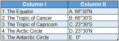
1.WBBSE Solutions For Class 7 Geography Chapter 2 Topic B Meridians Of Longitude Match The Cloumns

Answer: 1. B, 2. D, 3. E, 4. C, 5. A

2. WBBSE Solutions For Class 7 Geography Chapter 2 Topic B Meridians Of Longitude Match The Cloumns.

Answer: 1. E, 2. D, 3. A, 4. B, 5. C


Chapter 2 Topic B Meridians Of Longitude Answer In One Or Two Words

Question 1. What do we call the angular distance of a place located east and west of the Prime Meridian?
Answer: Longitude.

Question 2. What are the lines of longitude also known as?
Answer: Meridians.

Question 3. Which is the line that passes in a north-south orientation through the British Royal Observatory?
Answer: The Prime Meridian.

Question 4. What is the Prime Meridian also known as?
Answer: Greenwich Meridian.

Question 5. What is the time difference for every 1° difference in longitude?
Answer: 4 minutes.

Question 6. What is the local time at a longitude passing through the centre of a country called?
Answer: Standard time.

Question 7. What is the term for the time of a place with reference to the Sun’s position on the meridian passing through it called?
Answer: Local time.

Question 8. What is the suffix added to the time within the period 12 o’clock at noon and 12 o’clock at midnight?
Answer: p.m.

Question 9. What is the suffix added to the time within the period 12 o’clock at midnight and 12 o’clock at noon the next day?
Answer: a.m.

Question 10. What is the angular value of the standard meridian of India?
Answer: 82° 30′ E.

Question 11. Which time is referred to across the globe as the International Standard Time?
Answer: Greenwich Mean Time.

Question 12. What is the time difference between the Indian Standard Time and the Greenwich Mean Time?
Answer: 5 hours 30 minutes.

Question 13. Which technology helps us to find the latitude and longitude of a place on the Earth’s surface at any time of the day?
Answer: GPS.

Question 14. What is the name for the point that is diametrically opposite to a place on the Earth’s surface?
Answer: Antipode.

Question 15. Which instrument is used to determine the time at Greenwich?
Answer: Chronometer.

Question 16. Which instrument is used to calculate the local time of a place by observing the Sun’s altitude?
Answer: Sextant.


Chapter 2 Topic B Meridians Of Longitude Miscellaneous Type Questions Find The Odd One Out

Question 1. Equator: Arctic Circle: Prime Meridian: Antarctic Circle
Answer: Prime Meridian (not a full circle)

Question 2. 1 hour: 1° 1′ 1″
Answer: 1 hour (not a unit of latitude and longitude)

Question 3. 1 hour: 1°: 1 minute: 1 second
Answer: 1° (not a unit of time)

Question 4. Local Time: School time: Standard Time: Greenwich Mean Time
Answer: School time (not a measurement of geographical time)


Correct The Following

Question 1. The Equator runs north-south through the middle of the Earth.
Answer: East-west

Question 2. The Prime Meridian runs through the River Thames.
Answer: Greenwich

Question 3. The Prime Meridian divides the Earth into the northern and southern Hemispheres.
Answer: Eastern and western

Question 4. The lines running from the North Pole to the South Pole are known as latitudes.
Answer: Meridians of Longitude

Question 5. The Royal Astronomical Observatory is located in the city of Reading near London in the United Kingdom.
Answer: Greenwich

Question 6. The Earth needs 4 seconds to cover 1° of longitudinal distance.
Answer: 4 minutes


Who Am I?

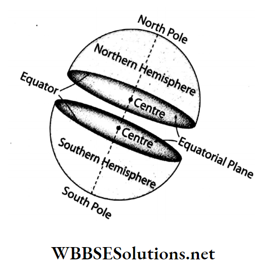
Question 1. I am an imaginary line on the Earth’s surface equidistant from the two Poles dividing the Earth into two equal halves-the northern and the southern hemispheres. Who am I?
Answer: Equator

Question 2. We are a set of circular lines running in the east-west direction which extend from east to west across the globe. Who are we?
Answer: Parallels

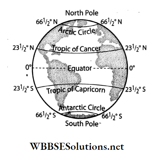
Question 3. I am an imaginary circular line located 232° north of the Equator. Who am I?
Answer: Tropic of Cancer

Question 4. I am an imaginary circular line located at 23% south of the Equator. Who am I?
Answer: Tropic of Capricorn

Question 5. In both hemispheres, the meridians converge at us. Who are we?
Answer: North and South pole

Question 6. I am an imaginary line passing through Greenwich (east of London), oriented in a north-south direction. Who am I?
Answer: Prime Meridian

Question 7. We are semi-circular imaginary lines having a north-south orientation. Who are we?
Answer: Meridians

Question 8. We divide the Earth into two equal halves- the eastern and the western hemispheres. Who are we?
Answer: Prime Meridian (0°) and International Date Line (180°)

Question 9. I am an imaginary semi-circular line passing through a place whose standard time is 24 hours ahead of Greenwich Mean Time. Who am I?
Answer: 180°

Question 10. The location of a place on the Earth’s surface is determined with respect to the point of our intersection. Who are we?
Answer: Parallels and Meridians


Scrambled words

1. TORUAEQ
2. PICCAPCORIRNTROOF
3. TUNLOGIDE
4. LENORPOTH
5. PHEHEMISRE
6. NEPLAEQTOUARIAL

Answers:

1. EQUATOR
2. TROPIC OF CAPRICORN
3. LONGITUDE
4. NORTH POLE
5. HEMISPHERE
6. EQUATORIAL PLANE

Chapter 2 Topic B Meridians Of Longitude Fill Up The Blanks In The Knowledge Hive

Question 1. Fill up the knowledge live with information about the Royal Observatory in Greenwich.

WBBSE Solutions For Class 7 Geography Chapter 2 Topic B Meridians Of Longitude Royal observatory

Answers:

1. The observatory was commissioned in. 1675 with the foundation stone being laid on 10 August.
2. The Prime Meridian passes through this observatory.
3. Since 1924, hourly time signals from the Royal Observatory is broadcast every 5 February.
4. Today, the observatory houses a museum for astronomical and navigational tools.

Question 2. Fill up the knowledge live with information about the Global Positioning System.

WBBSE Solutions For Class 7 Geography Chapter 2 Topic B Meridians Of Longitude Global positioning system

Answers:

1. GPS satellites fly in medium Earth orbit at an altitude of approximately 20,200 km above the Earth’s surface.
2. GPS was created and accomplished by the U. S. Department of Defence.
3. At present 31 satellites have been installed by the US Space Force out of which 24 are for general use and rest are used by the U.S. Department of Defence.
4. GPS plays a major role in determining the accurate location of a place.
5. GPS is being used to determine the land use or location of mineral resources, connect mobile networks, transport and communication and many others.

Answer With Reference To The Illustration

Question 1. They are standing in three different longitudes. Can you say whose time, Sabina’s or Piku’s will be ahead or behind of Mandira’s?


WBBSE Solutions For Class 7 Geography Chapter 2 Topic B Meridians Of Longitude different longitudes can you say time

Answer: According to the picture, Sabina’s time is ahead of Mandira, because she is at a position due east of Mandira. On the other hand, Pinku’s position being west with respect to Mandira is behind in time.

Crossword

Question 1.


WBBSE Solutions For Class 7 Geography Chapter 2 Topic B Meridians Of Longitude Crossword


Clues

Down:

1. The point which is diametrically opposite to a place on the Earth’s surface.
2. The place where the Royal Observatory is located.
4. This is formed due to the intersection of parallels and meridians.

Across:

2. Small replica of the earth.
3. Angular distance of a place measured in degrees, with respect to the Equator.
5. The nearest star from the Earth, other than the Sun.
6. The instrument used to calculate the local time of a place by observing the Sun’s altitude.

Answers

Down: 1. ANTIPODE, 2. GREENWICH, 4. GRID
Across: 2. GLOBE, 3. LATITUDE 5. PROXIMA CENTAURI, 6. SEXTANT

Question 2.


WBBSE Solutions For Class 7 Geography Chapter 2 Topic B Meridians Of Longitude Crossword.


Clues

Down:

1. The time of a place expressed with reference to the Sun’s position on the meridian passing through it.
3. The Meridian is also known as the fixed meridian or zero meridians.

Across:

1. Angular distance of a place lying on either side of the Prime Meridian.
2. All parallels are of this shape.
4. The time of a place is calculated with reference to the Greenwich Mean Time.

Answers:

Down: 1. LOCAL TIME, 3. PRIME
Across: 1. LONGITUDE 2. CIRCULAR, 4. STANDARD TIME

Chapter 2 Topic B Meridians Of Longitude Advanced Questions And Answers

Question 1. What is the role of the Sextant and Marine Chronometer in determining the location of any place or determining the location of any ship in danger at mid-sea?
Answer:

Marine Chronometer is a precise and accurate clock, used to determine the longitude of any place by means by celestial navigation and Sextant is an instrument used to determine the latitude of any place by measuring the altitude of the Sun at that place.

Every ship carries a Chronometer and Sextant. So that sailors can measure the longitude and the latitude of the place at which the ship is located.

The sailors of the ship which is in danger at mid-sea, thus measure the latitude and longitude of that place and transmit this information by radio to the nearest ship or port asking for help.

This information helps the rescue team to reach the spot quickly.

WBBSE Solutions For Class 7 Geography Chapter 2 Topic B Meridians Of Longitude Marine Chronometer, sextant

Chapter 2 Topic B Meridians Of Longitude Formative

Interpretation And Application

This segment will test whether the students have understood topics or whether they are just memorising them.

Question 1. It is very easy to describe the location of a house in a locality. But how can you explain the location of that house as a place on the Earth’s surface?
Answer: The exact location of a place on the surface of the Earth is easily understood by the name of the place, district, state, country, continent and hemisphere.

However, to be more precise, the location of the place is determined by the intersecting coordinate of the parallel and meridian passing over it.

Question 2. What is the exact location of a point you have marked on the ball?
Answer: It is not possible for us to tell the exact position of the point drawn on a ball. Since there is no fixed point on the ball, with respect to which distance of a point can be measured.

Turning the ball again changes the position of the point east or west, north or south, up or down on the ball. As a result, the exact position of the point drawn on the ball cannot be stated.

WBBSE Solutions For Class 7 Geography Chapter 2 Topic B Meridians Of Longitude Standard Meridian of india ball

Question 3. Prepare a list of different places situated on the same meridian from the atlas.
Answer: Here we list different cities on the atlas along the 0° meridian or the Prime Meridian.

WBBSE Solutions For Class 7 Geography Chapter 2 Topic B Meridians Of Longitude Different cities on the atlas along the prime meridian

Question 4. Determine the latitudinal and longitudinal location on the globe.

WBBSE Solutions For Class 7 Geography Chapter 2 Topic B Meridians Of Longitude Latitude and longitude location on the globe
Answer:

WBBSE Solutions For Class 7 Geography Chapter 2 Topic B Meridians Of Longitude Latitude and Longitudinal location on the globe

Question 5. Find the locations of the marked points on the globe.

WBBSE Solutions For Class 7 Geography Chapter 2 Topic B Meridians Of Longitude Latitude and longitude location on the globe.
Answer:

WBBSE Solutions For Class 7 Geography Chapter 2 Topic B Meridians Of Longitude Location of the marked points on the globe

Aesthetics And Creativity

This segment will check the authentic sense and creativity of the students.

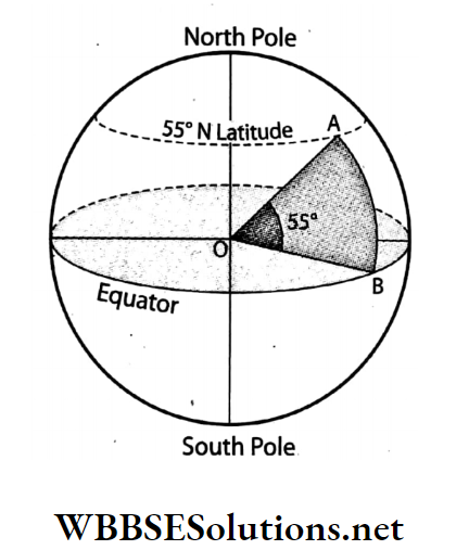
Question 1. Cut a piece from a watermelon as shown in the figure. Is the concept of latitude available from this figure?

WBBSE Solutions For Class 7 Geography Chapter 2 Topic B Meridians Of Longitude Watermelon

Answer: Cutting a watermelon with a knife according to the picture gives an idea of latitude. Removing the cut piece creates a triangular space.

The innermost part of the hollow portion is considered to be the centre of the watermelon as well as the centre of the Earth. The plane along the centre is the equatorial plane.

The angle at the centre of the equatorial plane of the Earth with the vertex above is the value of the latitude of that vertex (∠).

Question 2. Draw parallels of latitude and meridians of longitude on the world map.
Answer: Parallels of latitude and meridians of longitude on the world map-

WBBSE Solutions For Class 7 Geography Chapter 2 Topic B Meridians Of Longitude Parallel of latitude and meridians of longitudeon world map

Question 3. Create a small earth for yourself by drawing two poles and the parallels of latitude on a ball.
Answer: A small earth is made by a ball-

WBBSE Solutions For Class 7 Geography Chapter 2 Topic B Meridians Of Longitude Latitude and longitude location on the Earth


WBBSE Solutions For Class 7 Geography Chapter 4 Landforms Topic A Mountains

Chapter 4 Landforms Synopsis

Not all parts of the Earth’s surface are the same. Some places are high, some places are undulating and some places are low-lying plains. This diversity of land on the Earth’s surface is called landform.

The asthenosphere is the viscous or semi-liquid layer that has a depth of about 700 km below the Earth’s crust.

The crust is divided into several pieces which are floating and moving within the asthenosphere. These pieces are called plates.

All landforms have been created by two main types of forces. Forces that act from within the Earth’s surface are called endogenetic forces and the ones acting from outside the Earth’s surface are called exogenetic forces.

A mountain is a landform formed by rocks, usually more than 900 metres high and extends over a wide area.

WBBSE Solutions For Class 7 Geography

When the land gets uplifted due to compressional forces acting on it, a fold mountain is formed.

Tectonic movements may sometimes lead to the formation of cracks along the Earth’s surface. The middle segment of these cracks may either uplift or the segments of both sides may subduce so that the middle segment forms a block mountain.

Lava, ashes and pieces of rocks that gush out during a volcanic eruption get accumulated all around a volcano, thereby forming a conical highland called a volcanic mountain.

The topmost part of a mountain which has a needle-like shape is called a mountain peak.

The lowland or depression between two mountains or mountain ranges is called a valley.

A series of mountains, or more or less parallel lines of mountains extending over a large area is collectively called a mountain range.

A high elevated place on the Earth’s surface, where several mountain ranges meet or, from where several mountain ranges radiate in different directions, is known as a knot.

A landform that suddenly rises over its surroundings with steep slopes on all sides, generally over 300m is called a plateau. It is also called a tableland.

Intermontane Plateaus are the highest and the most expansive type of plateaus.

Vast stretches in South Africa, Western Australia, Antarctica and Greenland are occupied by Continental Plateaus.

Lava gushing during volcanic eruptions and spreading like sheets through large stretches of land can form expansive lava plateaus or Volcanic Plateaus.

Plateaus are dissected by intervening rivers with the dissected pieces standing apart, interspersed by river valleys are called Dissected Plateaus.

A plain is a low, flat stretch of land.

Lava plains form when lava accumulates over vast, flat, low-lying stretches.

Deposits of alluvium accumulating in the valleys and beds of rivers, seas and lakes for many years form alluvial plains.

A flat plain formed by the deposition of wind-blown fine sand particles is known as a loess plain.

Chapter 4 Topic A Mountains Analytical Type Questions

Question 1. Describe the origin of fold mountains with reference to the Plate Tectonic Theory.
Answer:

Origin of fold mountains with reference to the Plate Tectonic Theory:

The most recent scientific theory explaining the origin of fold mountains is the Plate Tectonic Theory. Leading geomorphologists such as Mackenzie, Parker, and Morgan endorse the Plate Tectonic Theory in relation to the formation of fold mountains.

Plate movement:

According to this theory, the Earth’s crust is made up of various plates. The average depth of the plates is almost 70 km for the oceanic ones and almost 150 km for the continental ones.

These plates are floating on the mantle which is in a viscous state. Tremendous heat and pressure within the Earth generate convection currents. These currents cause the movement of the tectonic plates.

Origin of fold mountains:

The following steps occur during the formation of a fold mountain-

  1. There exists a constant convectional current in the Asthenosphere, on which plates are floating. As a result of this current, the plates start moving slowly at an average speed of 2-3 cm per year.
  2. When two plates move towards each other, they are known as converging plates. In such a situation, the oceanic plate will move below the continental plate as it is heavier.
  3. The thickest deposits of sedimentary rocks are generally found at the edges of the continents. As the plates collide with each other, the accumulated layers of rocks crumple and fold like a tablecloth that is pushed across a table.

WBBSE Solutions For Class 7 Geography Chapter 4 Landforms Topic A Mountains Origin of fold mountains with references to the plate tectonic Theory

Example:

The Himalayan Mountain Range originated as a result of the collision between the Indian plate and the Eurasian plate.

Question 2. Describe the origin of block mountains.
Answer:

Origin of block mountains:

Tectonic movement sometimes causes cracks or fractures in the rigid lithosphere. One side of this crack subsidies, resulting in a fault.

When the landmass between any two fractures rises comparatively higher than the surrounding level, a block mountain is developed.

Again, when the landmass between any two faults sinks comparatively lower than its surrounding level, the comparatively higher landmasses form block mountains.

The following steps take place to form a block mountain-

  1. The landmass between any two parallel faults moving upwards due to the pressure (upthrust) forms block mountains. These are also called horses. Example: Satpura Range in Central India.
  2. If the landmass between two parallel faults moves downwards instead of upwards, then the two elevated landmasses beside the subsided region, are both block mountains. Example-Vosges in France and Black Forest in Germany are two block mountains of this type.

WBBSE Solutions For Class 7 Geography Chapter 4 Landforms Topic A Mountains Formation of block mountains

Question 3. Describe the origin of volcanic mountains.
Answer:

Origin of volcanic mountains:

The formation of a volcanic mountain is a slow and gradual process that can be divided into stages. The different stages involved are discussed below-

  1. First, due to an abnormal increase in temperature at a depth of 80 to 160 km, in the interior of the Earth, rocks melt to form magma and enormous pressure is generated.
  2. Then, this magma gets transported to the Earth’s surface through fissures or vents and spreads there as lava along with ashes, lapilli and volcanic bombs.
  3. The pyroclastic materials emitted from the interior of the Earth get deposited around the fissure or crater and gradually increase in height as well as volume to form a conical-shaped volcanic mountain.

WBBSE Solutions For Class 7 Geography Chapter 4 Landforms Topic A Mountains Origin of Volcanic mountains

Thus, volcanic mountains are formed mainly due to the deposition of pyroclastic materials. Igneous mountains or volcanic mountains developed mostly near the plate boundaries-the convergent, the divergent or the transitional plate boundaries.

Question 4. Discuss the characteristics of fold mountains and block mountains.
Answer:

Characteristics of fold mountains:

The characteristics of fold mountains are as follows-

1. Type of fold:

Fold mountains have different kinds of folds in their rock beds. These are- symmetrical fold, asymmetrical fold, overfold, recumbent fold, overthrust fold, nappes, etc.

2. Anticlines and Synclines:

Folds are collectively formed by both anticlines and synclines.

3. Type of rock:

Fold mountains are mainly formed out of sedimentary rocks. As a result, fossils are found in fold mountains.

4. Shape of the peak:

The peaks of most of these mountains are usually cone-shaped. However, old fold mountains like the Aravallis have been exposed to erosion for a long time. So they have been lowered and their summits are rounded off.

Characteristics of block mountains:

The characteristics of block mountains are as follows-

  1. Slope: The two sides of a block mountain or the slopes along the faults are quite steep.
  2. Summit: The summit or crest of this type of mountain is a little flat.
  3. Height and extension: Block mountains are not as high as the fold mountains and do not extend over a large area.
  4. Associated features: Block mountains (horsts) are generally associated with rift valleys (grabens) and these mountains generally do not have any peaks.

Question 5. Explain the influence of mountains on human life.
Answer:

Influence of mountains on human life:

Mountains have a great influence on human life. These are discussed below-

1. Source of rivers:

Most rivers originate from mountains. Rivers that originate from mountains generally create fertile plains.

2. Influence the climate:

Relief rainfall occurs due to the presence of mountains. The climatic conditions on the windward side and on the leeward side of mountains are completely different.

3. Generation of hydroelectricity:

Hydro-electricity is generated from fast-flowing rivers that originate on mountains. This aids in power generation and also in agriculture.

4. Forest resources:

The soft wood that is available in the forests on the mountains, provides many human needs. Moreover, this region the primary areas for growing tea, fruits and herbs.

5. Tourist spots:

Mountains are ideal locations to be developed as tourist spots.

6. Guard from external enemies:

Countries that are bounded by mountains always enjoy a natural barrier against external enemies.

7. Difficulty for carrying out agriculture:

It is difficult to carry out agriculture in the mountainous region because of the height, the soil infertility and the overall difficult terrain.

8. Transportation is difficult:

‘It is difficult to develop a transportation system in the mountains. This makes life more difficult for the people residing in the mountains.

Chapter 4 Topic A Mountains Short Analytical Type Questions

Question 1. How are landforms classified?
Answer:

Classification Of landforms:

In general, landforms can be classified into three types on the basis of altitude, shape, geological structure, slope, ruggedness, etc. of the land.

These are-

  1. Mountains
  2. Plateaus and
  3. Plains.

These three types can be further divided into many sub-classes.
They are-

WBBSE Solutions For Class 7 Geography Chapter 4 Landforms Topic A Mountains Landform

Question 2. What are the characteristics of a mountain?
Answer:

The characteristics of a mountain are as follows-

  1. Height: Generally the height of a mountain is more than 900 metres above sea level.
  2. Rough surface: The rocky and stony surface of the mountain is usually rugged and uneven in nature.
  3. Location and expanse: Mountains extend over a large area and are much higher than the surrounding level.
  4. Landforms: Gorges, deep valleys, and steep slopes are found in mountainous regions.
  5. Mountain peak: The topmost part of a mountain is called the peak. The mountain peaks remain covered with snow for most of the year.

Question 3. What are the characteristics of a hill?
Answer:

The characteristics of a hill are as follows-

  1. Height: The average height of a hill is 600- 900 metres above sea level. Generally, hills are the smaller form of mountains.
  2. Peak: Hills usually have peaks which are not as high as that of mountains. They may be sharp or flat or rounded in shape.
  3. Other features: Hills consist of valleys. The surface of hills are moderately rugged in nature.

Question 4. How are mountains classified?
Answer:

According to the origin, mountains on the Earth’s surface can be classified into three types. They are-

  1. Fold mountains: Examples of fold mountains are the Himalayas in Asia, the Andes in South America, etc.
  2. Block mountains: Examples of block mountains are Satpura Range in Central India, the Black Forest in Germany, etc.
  3. Volcanic or Depositional mountains: Examples of volcanic mountains are- Barren and Narcondam in India, Mt. Fujiyama in Japan, etc.

Other than these, all three types of mountains get eroded due to exogenic processes (river, wind, glacier etc.) and form erosional mountains. Prolonged erosion results in residual mountains, such as the Aravalli Range in India.

Question 5. What are the characteristics of a fold mountain?
Answer:

Characteristics of fold mountains:

The characteristics of fold mountains are as follows-

1. Type of fold:

Fold mountains have different kinds of folds in their rock beds. These are- symmetrical fold, asymmetrical fold, overfold, recumbent fold, overthrust fold, nappes, etc.

2. Anticlines and Synclines:

Folds are collectively formed by both anticlines and synclines.

3. Type of rock:

Fold mountains are mainly formed out of sedimentary rocks. As a result, fossils are found in fold mountains.

4. Shape of the peak:

The peaks of most of these mountains are usually cone-shaped. However, old fold mountains like the Aravallis have been exposed to erosion for a long time. So they have been lowered and their summits are rounded off.

Question 6. Give examples of some important fold mountains.
Answer:

Examples of some important fold mountains in different continents are given in the following table.

WBBSE Solutions For Class 7 Geography Chapter 4 Landforms Topic A Mountains important of fold mountains


Question 7. What are block mountains?
Answer:

Block mountains:

Due to tectonic movement, sometimes cracks or fractures develop in the rigid lithosphere. One side of this crack gets depressed resulting in a fault.

When the landmass between any two fractures rises comparatively higher than its surrounding level, a mountain is formed which is referred to as a block mountain.

Again, when the landmass between any two faults sinks or gets depressed comparatively lower than its surrounding level, the comparatively higher landmasses look like mountains and are called block mountains.

Example: Satpura Range in India, etc.

WBBSE Solutions For Class 7 Geography Chapter 4 Landforms Topic A Mountains Block mountains

Question 8. What are the characteristics of a block mountain?
Answer:

The characteristics of block mountains are as follows-

  1. Slope: The two sides of a block mountain or the slopes along the faults are quite steep.
  2. Summit: The summit or crest of this type of mountain is a little flat.
  3. Height and extension: Block mountains are not as high as the fold mountains and do not extend over a large area.
  4. Associated features: Block mountains (horsts) are generally associated with rift valleys (grabens) and these mountains generally do not have any peaks.

Question 9. What do you mean by rift valley?
Answer:

Rift valley:

Sometimes within the Earth’s surface, intense tectonic movement results in vertical cracks which eventually develop into faults.

When the landmass between any two parallel faults sinks downwards instead of going upwards, then it is called a rift valley. Generally, rift valleys are associated with block mountains.

For example– the Satpura Range in Central India and the Rift Valley of the Narmada River are associated with each other.

Question 10. “Block mountains and rift valleys are two associated features.”- Explain.
Answer:

Block mountains and rift valleys are two associated features, because-

  1. The landmass between any two parallel faults may rise upwards to form a block mountain. In this case, there will be two rift valleys located on both sides.
  2. If the landmass between any two parallel faults remains at the same position while its adjacent landmasses subside, then also a block mountain is formed with two rift valleys on both its sides.
  3. If the landmass between any two parallel faults subsides, while the surrounding landmasses remain in the same position, then a rift valley is formed with two block mountains on either side.

Question 11. What are the differences between fold mountains and block mountains?
Answer:

The differences between fold mountains and block mountains are as follows-

WBBSE Solutions For Class 7 Geography Chapter 4 Landforms Topic A Mountains Differences between fold and block mountains

Question 12. What are the characteristics of a volcanic mountain?
Answer:

The characteristics of a volcanic mountain are as follows-

Shape:

These mountains are more or less conical in shape. The slopes surrounding this mountain are quite steep.

Crater:

There is an opening at the top of this mountain called a crater. More than one crater is found in large volcanic mountains.

Type of rock:

The crater is connected to the magma chamber in the Earth’s interior through a vent. The magma that reaches the Earth’s surface deposits around the crater and forms the mountain. This is the reason why this mountain is formed of igneous rocks only.

Question 13. What are residual mountains?
Answer:

Residual mountains:

Due to the action of different exogenic natural forces (river, glacier, wind, sea waves, sunlight, rainfall, etc.), old mountains or soft rock-bedded highlands get partially eroded to form a plain whereas the relatively harder rock-beds are barely eroded and remain intact.

This type of eroded mountain are called residual mountain. Example- Aravallis in Rajasthan.

WBBSE Solutions For Class 7 Geography Chapter 4 Landforms Topic A Mountains Residual mountain

Question 14. What are the reasons that heavy industries do not develop in hilly regions?
Answer:

The reasons that heavy industries do not develop in hilly regions:

The hilly regions are steep and have stony and rugged topography. The transport system is also not well-developed and mining is practised to a very limited extent.

Due to low population in the hilly regions, there is insufficient availability of skilled labour and demand for industrial products is also less.

Again, as the region is economically undeveloped, heavy industries cannot be established, due to a lack of sufficient capital and developed technology. Due to all these reasons, heavy industries do not develop in hilly regions.

Question 15. Why are fossils found in fold mountains?
Answer:

Fossils found in fold mountains:

Fossils are usually formed in sedimentary rock, almost all of which were originally deposited as sediments in the depths of the sea. These rocks unlike igneous and metamorphic rocks are formed at low temperatures and pressure.

This helps in preserving buried animal and plant remains in the sediments. As the sediments are compressed into sedimentary rocks, the dead organisms decay and dissolve, leaving behind a cast of their skeleton i.e. fossil.

As fold mountains are formed mainly by the effects of folding on layers of sedimentary rock, fossils are mostly found in the fold mountains.

Chapter 4 Topic A Mountains Short Answer Type Questions

Question 1. What is meant by landform?
Answer:

Landform:

Landform refers to the natural physical features on the Earth’s surface that can be categorised by characteristic physical attributes such as elevation, slope, orientation, stratification, surface area, ruggedness etc.

According to these attributes, landforms are broadly classified into three major types

  1. Mountains and hills
  2. Plateaus and
  3. Plains.

Question 2. Define endogenic forces.
Answer:

Endogenic forces:

The forces which originate and act beneath the Earth’s surface or in the interior of the Earth are called endogenic forces.

Example: Tectonic movement, continents, oceans, plateaus, and mountains are created by these forces.

Question 3. Define exogenic forces.
Answer:

Exogenic forces:

The forces which originate above and on the Earth’s surface and create different types of landforms by acting on or above it are called exogenic forces.

Examples: Rivers, wind, glaciers, sea waves, etc.

Question 4. What is a tectonic plate?
Answer:

Tectonic plate:

The Earth’s crust, which is the rigid outermost shell of our planet, is broken up into several slabs called crustal or tectonic plates. These slabs are in constant motion i.e. floating over the molten asthenosphere.

These slabs are called plates. Average thickness of these plates is 100 km. The Earth’s lithosphere consists of 7 major and 20 minor plates.

Question 5. What is Asthenosphere?
Answer:

Asthenosphere:

The word ‘Asthenosphere’ has been derived from the Greek words ‘asthenes’ So ‘asthenosphere’ means weak region. It is the meaning ‘weak’ and ‘sphere’ meaning ‘region’. highly viscous, mechanically weak, flexible and Earth.

It lies below the Lithosphere at depths deforming region of the upper mantle of between 100 km to 200 km below the Earth’s surface.

WBBSE Solutions For Class 7 Geography Chapter 4 Landforms Topic A Mountains cross section of the earths interior showing the Asthenosphere

Question 6. What are mountains?
Answer:

Mountains:

Extensive and unequal rock blocks with an elevation of more than 900 metres above sea level are called mountains. Mountains are sometimes associated with deep gorges, steep slopes, very high peaks etc.

Examples: the Himalayas in Asia, the Alps in Europe, the Rockies in North America, etc.

WBBSE Solutions For Class 7 Geography Chapter 4 Landforms Topic A Mountains Mountain

Question 7. What are mountain peaks?
Answer:

Mountain peaks:

The topmost part of a mountain shaped like a needle is called the mountain peak. Example: Mt. Everest and Kanchenjunga are two important mountain peaks located in the Himalayas.

Question 8. What is a mountain valley?
Answer:

Mountain Valley:

The lowland or depression between two mountains is called a mountain valley. Example: Dun Valley and the Vale of Kashmir in the Himalayas.

Question 9. What is a mountain range?
Answer:

Mountain range:

A series of mountains, or parallel lines of mountains, closely connected by highland over a large region, is called a mountain range.

Example:

The Himalayas in Asia consists of three parallel mountain ranges. Some other well-known mountain ranges are the Alps in Europe and the Rockies in North America.

WBBSE Solutions For Class 7 Geography Chapter 4 Landforms Topic A Mountains mountain ranga

Question 10. What is a knot?
Answer:

Knot:

A high elevated place on the Earth’s surface, where several mountain ranges meet or from where several mountain ranges radiate in different directions is called a knot.

Example: Pamir Knot, Armenian Knot.

Question 11. What is a hill?
Answer:

Hill:

A rocky block with an elevation lower than that of a mountain and extending over a smaller area is called a hill. The average height of a hill is between 600-900 metres. Hills also consist of many valleys and are comparatively less rugged.

Examples: Ajodhya Hills in Purulia, West Bengal, Susunia Hill in West Bengal, etc.

WBBSE Solutions For Class 7 Geography Chapter 4 Landforms Topic A Mountains Hill

Question 12. What are folding mountains?
Answer:

Folding mountains:

The mountains formed due to the bending or folding of underlying rock beds resembling the shape of a wave on the Earth’s surface, over a large area are called fold mountains.

Example-Himalayas.

WBBSE Solutions For Class 7 Geography Chapter 4 Landforms Topic A Mountains Fold mountain

Question 13. What is a volcanic mountain?
Answer:

Volcanic mountain:

When the hot and molten magma, ash, cinder or other rock fragments cannot flow away readily on reaching the Earth’s surface due to its high viscosity. It accumulates around the vent forming a steep-sided conical mound called a volcanic mountain.

Example: Mt. Vesuvius.

WBBSE Solutions For Class 7 Geography Chapter 4 Landforms Topic A Mountains Volcanic mountain

Question 14. Why aren’t all places on the Earth’s surface similar?
Answer:

On the Earth’s surface, we find different landforms, like mountains, plateaus and plains. These landforms can also change due to erosional and depositional processes. All these landforms form by two main forces-

  1. Exogenetic forces and
  2. Endogenetic forces.

These forces are the reason for the continuous change of the Earth’s crust. That is why, all places on the Earth’s surface are not similar.

Chapter 4 Topic A Mountains Multiple Choice Questions Choose The Correct Option

Question 1. Landforms can be classified into types on the basis of their altitude, geological structure, slope, ruggedness, etc.

  1. 3
  2. 4
  3. 5

Answer: 1. 3

Question 2. The average height of a mountain is-

  1. More than 900 metres
  2. Less than 1000 metres
  3. Less than 500 metres

Answer: 1. More than 900 metres

Question 3. The Rocky Mountains are located in the continent of-

  1. North America
  2. Asia
  3. Europe

Answer: 1. North America

Question 4. Himalayas are-

  1. Fold mountains
  2. Igneous mountains
  3. Block mountains

Answer: 1. Fold mountains

Question 5. Crumpled rock structures are seen in-

  1. Fold mountains
  2. Block mountains
  3. Erosional mountains

Answer: 1. Fold mountains

Question 6. The mountains, formed due to the folding of the underlying rock and resembling the shape of a wave are called-

  1. Fold mountains
  2. Block mountains
  3. Igneous mountains

Answer: 1. Fold mountains

Question 7. The fold mountains are primarily made up of-

  1. Sedimentary rocks
  2. Igneous rocks
  3. Metamorphic rocks

Answer: 1. Sedimentary rocks

Question 8. Mountains that are formed due to the rupture or fault in the rock-beds are called-

  1. Fold mountains
  2. Block mountains
  3. Igneous mountains

Answer: 2. Block mountains

Question 9. Faults can be seen in-

  1. Fold mountains
  2. Block mountains
  3. Volcanic mountains

Answer: 2. Block mountains

Question 10. Horst is a type of-

  1. Block mountain
  2. Valley
  3. Ridge

Answer: 1. Block mountains

Question 11. A is generally seen beside a block mountain or horst.

  1. Fold mountain
  2. Plain
  3. Rift valley

Answer: 3. Rift Valley

  1. Question 12. The river flows through a rift valley. Mahanadi
  2. Narmada
  3. Sabarmati

Answer: 2. Narmada

Question 13. The Satpura Range located in Central India is an example of a/an-

  1. Block mountain
  2. Igneous mountain
  3. Relict mountain

Answer: 1. Block mountain

Question 14. Nilgiri Hills are-

  1. Block mountains
  2. Rigneous mountains
  3. Relict mountains

Answer: 1. Block mountain

Question 15. mountains are formed due to the deposition of lava on the Earth’s surface.

  1. Volcanic
  2. Fold
  3. Block

Answer: 1. Volcanic

Question 16. Mt. Fujiyama in Japan is an example of a-

  1. Block mountain
  2. Volcanic mountain
  3. Fold mountain

Answer: 2. Volcanic mountain

Question 17. Mt. Vesuvius is an example of-

  1. An active volcano
  2. A dormant volcano
  3. An extinct volcano

Answer: 1. An active volcano

Question 18. Mt. Krakatoa of Indonesia is an example of-

  1. A fold mountain
  2. A block mountain
  3. An igneous mountain

Answer: 3. An igneous mountain

Question 19. Which of the following is a volcano in Italy?

  1. Mt. Vesuvius
  2. Mt. Fujiyama
  3. Barren Island

Answer: 1. Mt. Vesuvius

Question 20. Barren Island volcano is situated in-

  1. India
  2. Japan
  3. Italy

Answer: 1. India

Question 21. Relict mountains are also known as-

  1. Volcanic mountains
  2. Residual mountains
  3. Block mountains

Answer: 2. Residual mountains

Question 22. Which of the following is a famous hill in the Bankura district of West Bengal?

  1. Paresh Nath
  2. Ajodhya
  3. Susunia

Answer: 3. Susunia

Question 23. Prashanth is an example of a-

  1. Hill
  2. Plain
  3. Mountain

Answer: 1. Hill

Question 24. The highest part of a mountain is called-

  1. Peak
  2. Valley
  3. Ridge

Answer: 1. Peak

Question 25. Mt. Everest is a mountain-

  1. Peak
  2. Range
  3. Knot

Answer: 1. Peak

Question 26. An elongated lowland between two mountains is called a-

  1. Valley
  2. Peak
  3. Ridge

Answer: 1. Valley

Question 27. The place at which several mountain ranges meet is called a mountain-

  1. Peak
  2. Knot
  3. Range

Answer: 2. Knot

Chapter 4 Topic A Mountains Very Short Answer Type Questions Fill In The Blanks

Question 1. The formation of mountains is known as _______ movement.
Answer: Orogenic

Question 2. The longest mountain range in the world is the _______.
Answer: Andes

Question 3. The largest mountain range not only in Asia, but also in the world is the _______.
Answer: Himalayas

Question 4. The oldest mountain range of India is the _______.
Answer: Aravallis

Question 5. Fossils are found in _______ mountains.
Answer: Fold

Question 6. Block mountains are formed as a result of _______ movement.
Answer: Tectonic

Question 7. _______ is a block mountain situated in India.
Answer: Satpura

Question 8. Mountains formed out of lava deposits are called _______ mountains.
Answer: volcanic

Question 9. _______ is a dormant volcano in the Andaman group of islands in India.
Answer: Narcondam Island

Question 10. The opening or mouth of a volcano through which lava comes out is called _______.
Answer: Crater

Question 11. _______ is an extinct volcano situated in Myanmar.
Answer: Mt. Popa

Question 12. The highest active volcano in the world is _______.
Answer: Ojos del Salado

Question 13. The Pacific Ring of Fire has been formed along a _______ plate boundary.
Answer: Convergent

Question 14. _______ is known as the ‘Lighthouse of the Mediterranean Sea’.
Answer: Mt. Stromboli

Question 15. The other name of relict mountain is _______ mountain.
Answer: Residual

Write True Or False

Question 1. Block mountains are referred to as ‘horsts’ in German.
Answer: True

Question 2. Generally, rift valleys are associated with fold mountains.
Answer: False

Question 3. The size and extension of a hill is much more than a mountain.
Answer: False

Question 4. Volcanic mountains are also called relict mountains.
Answer: False

Question 5. Narmada and Tapti river valleys are examples of rift valleys located in India.
Answer: True

Question 6. Generally, the height of a mountain is more than 900 metres above sea level.
Answer: True

Question 7. The Black Forest in Germany is a volcanic mountain.
Answer: False

Question 8. The Appalachians of the USA are fold mountains.
Answer: True

Question 9. Fossils are found in fold mountains.
Answer: True

Question 10. Horsts or block mountains are formed due to the rise of the intermediate landmass between two parallel faults.
Answer: True

Question 11. The transport system is quite developed in mountainous regions.
Answer: False

Chapter 4 Topic A Mountains Match The Columns

1.WBBSE Solutions For Class 7 Geography Chapter 4 Landforms Topic A Mountains Match the columns

Answer: 1. B, 2. A, 3. D, 4. C

2.WBBSE Solutions For Class 7 Geography Chapter 4 Landforms Topic A Mountains Match the columns.

Answer: 1. B, 2. A, 3. D, 4. C

3.WBBSE Solutions For Class 7 Geography Chapter 4 Landforms Topic A Mountains Match the columns..

Answer: 1. C, 2. D, 3. A, 4. B

Answer In One Or Two Words

Question 1. What do we call a rocky landform that is spread across a wide area with an average height of 900 metres above sea level?
Answer: Mountain.

Question 2. What is the collective name for the external forces that work on and shape the Earth’s surface?
Answer: Exogenic forces.

Question 3. What is the collective name given to the forces that originate within the Earth’s interior and cause horizontal and vertical movements?
Answer: Endogenic forces.

Question 4. What is the name of a rigid layer of Earth’s crust that is believed to be drifting slowly?
Answer: Plate.

Question 5. What is the molten upper mantle known as?
Answer: Asthenosphere.

Question 6. What kind of mountains are formed due to the folding of the upper part of the crust?
Answer: Fold mountains.

Question 7. What kind of mountains are formed due to the crumpling of the underlying rock structure?
Answer: Fold mountains.

Question 8. Name a fold mountain of South America.
Answer: Andes.

Question 9. What kind of mountains are formed due to the uplifting of the land surface lying between two faults?
Answer: Block mountains.

Question 10. What kind of mountains are formed due to the deposition of lava and magma?
Answer: Volcanic mountains.

Question 11. What do we call the topmost part of a as? volcanic mountain through which magma comes out?
Answer: Crater.

Question 12. Name a famous volcanic mountain in Japan.
Answer: Mt. Fujiyama.

Question 13. Which types of mountains, belonging to the pre-drift era, are subjected to denudation and uplift?
Answer: Relict mountains.

Question 14. What are smaller mountains known as?
Answer: Hills.

Question 15. What is the topmost part of a mountain, resembling the shape of a needle known as?
Answer: Mountain peak.

Question 16. What is a chain of mountains known as?
Mountain range.

Question 17. Which mountain range was formed due to the collision of Indo-Australian and Eurasian plates?
Answer: The Himalayas.

Question 18. What kind of landform forms between two mountains through which a river flows?
Answer: Valley.

Question 19. What do we call the junction of numerous mountain ranges?
Answer: Mountain knot.

WBBSE Solutions For Class 7 Geography Chapter 4 Landforms Topic C Plains

Chapter 4 Landforms Topic C Plains Analytical Type Questions

Question 1. Classify plains with examples.
Answer:

Classification of plains:

A ‘plain’ refers to an area of land that is not significantly higher than the adjacent areas and has relatively minor differences in elevation, generally less than 300 metres, within the area. Plains can be of different types.

These are discussed below-

1. Alluvial plain:

Alluvial plains are formed by the deposition of silt, brought down by the rivers.

WBBSE Solutions For Class 7 Geography

Example: Indo-Gangetic Plain.


WBBSE Solutions For Class 7 Geography Chapter 4 Landforms Topic C Plains Alluvial plain

2. Loess plain:

Loess plains are formed due to the continuous accumulation of fine-grained sand particles blown away by winds from deserts and deposited in far-off places.

Example: Loess plains have formed in the Hwang Ho river basin due to the deposition of sand particles blown away by the wind from the Gobi desert.

WBBSE Solutions For Class 7 Geography Chapter 4 Landforms Topic C Plains Loess plain

3. Lava plain:

These plains are formed by the accumulation of lava that seeps out from the fissures and deposits over vast, flat, low-lying stretches.

Example: Lava plain of Iceland.

All the above-mentioned plains fall under the category of depositional plains. The plains that develop from the depositions brought down by the agents of erosion, such as rivers, wind, sea waves or glaciers are called depositional plains.

Glacial plains and Bajada also are depositional plains. Apart from depositional plains, there can be two more types of plains namely, erosional plains and tectonic plains.

Erosional plains can be further divided into peneplain and pediplain whereas tectonic plains are classified into uplifted plains and subsided plains.

WBBSE Solutions For Class 7 Geography Chapter 4 Landforms Topic C Plains plain

Question 2. Explain the influence of plains on human life.
Answer:

Influence of plains on human life:

Plains have a great influence on human life. Some of the important ones are discussed below-

1. Development of agriculture:

The soil of most plains are generally formed by the deposition of silt, which makes plains fertile. Thus, agricultural activities are quite developed in the plains.

2. Development of transport and communication:

Development of railways, roadways and waterways is easier on the plains. It helps in better transport and communication.

3. Industrialisation:

The establishment of industries in the plain regions is always easier than in regions with rough terrain. Due to extensive agricultural activities and improved transportation and communication system, many agro-based and labour-intensive industries have developed in the plains.

4. Water for drinking and irrigation purposes:

Major parts of most rivers flow through the plains making water easily available for drinking and irrigation purposes.

5. Suitable environment for living:

Plains are the most favourable places to live among all types of landforms.

6. Urbanisation:

The fact that life is easier in the plains has given rise to the world’s biggest urban areas in the plain regions.

7. Development of animal-rearing farms:

In plain regions, the lands which are not used for agricultural activities, are used as grazing fields for farm animals.

8. Development of pisciculture:

Due to the presence of rivers, waterbodies and sometimes proximity to the sea, the plains are quite suitable for pisciculture and fishing.

Question 3. How do landforms influence our lives?
Answer:

Impact of landforms on human life:

Landforms are intimately related to the ways of our lives. Human lifestyle adjusts itself to the local landforms in all parts of the world. Landforms control our livelihood patterns, social and cultural activities, economic activities etc.

Landforms affect our lives in the following ways-

Impact of mountains:

Suitable for agriculture and animal rearing:

The slopes of mountains are ideal for animal rearing as these are extremely suitable for grazing. Mountains also directly influence step farming or terrace farming.

1. Favourable for tourism:

Mountains are very popular tourist spots. Some popular hill stations are Ooty, Shimla, Darjeeling etc. The elevation, climate and natural beauty of mountains always attract tourists which directly influences the livelihood of the locals.

2. Development of industries:

Rivers originating from the mountains are quite swift and this property is utilised for the development of hydroelectric power plants in the mountainous regions. This, in turn, has contributed significantly in the development of industries.

Impact of plateaus:

1. Source of minerals:

Plateaus are mainly made up of igneous rocks and thus are rich in minerals. So the plateau religious acts as an important natural source of industrial raw materials, that has led to the development of many mineral-based industries.

2. Suitable for animal husbandry:

Plateau regions have rugged and stony terrain that is not favourable for cultivation. However, the extensive grasslands of these regions help in grazing and thereby promote animal husbandry.

3. Impact of plains:

1. Suitable for agriculture:

Most of the plains have formed due to the deposition of silt that makes them very fertile. Due to this fertile soil, agricultural activities are extensively carried out in the plains.

Easy livelihood:

Plains are the most suitable place for agriculture, industrial activities, transport and communication etc. All these facilities bring different opportunities, which make lives easier.

The suitable living place for humans:

Due to low elevation, easy availability of drinking water and food, favourable agricultural and industrial practices, easy transport system, etc, plains are the most convenient of all landforms to live.

Question 4. What are the differences between mountains, plateaus and plains?
Answer:

Differences between mountains, plateaus and plains:

The differences between mountains, plateaus and plains are discussed in the following table-

WBBSE Solutions For Class 7 Geography Chapter 4 Landforms Topic C Plains Difference between mountains, plateaus and plains

Chapter 4 Landforms Topic C Plains Short Analytical Type Questions

Question 1. Give a brief account on the origin of plains.
Answer:

Origin of plains:

The origin of plains can be attributed to any one of the following causes-

1. Erosion:

Prolonged erosion of highlands leads to the formation of plains.

2. Deposition:

Prolonged sedimentation and filling of lowlands result in a plain. This may occur due to the action of natural agents like wind, rivers, glaciers, etc.

3. Tectonic movement:

The accumulation and solidification of lava over time also lead to the formation of a certain type of plain known as a lava plain.

Question 2. What are the characteristics of a plain?
Answer:

The different characteristics of a plain are as follows-

1. Slope:

The plains usually have a very gentle slope meeting the sea surface.

2. Height:

The height of a plain is generally less than 300 metres from the sea level.

3. Type of soil:

As the plains are generally made up of alluvial soil, they are fertile and important for agriculture.

4. Location and expanse:

Among the three types of landforms, plains occupy the largest part on the Earth’s surface. Most of the plains in the world have formed along river valleys and sea coasts.

Question 3. Write any three differences between a mountain and a plateau.
Answer:

WBBSE Solutions For Class 7 Geography Chapter 4 Landforms Topic C Plains Difference between mountains, plateaus

Question 4. Write any three differences between a plateau and a plain.
Answer:

WBBSE Solutions For Class 7 Geography Chapter 4 Landforms Topic C Plains Difference between plateaus and plains

Question 5. Why does the majority of the world’s population live on the plains?
Answer:

The majority of the world’s population lives on the plains, because-

  1. Most plains are made up of fertile alluvium, and so agriculture is highly developed in this region.
  2. The flat of a proper transport system comprising railways, roadways and waterways.
  3. As the region is developed in agriculture and communication system, different types of industries, like agro-based industries can easily develop and grow.
  4. Most of the large rivers flow over plains and so there is no scarcity of water for drinking or irrigation.

Chapter 4 Landforms Topic C Plains Short Answer Type Questions

Question 1. What is a plain?
Answer:

Plain:

An extensive region of land area with an elevation that is slightly higher than sea level. and a very gentle slope is called a plain. The average height of a plain is generally less than 300 metres.

Example: The Indo-Gangetic Plain of North India. Extensive regions of Punjab, Uttar Pradesh, Bihar and West Bengal are a part of this plain.

Question 2. What is an alluvial plain?
Answer:

Alluvial Plain:

Generally alluvium and sand carried by a river get deposited on both sides of the river or at its mouth forming a flat fertile surface or plain, which is called an alluvial plain.

Example: Ganges Plain, Plains of Hwang-Ho etc.

WBBSE Solutions For Class 7 Geography Chapter 4 Landforms Topic C Plains Alluvial plain.

Question 3. What is a loess plain?
Answer:

Loess plain:

Fine sand particles get carried by the wind from deserts to distant low-lying areas. The prolonged deposition of these fine sand particles in the low-lying areas leads to the formation of a plain called loess plain.

Example: The loess plain along the Hwang Ho river basin formed from loess sediments from the Gobi Desert.

Question 4. How is a lava plain formed?
Answer:

Hot and molten magma from the interior of the Earth erupts as lava on the surface of the Earth and solidifies to form a type of plain called lava plain.

Example: The northern part of the Deccan Plateau is a lava plain commonly known as the Deccan Traps.

Question 5. Write two differences between alluvial plain and loess plain.
Answer:

Two differences between alluvial and loess plain are-

Formation: Alluvial plains are formed by the silt brought down by the rivers.

On the other hand, loess plains are formed due to the accumulation of sand particles blown away by winds from deserts and deposited far-off places.

Fertility: Alluvial plains are fertile.

On the other hand, loess plains are infertile.

Chapter 4 Landforms Topic C Plains Multiple Choice Questions Choose The Correct Option

Question 1. Most of the land areas on the Earth are-

  1. Plains
  2. Plateaus
  3. Mountains

Answer: 1. Plains

Question 2. The average altitude of a plain from the sea level is-

  1. Less than 300 metres
  2. More than 300 metres
  3. More than 600 metres

Answer: 1. Less than 300 metres

Question 3. The Northern Plains of India are an example of-

  1. Alluvial Plains
  2. Coastal Plains
  3. Glacial Plains

Answer: 1. Alluvial Plains

Question 4. An example of a lava plain is-

  1. Deccan Trap
  2. Indo-Gangetic Plain
  3. Brahmaputra Plain

Answer: 1. Deccan Trap

Question 5. _______ are formed due to the deposition of sand carried by wind to distant places.

  1. Alluvial plains
  2. Loess plains
  3. Coastal plains

Answer: 2. Loess plains

Question 6. Which of the following is formed by the deposition of sand particles?

  1. Alluvial plain
  2. Loess plain
  3. Lava plain

Answer: 2. Loess plain

Question 7. The world’s largest deltaic plain has been formed at the mouth of the river-

  1. Ganges
  2. Nile
  3. Tigris

Answer: 1. Ganges

Question 8. Maximum population density is observed in the-

  1. Plains
  2. Plateaus
  3. Mountains

Answer: 1. Plains

Question 9. Sustenance of life is much easier in the-

  1. Plains
  2. Mountains
  3. Plateaus

Answer: 1. plains

Question 10. Most ancient civilisations have thrived on-

  1. Alluvial Plains
  2. Lava Plains
  3. Loess Plains

Answer: 1. Alluvial Plains


Chapter 4 Landforms Topic C Plains Very Short Answer Type Questions

Question 1. Generally, river-based civilisations have flourished in the __________ regions.
Answer: Plain

Question 2. The Indo-Ganga-Brahmaputra plain is an __________ plain.
Answer: Alluvial

Question 3. Loess plains are found in the __________ river basin.
Answer: Hwang Ho

Question 4. The plainland of Pampas is in __________.
Answer: South America

Question 5. The Nile River Basin is an example of a __________ plain.
Answer: Flood

Question 6. The most famous plain of South America is __________.
Answer: Pampas

Question 7. A __________ is the most fertile region among all landforms.
Answer: Plain

Question 8. A notable plain of North America is __________.
Answer: Prairie

Chapter 4 Landforms Topic C Plains Write True Or False

Question 1. The Ganga Plain is an example of an alluvial plain.
Answer: True

Question 2. A loess plain is formed due to the deposition of lava.
Answer: False

Question 3. The upper surface of a plain is undulating.
Answer: False

Question 4. Both internal and external forces are responsible for the formation of plains.
Answer: True

Question 5. The highest density of population is found in the plains.
Answer: True

Question 6. Flood plains are examples of the depositional plains.
Answer: True

Question 7. Alluvial plains are formed due to the deposition of alluvium.
Answer: True

Question 8. Plains do not have any influence on human life.
Answer: False

Question 9. Glacial plains and Bajada are examples of the erosional plains.
Answer: False

Question 10. The slope of a mountain is ideal for animal rearing.
Answer: True

Chapter 4 Landforms Topic C Plains Match The Columns

1.WBBSE Solutions For Class 7 Geography Chapter 4 Landforms Topic C Plains Match the following

Answer: 1. D, 2. C, 3. A, 4. B

Chapter 4 Landforms Topic C Plains Answer In One Or Two Words

Question 1. Which is the world’s largest deltaic plain?
Answer: Ganga-Brahmaputra Plain.

Question 2. What is formed by the deposition of alluvial sediments that are brought down by rivers over a period of time?
Answer: Alluvial plain.

Question 3. What do we call A-shaped flat plains formed by alluvium deposition on river beds?
Answer: Deltaic plain.

Question 4. What do we call a large expanse of nearly flat plains formed by the accumulation of lava?
Answer: Lava plain.

Question 5. Which type of plain can be seen in Iceland?
Answer: Lava plain.

Question 6. What kind of landform is created by the deposition of sand or silt particles carried by the wind from one place to another?
Answer: Loess plain.

Question 7. Where can we find the plain land of Prairies?
Answer: North America.

Question 8. Which type of landform enables an easy livelihood?
Answer: Plains.

Chapter 4 Landforms Topic C Plains Miscellaneous Type Questions Find The Odd One Out

Question 1. Hill: River: Plateau: Plain
Answer: River (not a landform)

Question 2. River: Wind: Glacier: Asthenosphere
Answer: Asthenosphere (not an exogenic force)

Question 3. Aravalli: Himalaya: Alps: Andes
Answer: Aravalli (not a fold mountain)

Question 4. Vesuvius: Fujiyama: Himalaya: Krakatoa
Answer: Himalaya (not a volcanic mountain)

Question 5. Deccan Plateau: Tibetan Plateau: Malwa Plateau: Columbia Plateau
Answer: Tibetan Plateau (not a volcanic plateau)

Question 6. Tibetan Plateau: Deccan Plateau: Pamir Plateau: Bolivian Plateau
Answer: Deccan Plateau (not an intermontane plateau)

Question 7. Darjeeling: Puri: Ooty: Shimla
Answer: Deccan Plateau (not an intermontane plateau)

Chapter 4 Landforms Topic C Plains Correct The Following

Question 1. The arrangement of landscape on the surface of the Earth is known as hill.
Answer: Landform

Question 2. The continental and oceanic plates float on the ocean.
Answer: Asthenosphere

Question 3. Aravalli is a new fold mountain.
Answer: Himalaya

Question 4. Satpura is a volcanic mountain.
Answer: Block

Question 5. stretch of the geographic area consisting of mountain peaks and valleys is known as a knot.
Answer: Mountain range

Question 6. Ladakh Plateau is called the ‘Roof of the World’.
Answer: Pamir Plateau

Question 7. The aeolian (wind-blown) sediments from the deserts accumulate to form a deltaic plain.
Answer: Loess

Who Am I?

Question 1. I am a rocky highland. My average height is more than 900 metres above sea level. Who am I?
Answer: Mountain

Question 2. I extend over a wide area, comprising a chain of mountains. Who am I?
Answer: Mountain range

Question 3. I am the topmost portion of a mountain, resembling the shape of a needle. Who am I?
Answer: Mountain peak

Question 4. I am the lowland between two mountains. Who am I?
Answer: Valley

Question 5. I am a special type of mountain formed due to the folding of my rock beds. Who am I?
Answer: Fold mountain

Question 6. I am a chain of young fold mountains located to the north of India. Who am I?
Answer: Himalayas

Question 7. I am a steep-sloped highland resembling the shape of a table. Who am I?
Answer: Plateau

Question 8. I am a tabular landform surrounded by mountains on all sides. Who am I?
Answer: Intermontane Plateau

Question 9. I am the highest plateau in the world. Who am I?
Answer: Pamir Plateau

Question 10. I am a junction of several mountain ranges. Who am I?
Answer: Knot

Question 11. I am a flat plain formed by the deposition of fine sand particles blown by winds. Which type of plain am I?
Answer: Loess plain

Question 12. A number of river valley civilisations have developed on me. Who am I?
Answer: Plain

Scrambled Words

1. DOENNICGE
2. CAVOLNIC
3. VALARALI
4. TNKO
5. JAKIMANROLI
6. TALTICONNEN
7. ELOSS
8. TOTECNIC
9. YAMAHILA
10. SSFOIL

Answers:

1. ENDOGENIC
2. ARAVALLI
3. VOLCANIC
4. KNOT
5. KILIMANJARO
6. CONTINENTAL
7. LOESS
8. TECTONIC
9. HIMALAYA
10. FOSSIL

Chapter 4 Landforms Topic C Plains Fill Up The Blanks In The Knowledge Hive

Question 1. Fill up the knowledge hive with information about the ways in which mountains influence our lives.

WBBSE Solutions For Class 7 Geography Chapter 4 Landforms Topic C Plains Influence of mountains

Answers:

1. The crust is divided into small parts. These parts are known as plates, which are floating on the Asthenosphere.
2. These plates are moving because of the convectional current that is going on in the Asthenosphere.
3. When two plates move towards each other, the oceanic plate will move below the continental plate as it is heavier.
4. As the thickest deposits of sedimentary rocks are accumulated at the edges of the continent, they crumple due to the convergent movement of the plates and fold mountains are formed.

Question 2. Fill up the knowledge hive with the information about the process of fold mountain formation.

WBBSE Solutions For Class 7 Geography Chapter 4 Landforms Topic C Plains Formation Of mountains

Answers:

1. Generate several perennial rivers.
2. Mountains act as barriers for wind flow and produce orographic rainfall.
3. Mountains influence the climate of a country or a region.
4. Rivers originating from the mountains generate hydroelectricity.
5. Softwood forests are found here.
6. Make ideal tourist spots.

Crossword

Question 1.


WBBSE Solutions For Class 7 Geography Chapter 4 Landforms Topic C Plains Crossword

Clues

Down:

5. Plains of South America.
6. A fold mountain in North America.
7. A fold mountain in South America.

Across:

1. A fold mountain in Europe.
2. A volcanic mountain in Japan.
3. A block mountain in India.
4. A fold mountain in Asia.

Answers:

Down: 5. PAMPAS, 6. ROCKY, 7. ANDES
Across: 1. ALPS, 2. FUJIYAMA, 3. SATPURA, 4. HIMALAYAS

Question 2.

WBBSE Solutions For Class 7 Geography Chapter 4 Landforms Topic C Plains Crossword.

Clues

Down:

2. Fold Mountain in North America.
3. Block Mountain in India.
4. Intermontane plateau between the Himalayas and Kunlun.
5. Darjeeling is a famous spot.

Across:

1. Landforms exceeding 1000m in height.
6. A famous hill station in South India.
7. A volcano in Sicily.

Answers:

Down: 2. ROCKY, 3. SATPURA, 4. TIBET, 5. TOURIST
Across: 1. MOUNTAIN, 6. OOTY, 7. ETNA

Chapter 4 Landforms Topic C Plains Advanced Questions And Answers

Question 1. What are active volcanoes?
Answer:

Active volcanoes:

The volcanoes which erupt often are called active volcanos. These volcanoes are of two types-

  1. Volcanoes which erupt incessantly example Mt. Vesuvius in Italy.
  2. Volcanoes which erupt intermittently example Stromboli in Italy.

Question 2. What are dormant volcanoes?
Answer:

Dormant Volcanoes:

The volcanoes which have not erupted for a long time but can erupt at any moment, are called dormant volcanoes.

Example: Mauna Kea in Hawaii, Mt. Kilimanjaro in Africa.

Question 3. What is an extinct volcano?
Answer:

Extinct Volcano:

The volcanoes which have erupted in historical times, but do not show any sign of eruption in the future are called extinct volcanoes.

Example: Mount Popa in Myanmar.

Question 4. Name the mountain ranges radiating from the Armenian Knot.
Answer:

Several mountain ranges radiate in different directions from the Armenian Knot. They are-

WBBSE Solutions For Class 7 Geography Chapter 4 Landforms Topic C Plains Mountain ranges radiating from the armenian Knot.

Question 5. Name the mountain ranges radiating from Pamir Knot.
Answer:

Several mountain ranges radiate in different directions from the Pamir Knot. These are-

WBBSE Solutions For Class 7 Geography Chapter 4 Landforms Topic C Plains Mountain ranges radiating from Pamir Knot

Question 6. What is a geosyncline?
Answer:

Geosyncline:

Shallow seas in the interior of any continent or at the edge of any continent where deposition of sediments takes place accompanied by folding and crumpling of the deposits, gets transformed into a belt of folded mountains, called geosynclines.

Characteristics:

The characteristics of geosyncline are-

  1. They are narrow, elongated and shallow water bodies.
  2. The geosynclines become shallow and subside due to the accumulation of the vast amounts of sediments.
  3. Geosynclines are surrounded by continental landmasses called foreland.

Example:

Tethys Geosyncline between Angaraland and Gondwanaland.

Question 7. Write the differences between epeirogenic and orogenic movements.
Answer:

The differences between epeirogenic and orogenic movements are-

WBBSE Solutions For Class 7 Geography Chapter 4 Landforms Topic C Plains Difference between Epeirogenic and orogenic movements

Question 8. Write a short note on the anticline and syncline.
Answer:

Anticline and Syncline:

Fold mountains consist of different types of folds. The apex of the fold pointing upwards is called an anticline and the apex of the fold pointing downwards is called a syncline.

In other words, the crest between any two bends is called an anticline (A-shaped) and the trough is called a syncline (V-shaped).

WBBSE Solutions For Class 7 Geography Chapter 4 Landforms Topic C Plains Anticline and Syncline

Question 9. Write a short note on fossils.
Answer:

Fossils:

Fossils are the preserved remains or traces of animals, plants or other organisms from the ancient past buried inside the sedimentary rocks millions of years ago.

Example: Glossopteris.

Importance of fossils: With the help of fossils-

  1. The age of the rocks can be estimated,
  2. The climate during the historic times can be assumed,
  3. The nature of the organisms which lived in the historic times can be understood.

WBBSE Solutions For Class 7 Geography Chapter 4 Landforms Topic C Plains Loess Fossil

Question 10. What is a crater?
Answer:

Crater:

The mouth or opening at the top of a volcanic mountain through which magma, gas, ash, etc. erupt, is called a crater. The crater is connected to the magma chamber inside the Earth through a cylindrical path called a vent.

The diameter of a crater may vary from a few metres to a few kilometres. Some volcanoes have subsidiary cones beside the main crater.

Sometimes lake can also be formed in a crater which is called a crater lake. Lake Pinatubo of the Philippines is an example of a crater lake located at the mouth of a volcanic crater.

Question 11. What is a caldera?
Answer:

Caldera:

The mouth of a volcano through which lava, gas, ash, etc. are ejected is called a crater. A large but shallow crater is called a caldera. Calderas are usually formed when the existing volcanic cone gets blown off.

Sometimes calderas are formed due to the collapse of craters. The word caldera has been derived from the Latin word ‘caldaria’ meaning ‘cooking pot’.

WBBSE Solutions For Class 7 Geography Chapter 4 Landforms Topic C Plains Caldera

Chapter 4 Landforms Topic C Plains Formative

Interpretation And Application

This segment will test whether the students have understood the topics, or whether they are just memorising them.

Question 1. Solve it if you grasp it.

WBBSE Solutions For Class 7 Geography Chapter 4 Landforms Topic C Plains grasp mountains, plateaus, plains.

Answer:

WBBSE Solutions For Class 7 Geography Chapter 4 Landforms Topic C Plains Grasp mountains, plateaus and plains

Question And Experimentation

This segment will investigate the student’s understanding of the subject, questioning capacity, ability to explain and apply and urge for experimentation

Question 1. By showing the pictures, the teacher checks the students’ enthusiasm and interest in asking questions. Does the teacher want to know what are these pictures.

WBBSE Solutions For Class 7 Geography Chapter 4 Landforms Topic C Plains Mountains
Answer:

Student: The first one is a picture of a mountain, the second one is a picture of a plateau and the third one is of a plain. Okay! are they all created at once?
Teacher: Not at all. They have been created for different reasons, at different times, in different ways.
Student: How did such a high mountain come to be?
Teacher: The picture is of a fold mountain. The terrain on which we stand is not static, it is moving. This Earth’s crust is made up of large and small plates which are floating on a viscous layer (Asthenosphere). When two plates are facing each other, the sediments of the shallow sea in the space between fold to form such a mountain.
Student: Are all mountains formed in the same way?
Teacher: Not at all. Many times hot underground magma comes out and solidifies in the form of lava to form volcanic mountains. Sometimes tectonic movements occur and the surface of the Earth ruptures and rises to form block mountains. Sometimes, due to the action of rivers, glaciers, winds, weathering, etc. those mountains get eroded and form residual mountains or hills.
Student: Are plateaus, and plains also formed in different ways?
Teacher: Yes, they are all created by different ways. That can be explained later.

Interpretation And Application

This segment will test whether the students have understood the topics, or whether they are just mugging up.

Question 1. Write the method of making shapes of different landforms with the help of a square paper.
Answer:

Mountain making:

Fold a square of paper into a triangle or into three corners. Look at the top of the paper that becomes sharp like a needle. This part can be considered as a mountain peak.

Because it is the highest part of that triangular piece of paper. Overall, the triangular paper may be considered as a replica of a mountain.

Plateau making:

Now the sharp part of the top of the triangular paper is folded a little. Then the sharp, pointed part of the paper is flattered and lowered. This shape of this paper resembles like a plateau.

Plain making:

Fold the top of the paper one more time and the top side becomes more flat and lower. With such a shape, the idea of the shape of a plain can be found.

WBBSE Solutions For Class 7 Geography Chapter 4 Landforms Topic C Plains shapes of different landforms with the help of a paper

Question 2. Explain how a fold mountain is formed with the help of a mat.
Answer:

Fold mountain is formed with the help of a mat:

We ourselves can explain how a fold mountain is formed with the help of a mat. At first, a mat is stretched on a plain floor. Now push the mat from two sides or ends towards the middle. Then the mat gradually folds and rises upwards.

Thus, when the plates come forward and collide against each other, the accumulated sediments fold in the middle under strong pressure from the two moving plates and rise to form a fold mountain.

WBBSE Solutions For Class 7 Geography Chapter 4 Landforms Topic C Plains Formation of a fold mountain with the help of a mat


WBBSE Solutions For Class 7 Geography Chapter 5 River Topic A Concept Of River

Chapter 5 River Synopsis

  1. Usually, mountains and plateaus or other highlands from where a river originates is called the source of the river.
  2. The place where a river joins a sea, lake or any other waterbody or the place where the course of the river ends is known as its mouth.
  3. The extensive area over which several small streams or channels and the main river flow is called the catchment area of the river. These numerous small streams originate from the highlands and join to form a river at the foothills.
  4. The highland which separates the basin of one river system from another is called the watershed or water divide. The peak of the highland divides and distributes the rainwater and makes parts of it flow in different directions.

The small streams or rivers which flow from different source regions and join the main river are called tributaries.

WBBSE Solutions For Class 7 Geography

  1. The small streams which branch off the main river channel, flow independently, and has its mouth somewhere else are called distributaries.
  2. The valley confined by lateral banks through which a river drains from its source to mouth is called a river valley.
  3. The total surface area covered by a river, its tributaries and distributaries, from the source to its mouth is known as the river basin.
  4. A river originating in a highland or a lake and emptying itself into a lake or any water body or swamp within the same country is called an inland river.
  5. A perennial river is a stream or river that has a continuous flow of water in its channel throughout the year. The streams have their sources high up in the mountains and are generally fed by ice-melt water.
  6. A non-perennial river is a river which does not have a continuous flow of water throughout the year except in the rainy season. These rivers have their sources in a lower land like a plateau and are rain-fed.

In humid regions, a steep and narrow ‘V-shaped river valley is known as a gorge.

  1. In arid and semi-arid regions, a very steep and narrow ‘T’ shaped valley is known as a canyon.
  2. When landforms formed of resistant and soft rocks lie in the course of a river, arranged in alternate layers, the soft rocks are eroded more and faster due to river action than the resistant rocks.

This results in the creation of a step-like structure from over which the river water seems to plunge down a certain height. This is known as a waterfall.

  1. In the middle course of a river, due to a sudden decrease of the slope of the land and higher discharge of water, the river moves in a sinuous track. This zigzag course is known as a meander.
  2. River deposits the transported sand, silt etc. on its bed in this middle course because of the reduction in the carrying capacity due to the gentle slope of the land. This load accumulates on the river bed to form a riverine island.
  3. In the middle course of a river, there is continuous erosion on one side and deposition on the other side of the sinuous river bends. At times, the river meanders to such an extent or if the water flow increases, a loop of the meander gets separated from the main channel.

This abandoned channel of the river is known as an oxbow lake or a horse-shoe lake, as it resembles the foot of a horse in shape.

  1. In the lower course of the river during floods, the river overflows its banks and deposits fine silt particles of the river bed on the low-lying areas along the channel and further away. As a result, a fertile plain is formed and it is known as a floodplain.
  2. When the sand, silt and clay get deposited at the mouth of a river, a triangular-shaped landform is formed. As it looks like the Greek letter delta, it is known as delta. The river bifurcates at the delta and flows along its sides.


Chapter 5 Topic A Concept Of River Analytical Type Questions Analytical

Question 1. What do you mean by a river? State the general characteristics of a river.
Answer:

River:

A river is a natural course of water that flows through a channel down the slope of the land under the influence of gravity from the source towards the confluence.

The place of origin of a river is known as its source, the path it follows is called its course and the place where it joins a sea or a lake is called its mouth.

Usually, a river is either rain-fed or snow-fed and always flows into a sea, lake or another river. Example: Ganga, Brahmaputra, Yamuna, etc.

General Characteristics of a River:

The general characteristics of a river are as follows-

  1. A river flows in a specific direction through a valley following the slope of the land.
  2. The water flowing through the rivers has natural sources which usually drains into the sea, ocean or any other water body.
  3. A river performs three activities-erosion, transportation and deposition along its course and also creates various landforms.
  4. Several small streams join together to form the main river and several small streams also branch out from the main river. These are known as tributaries and distributaries respectively.


Short Analytical Type Questions

Question 1. What do you mean by the source of the river? What is the mouth of a river? Which force helps a river to flow from source to confluence?
Answer:

Source of the river:

The place where a river originates is called the source of a river. Example-‘Gomukh’ in the Gangotri glacier is the source of the river Ganga.

The place where a river ends or flows into a sea or bay or lake or any other waterbody is called the mouth of a river.

Example: The Bay of Bengal is the mouth or confluence of the river Ganga.

The gravitational force helps a river to flow from the source of confluence.

Question 2. Prepare a table of the major rivers of the world along with their respective continents and length.
Answer:

Major rivers along with their respective continents and length are tabulated below-

WBBSE Solutions For Class 7 Geography Chapter 5 River Topic A Concept Of River Major rivers of the world along with their respective continents and length


Question 3. Why is River Ganga narrow at Haridwar but wide at Diamond Harbour?
Answer:

River Ganga narrow at Haridwar but wide at Diamond Harbour:

River Ganga has its source at Gomukh ice cave near Gangotri Glacier and enters the plain land at Haridwar. As the land is very steep and river velocity is high, vertical erosion predominates making the river valley narrow and deep.

Near Diamond Harbour, River Ganga is at its mouth, and flows into the Bay of Bengal. Here, the land slope is gentle and lateral erosion is predominant with little vertical erosion.

Moreover, many tributaries join River Ganga although its middle course increasing its water content and thus, making the river wide.

Question 4. What determines the velocity of river flow?
Answer:

The velocity of river flow:

The volume of water and river current together determine the velocity of river flow. The unit used to measure river flow is ‘cusec’ or ‘cumec’.

The unit used to measure the volume of water flowing within a specific area per second is called cusec (cubic feet per second). In the metric system instead of cubic feet, a cubic metre is used for calculation, that is cumec (cubic metre per second).

Thus, the unit to measure river velocity in a specific area is cusec or cumec.

Question 5. What is meant by a river basin?
Answer:

River basin:

A total surface area drained by a river and its tributaries and distributaries is called a basin. Each drainage basin is separated topographically from adjacent basins by a watershed.

Example: Ganga Basin is the largest river basin in India.

Important river basins of the world are- Amazon Basin, Thames Basin (London Basin), Seine Basin (Paris Basin), Ganga Basin, etc. Amazon Basin is the largest basin in the world (almost 70.50 lacks sq. km) and Ganga Basin is the largest basin in India (13.2 lacks sq. km).


WBBSE Solutions For Class 7 Geography Chapter 5 River Topic A Concept Of River river basin


Chapter 5 Topic A Concept Of River Short Answer Type Questions

Question 1. What is a river?
Answer:

River:

A river is a natural course of water that flows through a channel down the slope of the land under the influence of gravity from the source towards the confluence.

The place of origin of a river is known as its source, the path it follows is called its course and the place where it joins a sea or a lake is called its mouth. Usually, a river is either rain-fed or snow-fed and always flows into a sea, lake or another river.

Example: Ganga, Brahmaputra and Yamuna, etc.

Question 2. What do you mean by the source of a river?
Answer:

Source of a river:

The place of origin of a river is called its source. For example, the source of the River Indus is the Senge Khabab, a spring near Manasarovar in Tibet. The source of a river is almost always a highland.

Question 3. What is meant by the mouth of a river?
Answer:

Mouth of a river:

The place where a river joins a sea, lake or any other waterbody is known as its mouth.

Example: The mouth of the River Ganga is near Sagar Island where it flows into the Bay of Bengal after forming many deltas and distributaries.

Question 4. Define ‘catchment area’.
Answer:

catchment area:

A river usually originates in the mountains or high plateaus and flows down along the slope towards lowlands under the force of gravity.

The extensive area over which several small streams or channels and the main river flow is called the catchment area of the river. These streams originate from the highlands and join to form a river at the foothills.

Example: The catchment area of River Ganga is in the mountains of Uttarakhand.

Question 5. Define ‘watershed’ or ‘water divide’.
Answer:

‘watershed’ or ‘water divide’:

The highland which separates the course of one river system from another is called a watershed or water divide. The peak of the highland divides and distributes the water and makes parts of it flow in different directions.

In most cases, river basins are surrounded by watersheds.

Example: The Central Highlands of India separate the rivers of North and South India.

Question 6. Differentiate between a catchment area and a water divide.
Answer:

The differences between a catchment area and a water divide are as follows-

WBBSE Solutions For Class 7 Geography Chapter 5 River Topic A Concept Of River Differences between a catchment area and water divide


Question 7. What would happen if a water divide gets eroded?
Answer:

A water divide gets eroded:

A water divide separates the course of one river from the other. In case the water divide gets eroded, the two distinct river systems would join as one and the entire volume of water would flow in one direction.

As a result of this increased volume, there would be floods on the river banks.

Question 8. Define the terms ‘tributary’ and ‘distributary’.
Answer:

‘Tributary’ and ‘distributary’:

The small streams which flow from different source regions and join the main river are called tributaries. Example: River Yamuna is a tributary of the River Ganga.

Whereas, the small streams which branch off the main river channel and has its mouth somewhere else are called distributaries. The water of the main river flows through the distributaries.

Example: River Bhagirathi- Hooghly is a distributary of River Ganga.

Question 9. Define ‘inland river’ and ‘international inland river a river’. Or, What do you mean by ‘International river’? Or, What do you mean by ‘inland river’?
Answer:

A river originating in a highland and flowing into a lake or any waterbody or swamp within the same country is called an inland river.

Example: River Luni of India.

A river which flows through more than one country is called an international river.

Example: River Ganga in India and Bangladesh.

Question 10. Have you ever wondered where does the huge volume of water in a river that you have seen come from?

(ice-melt water/rainwater/water from a waterfall/a lake/ another river)

Answer:

  1. Name of the river-Nagar River
  2. Location of river-Raiganj

Such a huge volume of water in this river comes from rainwater.

Question 11. What is a perennial river?
Answer:

Perennial river:

A perennial river is a stream or river that has a continuous flow of water in its channel throughout the year. They are fed by the melting snow from glaciers of the high mountains where the streams have their sources.

Example: Ganga, Indus, and Brahmaputra are all perennial rivers.

Question 12. What is a non-perennial river?
Answer:

Non-perennial river:

A non-perennial river is a river which does not have a continuous flow of water in its channel throughout the year.

In the summer season, these streams have little water in their channels but in the rainy season, they come alive when rainfall is sufficient to generate run-off.

These rain-fed rivers generally originate from areas of low elevation such as hills and plateaus and are called non-perennial or seasonal rivers.

Example: Rivers of the western plateau in West Bengal namely Ajoy, Damodar, Mayurakshi, etc. are all non-perennial rivers.

Question 13. All rivers don’t have water flow throughout the year. Give a geographical explanation.
Answer:

All rivers don’t have water flow throughout the year.

The volume of water or the water content in various rivers varies. The rivers originating from the high mountains are glacier-fed and thus perennial.

Whereas, rivers originating from the plateaus are rain-fed and thus remain low in water content in seasons apart from the monsoon. Thus the volume of water or water content varies in different rivers throughout the year.

Question 14. What is a river valley?
Answer:

River valley:

A lowland between two highlands or mountains is called a valley. It may be narrow or wide. A number of tributaries in the course of a river determines its width. When a river flows through a valley, it is called a river valley.

In other words, from source to mouth, the valley confined by lateral banks through which the river maintains its flow is called a river valley.

Question 15. What is a doab?
Answer:

Doab:

Doab (Do two, ab – water) is a tract of land lying between two rivers. The confluence of any two rivers which have the same slope forms a doab. It is also called an interfluve.

Silt deposition in a doab makes the land very fertile and suitable for agriculture.

Example: The confluence of River Ganga and River Yamuna near Allahabad. Punjab is situated at the confluence of five rivers.

Question 16. How do the river valleys of perennial and non-perennial rivers form?
Answer:

The rivers of the mountainous regions being perennial form valleys that are very deep and very wide.

Example: The valleys of the River Ganga.

Since the rivers of the plateau region are non-perennial and do not have water throughout the year, the valleys formed are shallow and less wide.

Example:-The valleys of the River Mayurakshi.

Question 17. Why does river water appear muddy in the rainy season?
Answer:

Rainwater carries sand, silt, etc. from the land surface to the river, which mixes with the water making the river water appear muddy.


Chapter 5 Topic A Concept Of River Multiple Choice Questions Choose The Correct Option

Question 1. Gangotri Glacier is the source of the river-

  1. Ganga
  2. Yamuna
  3. Tista

Answer: 1. Ganga

Question 2. The place where a river joins a sea, ocean or any other waterbody is called its-

  1. Source
  2. Mouth
  3. Obasin

Answer: 2. Mouth

Question 3. The mouth of Ganga is in the-

  1. Bay of Bengal
  2. Indian Ocean
  3. Arabian sea

Answer: 1. Bay of Bengal

Question 4. The landform that distributes rainwater in opposite directions is-

  1. Catchment area
  2. River Valley
  3. Watershed

Answer: 3. Watershed

Question 5. is an important tributary of River Ganga.

  1. Bhagirathi
  2. Yamuna
  3. Hoogly

Answer: 2. Yamuna

Question 6. Distributaries are found in the-

  1. The upper course of a river
  2. The middle course of a river
  3. The lower course of a river

Answer: 1. Lower course of a river

Question 7. Luni is an inland river of –

  1. India
  2. Russia
  3. China

Answer: 1. India

Question 8. The rivers of the mountainous areas have

  1. Only in winter
  2. Only in summer
  3. Throughout the year

Answer: 3. Throughout the year

Question 9. On a map, non-perennial rivers are shown in-

  1. Red colour
  2. Brown colour
  3. Black colour

Answer: 3. Black colour

Question 10. Ichamati is a-

  1. Rain-fed river
  2. Tide-fed river
  3. Snow-fed river

Answer: 2. Tide-fed river

Question 11. Godavari is a-

  1. Rain-fed river
  2. Tide-fed river
  3. Snow-fed river

Answer: 1. Rain-fed river

Question 12. Famous cities are situated in the Ganga Yamuna Doab region of-

  1. Agra and Allahabad
  2. Bengaluru and Secunderabad
  3. Chandigarh and Amritsar

Answer: 1. Agra and Allahabad


Very Short Answer Type Questions Fill In The Blanks

Question 1. The place where a river originates is called its __________.
Answer: Source

Question 2. Gomukh ice cave of the Gangotri Glacier is the source of River __________.
Answer: Ganga

Question 3. The length of River Nile is __________.
Answer: 6650 km

Question 4. The longest river in India is __________ (length 2,510 km).
Answer: Ganga

Question 5. The longest river in the world is __________ (length 6650 km).
Answer: Nile

Question 6. The volume of water flow transported through a given cross-sectional area of a river at a given rate and time is called __________.
Answer: Discharge

Question 7. The widely used unit to measure river discharge is __________.
Answer: Cusec

Question 8. The largest river basin in the world is formed by the River __________.
Answer: Amazon

Question 9. The area in the highlands from where a river gets its supply of water is called its __________ area.
Answer: Catchment

Question 10. The highland which separates the course of one river system from another is called a __________.
Answer: watershed

Question 11.The watershed separating the North Indian and South Indian rivers is called __________.
Answer: Central Highlands of India

Question 12. Channels of water branching from the main river are __________.
Answer: Distributaries

Question 13. River __________ is an inland river of India.
Answer: Luni

Question 14. The meeting point of the two rivers is known as their __________.
Answer: Confluence

Question 15. The land in between two rivers is called a __________.
Answer: Doab

Question 16. With the decrease in the slope of the land, the river’s velocity __________.
Answer: Decreases


Chapter 5 Topic A Concept Of River Write True Or False

Question 1. The source of the River Ganga is the Gangotri Glacier.
Answer: True

Question 2. River Mahananda is a tributary of River Ganga.
Answer: True

Question 3. The highland which separates the course of one river system from another is called a river valley.
Answer: False

Question 4. The surface area covered by a river, its tributaries and distributaries is called the watershed.
Answer: False

Question 5. The land in between two river valleys is called a catchment area.
Answer: False

Question 6. The River Nile of Egypt is the longest river in the world.
Answer: True

Question 7. The Yangtze is the longest river in Asia.
Answer: True

Question 8. The number of tributaries of a river is highest in the delta region.
Answer: False

Question 9. The supply of water is maximum in the catchment area of a river.
Answer: True

Question 10. Bhagirathi-Hooghly is the most important distributary of Ganga.
Answer: True

Question 11. Perennial rivers are generally rain-fed.
Answer: False


Match The Columns

1.WBBSE Solutions For Class 7 Geography Chapter 5 River Topic A Concept Of River Match the columns

Answer: 1. B, 2. D, 3. F, 4. C, 5. A, 6. E


Answer In One Or Two Words

Question 1. What is a natural stream of water regulated by slope called?
Answer: River.

Question 2. What is the place from where a river originates called?
Answer: Source.

Question 3. What is the place where a river flows into the sea, lake or any other waterbody called?
Answer: Mouth.

Question 4. Which is the longest river in the world?
Answer: River Nile.

Question 5. What is a river that flows into a main river called?
Answer: Tributary.

Question 6. What is a river that branches off from and flows away from the main river called?
Answer: Distributary.

Question 7. What is a river which has water throughout the year called?
Answer: Perennial.

Question 8. What is a river which remains dry for the most part of the year known as?
Answer: Non-perennial.

Question 9. What is a river which has its source and mouth within the mainland of the same country called?
Answer: Inland river.

Question 10. What is a river which flows through more than one country known as?
Answer: International river.

Question 11. What is the land in between two rivers called?
Answer: Doab.

Question 12. Give the unit for the volume of water (in cubic centimetres) flowing per second.
Answer: Cusec.

Question 13. Which is the most important river in Oceania?
Answer: Murray-Darling.

WBBSE Solutions For Class 7 Geography Chapter 1 Earths Revolution Topic B Apparent Annual Motion Of The Sun And Effects Of The Earths Revolution

Chapter 1 Topic B Apparent Annual Motion Of The Sun And Effects Of The Earths Revolution Analytical Type Questions

Question 1. What are the reasons of the season change? Or, How is the setting in of different seasons affected by the varying lengths of days and night and the difference of the Sun’s angle of incidence?
Answer:

Reasons of season change:

The reasons behind the cycle of seasons are as follows-

1. Geoid shape of the Earth:

Due to the geoid shape of the Earth, the angle of incidence of the Sun’s rays is not equal all over the Earth. Thus, there is a difference of surface temperature.

2. Varying lengths of days and nights:

The hemisphere that experiences the vertical rays of the Sun, has longer days and shorter nights. The heat received during these longer days is more and all of it is not radiated back during the short night span.

Thus, some of the retained heat increases the temperature of the surface and those places experience summer. Likewise, when the nights are longer and the days are shorter, the entire heat is lost during the long nights.

Thus, the region becomes cold and experiences winter.

WBBSE Solutions For Class 7 Geography

3. Difference in the heat received due to the difference in the incidence of sunrays:

During a revolution, the region which remains inclined towards the Sun receives more sunlight. Therefore this region experiences summer and the other regions experience winter, spring and autumn.

4. Elliptical orbit of the Earth:

Since the orbit of the Earth is elliptical, the distance between the Sun and the Earth varies. This varying distance gives rise to the difference in the heat received and the experience of seasons.

Question 2. Describe the different seasons or cycles of seasons that prevail over the Earth.
Answer:

Different seasons that prevail over the Earth:

There are four seasons-

  1. Spring,
  2. Summer,
  3. Autumn and
  4. Winter.

1. Spring:

On 21 March the Earth reaches such a position with respect to the Sun that-

  1. The sun rays fall vertically on the equator,
  2. Days and nights are equal all over the earth on that day,
  3. The sun remains equidistant from both poles,
  4. At every place on the earth, the sun rises and sets at 6 a.m. And 6 p.m. Respectively. The northern hemisphere has sprung for a period of 1 month before and 12 months after 21 March. The southern hemisphere has autumn at that time.

2. Summer:

After 21 March, the Earth slowly moves towards such a position that the sun’s rays gradually begin to fall vertically over the northern hemisphere. On 21 June the Earth reaches such a position on its orbit with respect to the Sun that-

  1. The sun rays fall vertically on the tropic of cancer,
  2. The north pole remains completely inclined towards the sun,
  3. The south pole remains completely away from the sun,
  4. The northern hemisphere has longer days and shorter nights. The northern hemisphere experiences summer for a period of 1½ months before and 1½ months after 21 June. The southern hemisphere experiences winter at that time.

3. Autumn:

On 23 September the Earth reaches such a position on its orbit that-

  1. The sun rays fall vertically on the Equator due to which days and nights become equal on every place over the Earth,
  2. Like 21 March, this day is also called Equinox. The northern hemisphere has autumn for a period of 1½ months before and 12 months after 23 September. The southern hemisphere has spring at that time.

4. Winter:

On 22 December the Earth reaches such a position that-

  1. The sun rays fall vertically on the Tropic of Capricorn,
  2. The North Pole remains completely away from the Sun,
  3. The northern hemisphere has shorter days and longer nights. Winter prevails in the northern hemisphere for a period of 1½  months before and 1½ months after 22 December. The southern hemisphere has summer at that time.

Question 3. Draw a diagram to explain the occurrence of the summer season in the northern hemisphere.
Answer:

A diagram to explain the occurrence of the summer season in the northern hemisphere:

Occurrence of the summer season in the northern hemisphere: After 21 March, the Earth gradually comes to such a position with respect to the Sun that sunlight begins to fall vertically on the northern hemisphere.

As a result, the length of days increases while that of nights decreases. This indicates the apparent movement of the Sun towards the north.


WBBSE Solutions For Class 7 Geography Chapter 1 Topic B Apparent Annual Motion Of The Sun And Effects Of The Earths Revolution Day and night


On 21 June the Sun and the Earth lie at such a position concerning each other that-

  1. The sun rays fall vertically on the Tropic of Cancer,
  2. The North Pole remains completely inclined towards the Sun,
  3. The northern hemisphere experiences the longest day (14 hours) and the shortest night (10 hours). So the temperature increases and the summer season prevails. This season continues over a period of 1½ months before and 1½ months after 21 June.

At this time the Sun can be seen at the North Pole for 24 hours. On the other hand, the South Pole experiences 24 hours of darkness. Thus the northern hemisphere has summer while the southern hemisphere has winter.

Question 4. Describe the position of the Earth and the Sun from 23 September to 22 December and its effect.
Answer:

The position of the Earth and the Sun from 23 September to 22 December and its effects: The effects of the Earth-Sun position from 23 September – 22 December are as follows-

1. Autumnal Equinox:

On 23 September both the hemispheres of the Earth lie at an equal distance from the Sun. The sun rays fall vertically on the Equator and the length of the day and night is equal all over the Earth.

The northern hemisphere experiences autumn and thus it is known as the autumnal equinox.

WBBSE Solutions For Class 7 Geography Chapter 1 Topic B Apparent Annual Motion Of The Sun And Effects Of The Earths Revolution earth and sun from 23 sep to 22 dec

2. Commencement of winter in the northern hemisphere and summer in the southern hemisphere:

From after 23 September, the Earth is positioned on its orbit in such a way that the southern hemisphere receives vertical rays of the Sun.

Thus, the days are longer and nights are shorter in the southern hemisphere. Due to the southward march of the Sun, there is the commencement of winter in the northern hemisphere and summer in the southern hemisphere.

3. Winter Solstice:

On 22 December the Earth is positioned on its orbit in such a way that vertical sun rays fall on the Tropic of Capricorn (23½° S). On this day the southern hemisphere experiences the longest day and shortest night.

During this time there is 24 hours of sunlight in the south pole and 24 hours of darkness in the north pole. This day is known as the winter solstice.

Question 5. Discuss the effects of revolution.
Answer:

Effects of revolution:

The revolution of the Earth causes various changes on the Earth’s surface.

These are as follows-

1. Varying lengths of day and night:

As the Earth’s axis always remains inclined at an angle of 66½° towards the orbital plane, the lengths of days and nights on the Earth’s surface vary.

It has been observed that- On 21 June days are longer and nights are shorter in the northern hemisphere. On 21 March and 23 September days and nights are of equal duration.

These days are called equinoxes. On 22 December the southern hemisphere experiences shorter days and longer nights.

2. Change of seasons:

The variation in the lengths of days and nights leads to differences in temperature and this causes changes of seasons.

So we can experience four seasons all over the Earth-summer, autumn, winter and spring. Opposite conditions prevail in the two hemispheres.

3. Determining year and leap year:

The Earth revolves around the Sun once in 365 days 5 hours 48 minutes 46 seconds. This constitutes 1 year. Again one whole day is added to every fourth year which has 366 days with 29 days in the month of February. This is called a leap year.

4. Creation of heat zones:

The sun rays fall at different angles at different places on the Earth at different times of the year. The Earth is divided into three heat zones on the basis of the angle at which the sunrays fall.

These are-

  1. Torrid Zone
  2. Temperate Zone
  3. Frigid Zone.

Question 6. What are the various ways to prove the Earth’s revolution?
Answer:

Ways to prove the Earth’s revolution:

Some ways to prove that the Earth is in a state of constant revolution are as follows-

1. Observation of stars:

If we observe a particular group of stars in a particular part of the night sky for a few days, then we will find that they keep shifting towards the west.

After a few days, they disappear and new stars appear in their place. After one year, the first set of stars appears again. This happens because of the revolution.

2. Apparent movement of the Sun:

On 21 March and 23 September, the Sun rises in the due east and sets in the due west. On other days it rises and sets a little towards the north or the south.

If the Earth would have rotated at the same place then sunrise and sunset would have taken place at the same place every day.

3. Gravitational Force theory:

The Sun is 13 lakh times larger and 34 million times heavier than the Earth. So, according to the Gravitational Force theory, the Earth revolves around the Sun.

WBBSE Solutions For Class 7 Geography Chapter 1 Topic B Apparent Annual Motion Of The Sun And Effects Of The Earths Revolution Apparent movement of the sun

4. Revolution of other planets:

It has been observed through powerful telescopes that other planets in the solar system revolve around the Sun. So the Earth, being a planet, cannot be an exception.

5. Direct proof:

The photographs taken from space through the satellites also show that the Earth exhibits revolutionary movement.

Chapter 1 Topic B Apparent Annual Motion Of The Sun And Effects Of The Earths Revolution Short Analytical Type Questions

Question 1. What do you mean by the apparent daily movement of the Sun?
Answer:

Daily movement of the Sun:

Every day we see the sun rises in the east and set in the west. It seems as if the Earth is still while the Sun is moving around it.

This movement, showing the change in the position of the Sun with respect to the stars as seen from the Earth is called the apparent daily movement of the Sun or its apparent diurnal motion.

The term apparent is used because the Earth actually to the Tropic of Cancer and this movement is known to revolve around the Sun. as the apparent northward movement of the Sun.

WBBSE Solutions For Class 7 Geography Chapter 1 Topic B Apparent Annual Motion Of The Sun And Effects Of The Earths Revolution Apparent daily movement of the sun

Question 2. What do you mean by the apparent annual movement of the Sun?
Answer:

Annual movement of the Sun

If we look carefully at the positions of the sunrise and sunset throughout the year, we will notice that except on 21 March and 23 September, the sun rises a little more towards the north or south of due east.

The same thing happens with sunset. Since the sun’s rays fall vertically on the tropics at different times of the year, it seems as if the Sun moves between the Tropic of Cancer and the Tropic of Capricorn (23½° N-23½° S) throughout the year.

This change in the position of the Sun as seen from the Earth is termed as Sun’s apparent annual movement.

Question 3. Write about the Sun’s apparent northward movement.
Answer:

Sun’s apparent northward movement:

The change in the position of the Sun with respect to the stars as seen from the Earth is known as the Sun’s apparent movement.

This motion of the Sun is restricted between the Tropic of Cancer (23½°North) and the Tropic of Capricorn (23½° South). From December till 21 June, the Sun apparently moves from the Tropic of Capricorn to the Tropic of Cancer and this movement is known as the apparent northward movement of the sun.

Question 4. Write about the Sun’s apparent southward movement.
Answer:

Sun’s apparent southward movement:

The change in the position of the Sun with respect to the stars as seen from the Earth is known as the Sun’s apparent movement. This motion is restricted between the Tropic of Cancer (23½° N) and the Tropic of Capricorn (23½°S).

After 21 June till 22 December, the Sun apparently moves from the Tropic of Cancer to the Tropic of Capricorn. This movement is known as the apparent southward movement of the Sun.

Question 5. Why is it winter in the northern hemisphere, when it is summer in the southern hemisphere?
Answer:

Due to the tilt of the Earth after 23 September, the southern hemisphere moves towards the Sun while the northern hemisphere moves away from the Sun.

As a result of this apparent movement, vertical rays of the Sun fall over the area in the southern hemisphere and it experiences summer while the northern hemisphere experiences winter.

Question 6. What is Vernal Equinox?
Answer:

Vernal Equinox:

Vernal Equinox in the northern hemisphere refers to the day on which vertical sunrays fall over the Earth’s Equator at midday.

WBBSE Solutions For Class 7 Geography Chapter 1 Topic B Apparent Annual Motion Of The Sun And Effects Of The Earths Revolution Vernal Equinox

It falls on 21 March every year. On this day, every place on the Earth’s surface experiences equal hours of day and night (i.e. 12 hours of the day and 12 hours of the night).

Since it marks the end of winter and the beginning of spring in the northern hemisphere, the day is also called Spring Equinox.

Question 7. What is Autumnal Equinox?
Answer:

Autumnal Equinox:

Autumnal Equinox refers to the day on which vertical sun rays fall on the Earth’s Equator at midday. It falls on 23 September every year.

On this day, every place on the Earth’s surface experiences equal hours of day and night (12 hours of day and 12 hours of night). Since it marks the beginning of autumn in the northern hemisphere it is called the Autumnal or Fall Equinox.

Question 8. Write a short note on Solstice.
Answer:

Solstice:

Solstice refers to either of the two days of a year when the Sun is at the farthest point from the Equator. The summer solstice in the northern hemisphere is on 21 June, when the sunrays fall directly over the Tropic of Cancer.

The winter solstice is on 22 December, when the sunrays fall directly over the Tropic of Capricorn. The word ‘solstice’ is derived from the Latin words ‘sol’ (Sun) and ‘sister’ (to stand still).

The day of the solstice is either the longest day of the year (in summer) or the shortest day of the year (in winter) for any place on the tropics.

Question 9. What is Summer Solstice?
Answer:

Summer Solstice:

According to the apparent movement of the Sun, the Tropic of Cancer or 23½° N marks as the ultimate limit of the Sun’s movement towards the north. This movement ends on 21 June. This day is referred to as Summer Solstice.

On this day, the sun rays fall vertically over the Tropic of Cancer at noon. The northern hemisphere experiences the longest day (14 hours) and shortest night (10 hours) and the southern hemisphere experiences the opposite-shortest day and longest night.

WBBSE Solutions For Class 7 Geography Chapter 1 Topic B Apparent Annual Motion Of The Sun And Effects Of The Earths Revolution Summer solstice

Question 10. What is Winter Solstice?
Answer:

Winter Solstice:

According to the apparent movement of the Sun, the Tropic of Capricorn or 23%1⁄2°S marks as the ultimate limit of the Sun’s movement towards the south. This movement ends on 22 December. This day is referred to as Winter Solstice.

On this day the sun rays fall vertically over the Tropic of Capricorn at noon. The southern hemisphere experiences the longest day (14 hours) and shortest nights (10 hours). The northern hemisphere experiences the opposite -the shortest day and the longest night.

WBBSE Solutions For Class 7 Geography Chapter 1 Topic B Apparent Annual Motion Of The Sun And Effects Of The Earths Revolution Winter solstice

Question 11. Differentiate between Summer Solstice and Winter Solstice.
Answer:

The differences between Summer Solstice and Winter Solstice are as follows-

WBBSE Solutions For Class 7 Geography Chapter 1 Topic B Apparent Annual Motion Of The Sun And Effects Of The Earth Differences between summer and winter Solstice

Question 12. How does summer set in the northern hemisphere?
Answer:

Due to the Earth’s axial tilt (66½°) with the orbital plane from 21 March the northern hemisphere becomes more inclined towards the Sun.

During this time, sunrays fall vertically over the northern hemisphere leading to an increase in the length of the day and an average temperature of the Earth.

This period is termed as summer in the northern hemisphere. At the same time, the opposite happens in the southern hemisphere.

Question 13. How does autumn occur in the northern hemisphere?
Answer:

After 21 June, there is a gradual inclination of the South Pole towards the Sun and of the North Pole away from the Sun. On 23 September, sunrays fall vertically on the Equator leading to equal lengths of day and night.

The insolation received by the Earth’s surface during the day is radiated back to space at night as a result we experience moderate temperatures.

The period of one and half months before and after 23 September is known as autumn in the northern hemisphere. In the southern hemisphere, it is spring during this period.

Question 14. How does winter set in the northern hemisphere?
Answer:

After 23 September the North Pole moves away from the Sun and sunrays fall obliquely over the northern hemisphere. During this time days are shorter than the nights in the northern hemisphere and the surface of the Earth of this hemisphere gets less heated.

Longer nights mean that the solar insolation received during the days is completely radiated back to space and a sharp dip in the temperature is felt. This period of one and a half months before and after 22 December, is known as winter.

Question 15. When is it spring in the northern hemisphere and autumn in the southern hemisphere?
Answer:

On 21 March, the Earth reaches a position on its orbit at which both the Poles are equidistant from the Sun. Sun’s rays fall vertically over the Equator leading to equal lengths of day and night.

At this time, the solar insolation received during the day is completely radiated back to space and moderate temperature prevails. This period is called spring in the northern hemisphere and autumn in the southern hemisphere.

Question 16. How does summer set in the southern hemisphere?
Answer:

After 23 September, the South Pole gradually begins to incline towards the Sun and more than half of the southern hemisphere receives direct sun rays. As a result of this, days are longer than nights in this hemisphere.

The solar insolation received during the day does not completely radiate back to space. This leads to a gradual increase in the average surface temperature of the areas of the southern hemisphere.

This period of one and half months before and after 22 December, is summer in the southern hemisphere.

Question 17. Why do the people living in the southern hemisphere celebrate Christmas during summer?
Answer:

Christmas in the southern hemisphere is celebrated at the same time as the rest of the world i.e. 25 December. On 22 December, sunrays fall vertically over the Tropic of Capricorn (23½° S) in the southern hemisphere.

For this reason, from November to January, it is summer in the southern hemisphere. Since 25 December falls within this period people living in the southern hemisphere celebrate Christmas during summer.

Question 18. What is meant by illuminated night?
Answer:

Illuminated night:

Sunrays fall slantingly on the Arctic and Antarctic Circles throughout the year. From 22 March to 21 June, the Sun does not rise above the horizon or set below in the northern hemisphere.

It remains at a position parallel to the horizon i.e. for 24 hours the Sun can be seen in the sky. Since it can be seen in the sky even at night, the night seems to be illuminated.

Question 19. What do you mean by Midnight Sun and the Land of the Midnight Sun? Or, Why can the Sun be seen at midnight from Hammerfest Port in Norway?
Answer:

The tilted axis of the Earth and its movement around the Sun results in six months of continuous daylight (21 March – 23 September) at the North Pole and its surrounding areas.

WBBSE Solutions For Class 7 Geography Chapter 1 Topic B Apparent Annual Motion Of The Sun And Effects Of The Earths Revolution Midnight sun

During this time, from the northern extent of Port Hammerfest in Norway (70½° N, 24°E) the Sun (May-July) can be seen near the horizon even at night according to local time.

This is known as Midnight Sun and the country is known as the ‘Land of the Midnight Sun’.

Question 20. Why do polar regions experience continuous daylight for six months and continuous night-time for the next six months?
Answer:

The Earth is tilted at an angle of 66½° towards its orbital plane and rotates around at that angle. As it orbits the Sun, the northern. the hemisphere that is tilted towards the Sun receives more sunlight than the other hemisphere.

The poles are at the extreme ends and therefore, have extreme periods of Sun exposure i.e. when the North Pole experiences six months of daylight, darkness prevails at the South Pole (21 March – 23 September) and vice versa (23 September – 21 March).

Question 21. Write a brief note on Aurora Borealis and Aurora Australis.
Answer:

Aurora Borealis and Aurora Australis:

An ‘aurora’ is a natural light display in the sky, particularly in the high latitudes i.e. in the Arctic and the Antarctic regions.

When the polar regions experience six months of continuous night-time (23 September-21 March in the northern hemisphere and 21 March – 23 September in the southern hemisphere) spectacular glowing lights can be seen in the sky caused due to the collision of ionised gas present in the atmosphere and sun rays.

In the northern hemisphere, it is known as Aurora Borealis or Northern Lights and in the southern hemisphere it is known as Aurora Australis or Southern Lights.

WBBSE Solutions For Class 7 Geography Chapter 1 Topic B Apparent Annual Motion Of The Sun And Effects Of The Earths Revolution Aurora

Question 22. Throughout the year, there is no seasonal change in the equatorial and polar regions. Why?
Answer:

Throughout the year, sunrays fall vertically over the Equator (0°) and the summer season persists in the equatorial region (equal lengths of days and nights).

Since there is no change in temperature there is no seasonal change as well in the equatorial region. Whereas, the polar regions experience six months of daylight and six months of night-time as a result of which the surface never gets heated in excess and winter is prevalent.

Question 23. If the axis of the Earth was in the same plane with its orbit, (as seen in Uranus) what would have happened to the natural cycle of days, nights and seasons in such cases?
Answer:

Effects, if the axis of the Earth would have been on the same plane as the orbit-

Effect on the natural cycle of days and nights:

  1. There would have been no variation in the lengths of days and nights.
  2. The sunlight would have been incident on one-half of the Earth equally throughout the year.
  3. The lengths of days and nights would have been equal both in summers and winters.
  4. The two Poles wouldn’t have experienced 6 prolonged months of day and night.

Effect on seasons:

  1. Seasons wouldn’t have changed.
  2. The equatorial region would have changed into the cold polar region and the polar regions would have changed into the hot dry equatorial region.

Question 24. Tabulate the increase/decrease in the length of day and night as the year progresses.
Answer:

The increase/decrease in the length of day and night as the year progresses is tabulated below-

 Vertical Sunrays Length of Day and Night  
Date Name of the day Latitude Sun angle Northern Hemisphere Southern Hemisphere 
Day Night Day Night 
21-Jun Summer Solstice 23½°N 90° 14 hours 10 hours 10 hours 14 hours
23 September Autumnal Equinox 90° 12 hours 12 hours 12 hours 12 hours
22 December Winter Solstice 23½° S 90° 10 hours 14 hours 14 hours 10 hours
21 March Vernal Equinox 90° 12 hours 12 hours 12 hours 12 hours


Question 25. At what local time does the Sunset in New York, Delhi and Cairo on 23 September?
Answer:

23 September is the day of the Autumnal Equinox when the Sun shines vertically on the Equator and all places on the Earth experience equal hours of day and night, i.e. 12 hours each.

Thus, at 6:00 pm according to respective local times, the Sun will set in New York, Delhi and Cairo.

Question 26. How is the cycle of seasons caused?
Answer:

The cycle of seasons caused:

The cycle of seasons is caused by the inclination of the Earth’s axis. It is the transitional change of the four seasons i.e. summer, spring, autumn and winter at different places on the Earth’s surface.

WBBSE Solutions For Class 7 Geography Chapter 1 Topic B Apparent Annual Motion Of The Sun And Effects Of The Earths Revolution Cycle of seasons

Given below is a table showing the cycle of seasons

WBBSE Solutions For Class 7 Geography Chapter 1 Topic B Apparent Annual Motion Of The Sun And Effects Of The Earth Revolution Cycle of seasons

Question 27. What are the reasons behind the variation in the lengths of day and night?
Answer:

The variation observed in the lengths of day and night is mainly due to-

  1. Earth’s revolution
  2. The tilt of the Earth’s axis makes an angle of 66½° with the orbital plane.
  3. Geoid shape of the Earth
  4. Earth’s rotation
  5. The elliptical shape of the Earth’s orbit
  6. The fixed position of the tilted axis of the Earth (in the direction of the Pole Star) etc.

Question 28. How do seasons Influence human life?
Answer:

Seasons Influence human life:

Human life is greatly affected by the occurrence of seasons. Seasons play an important role in every sphere of our daily life.

For example-determination of time for agricultural practices and other occupations, clothes we wear, and festivals we celebrate. Everything is season-oriented. Apart from these, even animals have a fixed time for laying eggs and giving birth to offspring. Seasonal variations also affect our moods.

Question 29. Write a brief not on the season and seasonal change.
Answer: The Sun is the only source of energy and heat on the Earth’s surface. The Earth’s surface gets heated by the insolation coming from the Sun but due to the tilt of the Earth’s axis, every part on its surface does not get an equal amount of sunrays throughout the year.

This division of the year marked by changes in weather, ecology and hours of daylight is known as season. The transitional period between two seasons is known as seasonal change.

Chapter 1 Topic B Apparent Annual Motion Of The Sun And Effects Of The Earths Revolution Short Answer Type Questions

Question 1. Carefully observe the position of the sunrise in the sky on the 1st and 2nd day of each month. Mark these positions with a straight line in the direction.
Answer:

The position of the sunrise in the sky in different of the month is tabulated below-

WBBSE Solutions For Class 7 Geography Chapter 1 Topic B Apparent Annual Motion Of The Sun And Effects Of The Earth Revolution Different of the month from sunrise


Question 2. Prepare a list and write down the time of sunrise and sunset on any particular day each week in the month of June. Repeat this exercise in December.
Answer:

Time of sunrise and sunset in a different month of the year is tabulated below-

WBBSE Solutions For Class 7 Geography Chapter 1 Topic B Apparent Annual Motion Of The Sun And Effects Of The Earth Revolution Different month of year from sunrise

Question 3. What is meant by the apparent path of the Sun?
Answer:

The apparent path of the Sun:

We all know that the Earth moves around the Sun but it seems as if the Sun is moving around the Earth from east to west. This path is fixed and is termed the apparent annual movement of the Sun.

The revolution of the Earth around the Sun results in the apparent annual movement of the Sun. The Sun apparently moves northwards from 22 December to 21 June and southwards from 21 June to 22 December.

WBBSE Solutions For Class 7 Geography Chapter 1 Topic B Apparent Annual Motion Of The Sun And Effects Of The Earths Revolution Apparent part of the sun

Question 4. In summer you have a long time to play after school. But winter, dusk sets in earlier. Why?
Answer:

In winter dusk sets earlier because the hemisphere that experiences winter is away from the Sun. Thus, it receives slanting rays of the Sun resulting in shorter days (approximately 10 hours) and longer nights (approximately 14 hours).

Question 5. Why do we feel hot during summer? Or, Why is summer hotter than winter?
Answer:

During summer, the Sun’s rays hit the Earth at a steep angle. The light does not spread out much leading to an increase in the amount of energy received at the surface.

Also, during summer the length of the day is much longer. The long daylight hours give the Earth’s atmosphere plenty of time to get heated and we feel hot.

Question 6. Why do we feel cold during winter?
Answer:

During winter, the Sun’s rays hit the Earth at a shallow angle. These rays spread out on the surface minimising the amount of energy received at any particular point.

Also, the long nights and shorter days prevent the Earth from warming up and therefore, we feel cold.

Question 7. Choose the correct reason for the following-
The Sun’s apparent annual motion, changes in the duration of day and night, and season change.

  1. Elliptical Orbit of the Earth
  2. Earth’s inclined axis
  3. Rotation and revolution.
    (1,2/2,3/1,3/1,2,3)

Answer:! 1,2,3-all the options are correct.

Question 8. Is Christmas Day truly a long day?
Answer:

Christmas Day is on 25 December, 3 days after Winter Solstice. During this time, the southern hemisphere experiences summer with shorter nights and longer days.

The opposite condition prevails in the north. Thus, Christmas Day is never truly a longer day in the northern hemisphere.

Question 9. Had the axis of the Earth been perpendicular to its orbital plane (as seen in Jupiter) what would have happened to the natural cycle of days, nights and seasons in such a case?
Answer:

Effects if the axis of the Earth is perpendicular to the orbital plane-

  1. There would have been no variation in the lengths of days and nights.
  2. There wouldn’t have been 6 prolonged months of days and nights at the Poles.
  3. There wouldn’t have been any season change on Earth.

Question 10. What is the length of the day at 0° latitude when it is daytime in North Pole (six months of day)?
Answer:

The Earth’s axis is tilted on the orbital plane at an angle of 66 and its centre coincides with that of the Circle of Illumination due to which places on the 0° latitude experience equal hours of day and night (i.e. 12 hours of day and night) throughout the year.

Question 11. Why is there no seasonal change in the equatorial region?
Answer:

Our Earth makes an angle of 66% with the orbital plane and the centre of the Earth coincides with that of the Circle of Illumination.

Throughout the year, during midday sunrays fall vertically over the areas near the Equator resulting in equal lengths of day and night (12 hours of day and 12 hours of night).

Since the amount of sunlight received at the surface does not change there is no seasonal change.

Question 12. What is the local time of sunrise in Tokyo, Kolkata and Sydney on 21 March?
Answer:

On 21 March, the Sun will rise at 6 ‘o’clock in the morning in Tokyo, Kolkata and Sydney. As 21 March is the day of the Vernal Equinox, each and

every place on the Earth’s surface experiences the Sunrise at the same time on this day.

Question 13. When is the local time of sunrise on 4 July, 25 January and 20 September at any place on the Equator?
Answer:

Places on the equatorial line experience equal day and night throughout the year. So every day the sun rises at 6 ‘o’clock at places on the Equator.

Question 14. Each and every place on the Earth’s surface experiences equal hours of day and night on 21 March and 23 September. Why?
Answer:

During the revolution around the Sun, on 21 March and 23 September, the Earth reaches a point on its orbit which is perpendicular to the position of the Sun.

The Sun rises at 6 am and sets at 6 pm as per local time in all places resulting in equal length of day and night on the
Earth’s surface.

Question 15. Have you seen, reverse seasons in the Northern and Southern Hemispheres?
Answer:

Special Day Northern Hemisphere Seasonal flowers, fruits and festivals Southern Hemisphere
21 March Equal day-night Spring Olive, Palash, Holi Equal day-night Autumn
21 June Longest day Summer Rajnigandha, Mango, New year, Charak Mela Shortest day Winter
23 September Equal day-night Autumn Shiuli, Kash, Custard apple, Durga Puja Equal day-night Spring
22 December Shortest Winter Sunflower, Orange, X-mas Longest day Summer


Question 16. When does the sun rise over the equinoctial line on 25 August?
Answer:

On 25 August, the sun rises at 6 a.m. in the morning over the equinoctial line. Throughout the year, sunrays fall vertically on the equinoctial or equatorial line.

As a result of this, any place situated on this line experiences equal hours of day and night (12 hours of day and 12 hours of night).

Question 17. Why do scientists visit Antarctica in December?
Answer:

Antarctica is the Earth’s southernmost continent and is always covered in snow. During December it is summer in the southern hemisphere and with an increase in the surface temperature, many parts become frost-free.

For this reason, scientists prefer to undertake Antarctic expeditions in December.

Chapter 1 Topic B Apparent Annual Motion Of The Sun And Effects Of The Earths Revolution Multiple Choice Questions Choose The Correct Option

Question 1. The northernmost limit of the Sun’s apparent movement is-

  1. Tropic of Cancer
  2. Tropic of Capricorn
  3. Arctic Circle

Answer: 1. Tropic of Cancer

Question 2. The southernmost limit of the Sun’s apparent movement is-

  1. Tropic of Cancer
  2. Tropic of Capricorn
  3. Antarctic Circle

Answer: 2. Tropic of Capricorn

Question 3. The apparent northward movement of the Sun continues upto 21 June when the Sun appears overhead at the-

  1. Equator
  2. Arctic Circle
  3. Tropic of Cancer

Answer: 3. Tropic of Cancer

Question 4. The apparent southward movement of the Sun continues beyond the Equator till 22 December when the Sun appears overhead at the-

  1. Tropic of Cancer
  2. Tropic of Capricorn
  3. Antarctic Circle

Answer: 2. Tropic of Capricorn

Question 5. On 21 March the Sun will be vertically overhead at noon on the-

  1. Equator
  2. Tropic of Cancer
  3. Tropic of Capricorn

Answer: 1. Equator

Question 6. Autumnal Equinox is on-

  1. 23 September
  2. 21 March
  3. 22 December

Answer: 1. 23 September

Question 7. Vernal Equinox is on-

  1. 21 March
  2. 22 March
  3. 23 March

Answer: 1. 21 March

Question 8. The Earth experiences equal lengths of day and night on-

  1. Equinox
  2. Eclipse
  3. Solstice

Answer: 1. Equinox

Question 9. On Vernal Equinox, the Sun rises at-

  1. 6 o’clock in the morning
  2. 5 o’clock in the morning
  3. 7 o’clock in the morning

Answer: 1. 6 o’clock in the morning

Question 10. In the northern hemisphere, the length of the day is longest on-

  1. 21 June
  2. 22 May
  3. 22 December

Answer: 1. 21 June

Question 11. In the northern hemisphere, the length of the day is shortest on-

  1. 22 December
  2. 22 May
  3. 22 June

Answer: 1. 22 December

Question 12. In the southern hemisphere, the length of the day is longest on-

  1. 21 June
  2. 22 May
  3. 22 December
  4. Answer: 3. 22 December

Question 13. Southern or Winter Solstice is on-

  1. 21 December
  2. 23 December
  3. 22 December

Answer: 3. 22 December

Question 14. Summer Solstice is on-

  1. 21 June
  2. 22 June
  3. 23 June

Answer: 1. 21 June

Question 15. is known as the ‘Land of the Midnight Sun-

  1. The Netherlands
  2. Norway
  3. Japan

Answer: 2. Norway

Question 16. On 22 December, the Sun’s rays fall vertically on-

  1. 23½°N latitude
  2. 23½°S latitude
  3. 66½°N latitude

Answer: 2. 23½°S latitude

Question 17. Throughout the year the experiences hot and humid climate-

  1. Equatorial region
  2. Polar region
  3. Tropical region

Answer: 1. Equatorial region

Question 18. Aurora Borealis is seen near the-

  1. North Pole
  2. Equator
  3. South Pole

Answer: 1. North Pole

Question 19. Aurora Australis is seen near the-

  1. Desert region
  2. North pole
  3. South pole

Answer: 4. South pole

Question 20. Scientists go on expeditions to Antarctica in the month of-

  1. June
  2. December
  3. January

Answer: 2. December

Chapter 1 Topic B Apparent Annual Motion Of The Sun And Effects Of The Earths Revolution Very Short Answer Type Questions Fill In The Blanks

Question 1. When it is summer in the northern hemisphere, the southern hemisphere experiences _____________.
Answer: winter

Question 2. The apparent annual motion of the Sun is termed _____________.
Answer: Sun’s Ecliptic

Question 3. _____________ Onwards sunrays fall perpendicularly over the northern hemisphere.
Answer: 21 March

Question 4. When the northern hemisphere experiences winter, it is _____________ in the southern hemisphere.
Answer: Summer

Question 5 When the northern hemisphere experiences spring, it is _____________ in the southern hemisphere.
Answer: Autumn

Question 6. The limit of the Sun’s apparent northward movement is _____________.
Answer: Tropic of Cancer

Question 7. The limit of the Sun’s apparent southward movement is _____________.
Answer: Tropic of Capricorn

Question 8. Throughout the year, _____________ season prevails in the polar regions.
Answer: winter

Question 9. _____________ region experiences equal lengths of day and night throughout the year.
Answer: Equatorial

Question 10.  Winter Solstice is on _____________.
Answer: 22 December

Question 11. During winter, Sun’s rays fall _____________ on the northern hemisphere.
Answer: slantingly

Question 12. In the northern hemisphere, Summer Solstice is on _____________.
Answer: 21 June

Question 13. 21 March is also known as _____________.
Answer: Vernal Equinox

Question 14. Vernal Equinox is also known as _____________ Equinox.
Answer: Spring

Question 15. _____________ is on 23 September.
Answer: Autumnal Equinox

Question 16. _____________ season follows the winter season and precedes the summer season.
Answer: Spring

Question 17. _____________ is also termed as ‘fall’ in North America.
Answer: Autumn

Question 18. Summer is the only season in the _____________ region.
Answer: Equatorial

Question 19. Winter is the dominant season in the _____________ regions.
Answer: polar

Question 20. The longest day in the northern hemisphere is on _____________.
Answer: 21 June

Question 21. The longest day in the southern hemisphere is on _____________.
Answer: 22 December

Question 22. The shortest day in the northern hemisphere is on _____________.
Answer: 22 December

Question 23. The shortest day in the southern hemisphere is on _____________.
Answer: 21 June

Question 24. A gradual decrease in the length of the day is observed in the _____________ hemisphere after 22 December.
Answer: southern

Question 25. The north polar region experiences 24 hours of night from _____________  to  _____________month.
Answer: September, January

Question 26. The north polar region experiences 24 hours of day from _____________ to _____________ month.
Answer: March, June

Question 27. The south polar region experiences 24 hours of day from _____________ to  _____________ month.
Answer: September, December

Question 28. The south polar region experiences 24 hours of night from _____________ to  _____________month.
Answer: March, June

Question 29. In the southern hemisphere, Christmas is celebrated during _____________.
Answer: Summer

Question 30. In the northern hemisphere, Christmas is celebrated during _____________.
Answer: winter

Question 31. The Northern Lights are also known as _____________.
Answer: Aurora Borealis

Question 32. The Southern Lights are also known as _____________.
Answer: Aurora Australis

Question 33. In the northern hemisphere, the Sun can be seen at midnight from _____________ port of _____________.
Answer: Hammerfest, Norway

Question 34. Seasonal changes occur due to the Earth’s _____________.
Answer: Tilted axis

Question 35. The periodic change from winter to summer is known as _____________.
Answer:  cycle of seasons

Question 36. In India the season before summer is called _____________.
Answer: Spring

Question 37. In India, the end of summer is called _____________.
Answer: Monsoon

Question 38. In the northern hemisphere, _____________ season prevails from the first week of August to that of November.
Answer: Autumn

Question 39. In India, _____________ sets in with the end of winter season.
Answer: spring

Question 40. In the northern hemisphere, _____________ season prevails from the last week of November to the mid-week of February.
Answer: winter

Question 41. During _____________ leaves change colour and fall from the trees.
Answer: Autumn

Question 42. In India, the season before winter is called _____________.
Answer: Autumn

Question 43. During winter, days are _____________ in length.
Answer: shorter

Question 44. In the month of _____________ Scientists undertake voyages to Antarctica.
Answer: December

Chapter 1 Topic B Apparent Annual Motion Of The Sun And Effects Of The Earths Revolution Write True Or False

Question 1. Polar regions have continuous 6 months of day and 6 months of night.
Answer: True

Question 2. 23½° N latitude is the limit of the Sun’s apparent northward movement.
Answer: True

Question 3. 23½° S latitude is the Tropic of Capricorn.
Answer: True

Question 4. Seasonal changes are not observed in equatorial regions.
Answer: True

Question 5. Polar regions experience 6 months of winter and 6 months of summer.
Answer: False

Question 6. Australia is known as ‘the Land of the Midnight Sun’.
Answer: False

Question 7. Equatorial regions experience equal day and night hours throughout the year.
Answer: True

Question 8. In the North Pole, from 21 March to 23 September Northern Lights or Aurora Borealis can be seen.
Answer: False

Question 9. In the northern hemisphere, sunrays fall vertically on the Earth’s surface up to the Arctic Circle.
Answer: False

Question 10. In the southern hemisphere, sunrays fall vertically on the Earth’s surface up to the Tropic of Capricorn.
Answer: True

Question 11. During autumn and spring, the length of day and night becomes equal.
Answer: False

Question 12. From the Poles towards the Equator sunrays gradually become slanted or oblique.
Answer: False

Question 13. The word ‘Equinox’ means equal day and night.
Answer: True

Question 14. On 21 June days and nights are equal in all parts of the Earth’s surface.
Answer: False

Find The Relation

Question 1. Vernal Equinox: ____________:: Autumnal Equinox: 23 September.
Answer: 21 March

Question 2. Aurora Borealis North Pole: : ____________: South Pole.
Answer: Aurora Australis

Chapter 1 Topic B Apparent Annual Motion Of The Sun And Effects Of The Earths Revolution Match The Columns

1.WBBSE Solutions For Class 7 Geography Chapter 1 Topic B Apparent Annual Motion Of The Sun And Effects Of The Earth Revolution Match the columns 1

Answer: 1. B, 2. A, 3. D, 4. C, 5. E

2. WBBSE Solutions For Class 7 Geography Chapter 1 Topic B Apparent Annual Motion Of The Sun And Effects Of The Earth Revolution Match the columns 2

Answer: 1. A, 2. C, 3. B, 4. E, 5. D

Answer In One Or Two Words

Question 1. What is the apparent path followed by the Sun while moving from east to west in the sky called?
Answer: Sun Path.

Question 2. What is the apparent seasonal and hourly positional changes of the Sun known as?
Answer: Sun’s Ecliptic.

Question 3. What is the limit of the Sun’s apparent northward movement?
Answer: Tropic of Cancer (23½° N).

Question 4. What is the limit of the Sun’s apparent southward movement?
Answer: Tropic of Capricorn (23½° S).

Question 5. On which day in March does every place on the Earth’s surface have 12 hours of day and night?
Answer: Vernal Equinox (21 March).

Question 6. On which day in September does every place on the Earth’s surface have 12 hours of day and night?
Answer: Autumnal Equinox (23 September).

Question 7. On which day does the Tropic of Cancer receive vertical sun rays?
Answer: Summer Solstice (21 June).

Question 8. What is the longest day in the northern hemisphere and shortest day in the southern hemisphere called?
Answer: Summer Solstice

Question 9. On which day does the Tropic of Capricorn receive vertical sun rays?
Answer: Winter Solstice (22 December).

Question 10. What is the shortest day in the northern hemisphere called?
Answer: Winter Solstice (22 December).

Question 11. Which direction does the Sun apparently move towards from 22 December to 21 June?
Answer: North.

Question 12. In which region do we observe six months of daylight at a stretch?
Answer: Polar regions.

Question 13. Which direction does the Sun apparently move towards in between 21 June and 22 December?
Answer: South.

Question 14. What is the name of the Polar Lights seen in the Polar skies at night?
Answer: Aurora Borealis in the North Pole and Aurora Australis in the South Pole.

Question 15. Name a port in Norway from which the midnight Sun can be seen.
Answer: Hammerfest.

Question 16. In which seasons do we have a clear sky on most of days?
Answer: Spring and autumn.

Question 17. Name the season in which the Earth is parched.
Answer: Summer.

Question 18. Name the season in which ponds are full of water.
Answer: Monsoon.

Question 19. Name the season in which floods are likely.
Answer: Monsoon and autumn.

Question 20. Name the season in which you can actually fish in shallows and canals.
Answer: Summer and winter.

Question 21. In which season does the location of sunrise shift the most southward in the sky?
Answer: Winter.

Question 22. In which season is the shadow at 12 noon found to be the longest compared to the rest of the year?
Answer: Winter.

Question 23. What is the name of the season when you hear the Cuckoo calling?
Answer: Spring

Question 24. In which season is the day longest in the northern hemisphere?
Answer: Summer.

Question 25. Does the southern hemisphere feel warm or cold on 25 December?
Answer: Warm.

Question 26. When do we come closer to Sun, July or January?
Answer: January.

Chapter 1 Topic B Apparent Annual Motion Of The Sun And Effects Of The Earths Revolution Miscellaneous Type Questions

Find The Odd One Out

Question 1. Sun Earth Moon: life
Answer: Life (not a celestial body)

Question 2. North Pole South Pole centre of Earth: Tropic of Cancer
Answer: Tropic of Cancer (not an imaginary point)

Question 3. Month: hour minute: second
Answer: Month (not a unit of time)

Question 4. 1996 2004 2007: 2012
Answer: 2007 (not a leap year)

Question 5. 21 March 21 April: 21 June: 23 September
Answer: 21 April (not a date of Equinox or Solstice)

Question 6. India: Norway: Alaska: Sweden
Answer: India (not a country experiencing Northern Lights)

Correct The Following

Question 1. The Sun is 13 times larger than the Earth.
Answer: 13 lakh

Question 2. The imaginary line on which the Earth rotates is called an orbit.
Answer: Axis

Question 3 The orbit of the Earth is circular.
Answer: Elliptical

Question 4. The Sun lies at the centre of the ellipse.
Answer: Focus

Question 5. 4 July is called Perihelion.
Answer: Aphelion

Question 6. A year with 365 days is called a leap year.
Answer: 366

Who Am I?

Question 1. On 21 June, sunrays fall vertically on me. Who am I?
Answer: Tropic of Cancer

Question 2. In the sky above me midnight Sun can be observed. I am in Norway. Who am I?
Answer: Hammerfest Port

Question 3. People who live within my boundaries have to wear woollen clothes throughout the year. Which region am I?
Answer: Polar region

Question 4. I am a place on Earth where the Sun rises at 6 in the morning and where there is 12 hours of the day and 12 hours of the night throughout the year. Who am I?
Answer: Equatorial region

Question 5. I was the one who first stated that the Earth and the other planets revolve around the Sun. Who am I?
Answer: Copernicus

Question 6. I stay at the focus of the elliptic orbital path. Who am I?
Answer: Sun

Question 7. I am the only satellite of the Earth. Who am I?
Answer: Moon

Question 8. Due to me all the celestial bodies move along specific paths in space. Who am I?
Answer: Gravitational force

Question 9. We were the ones who first put forward the idea of leap year. Who are we?
Answer: Egyptians

Question 10. I illuminate the northern polar region during the six months of night time. Who am I?
Answer: Aurora Borealis or Northern Lights

Scrambled Words

1 CALLIPELTI
2 LOCAPETYVEESCI
3 ONAPLI HE
4 THNARMONLU
5 YESOLARAR
6 ARAPLEYE
7 MERICESOLSUMST
8 UINOXEQ

Answers:

1. ELLIPTICAL
2. ESCAPE VELOCITY
3. APHELION
4. LUNAR MONTH
5. SOLAR YEAR
6. LEAP YEAR
7. SUMMER SOLSTICE
8. EQUINOX

Chapter 1 Topic B Apparent Annual Motion Of The Sun And Effects Of The Earth Revolution Fill Up The Blanks In The Knowledge Hive

Question 1. Fill up the knowledge hive with information about Summer Solstice.

WBBSE Solutions For Class 7 Geography Chapter 1 Topic B Apparent Annual Motion Of The Sun And Effects Of The Earths Revolution Summer solstice.

Answers:

1. On 21 June the sunrays fall vertically on the Tropic of Cancer (23½°).
2. The northern hemisphere leans more towards the Sun.
3. The area from the Arctic Circle to the North Pole receives 24 hours of daylight for a period of 6 months around this time.
4. The area from the Antarctic Circle to the South Pole has 24 hours of darkness for a period of 6 months around this time.
5. The northern hemisphere experiences the longest day and shortest night.
6. The southern hemisphere experiences the shortest day and longest night.

Answer With Reference To The Illustration

Question 1.

WBBSE Solutions For Class 7 Geography Chapter 1 Topic B Apparent Annual Motion Of The Sun And Effects Of The Earths Revolution sun

Answers:

1. 23 September
2. 22 December
3. 21 March

Crossword Word

Question 1.

WBBSE Solutions For Class 7 Geography Chapter 1 Topic B Apparent Annual Motion Of The Sun And Effects Of The Earths Revolution Crossword 1

Clues

Down:

2. This is the season after winter.
3. 0° latitude.
4. This season is known as fall and marks the transition from summer to winter.

Across:

1. February has 29 days in this year

Answers:

Down: 2. SPRING, 3. EQUATOR, 4. AUTUMN
Across: 1. LEAP YEAR

Question 2.

WBBSE Solutions For Class 7 Geography Chapter 1 Topic B Apparent Annual Motion Of The Sun And Effects Of The Earths Revolution Crossword 2

Clues

Down:

1. A star at the centre of the solar system.
3. It contains within itself all the planets, stars, intergalactic matter, etc.

Across:

2. This motion of the Earth is the reason behind the occurrence of seasons.
4. This motion of the Earth causes day and night.

Answers:

Down: 1. SUN, 3. UNIVERSE
Across: 2. REVOLUTION, 4. ROTATION

Question 3.

WBBSE Solutions For Class 7 Geography Chapter 1 Topic B Apparent Annual Motion Of The Sun And Effects Of The Earths Revolution Crossword 3

Clues

Up-Down:

2. The position when the Earth is furthest away from the Sun on its orbit.
3. Equal days and equal nights.
4. Our galaxy.

Across:

1. The eighth planet.
5. The shape of the Earth’s orbit.
6. The dramatic play of light in the night sky near the Poles.
7. 23½° N latitude is the Tropic of ________.

Answers :

Up-Down: 2. APHELION, 3. EQUINOX. 4. MILKY WAY
Across: 1. NEPTUNE, 5. ELLIPTICAL, 6. AURORA, 7. CANCER

Advanced Questions And Answers

Question 1. Briefly explain the Relation between the celestial bodies with respect to the Law of Gravitation.
Answer:

Relation between the celestial bodies with respect to the Law of Gravitation:

According to the Law of Gravitation, lighter objects move around the heavier ones. Since the Earth’s mass is less than that of the Sun, the former moves around the latter.

Similarly, the satellites move around the planets as they are lighter.

Question 2. Why is there a gradual decrease in surface temperature from the Equator to the Poles? Or, As we move towards the north or south from the Equator, a distinct change in the intensity of the sun’s rays is observed. Why is it so?
Answer:

As the Earth is in the form of a sphere, the angle of incidence of the sun’s rays at the Earth’s surface decreases from the Equator towards the Poles and therefore the amount of heat received over a given area decreases in the same direction.

Surface temperature is normally highest near the Equator and lowest at the Poles. However, there is a seasonal variation of temperature owing to the annual changes in the Sun’s declination between 23½° N and 23½° S.

Question 3. Why is the heat received at the lower latitudes more than that at the higher latitudes?
Answer:

At the lower latitudes, sunrays fall vertically over the Earth’s surface producing more heat. At the equator (0°) it is summer throughout the year.

As one moves away from the Equator, sunrays become slanting. This leads to a decrease in average heat received on the Earth’s surface.

WBBSE Solutions For Class 7 Geography Chapter 1 Topic B Apparent Annual Motion Of The Sun And Effects Of The Earths Revolution Lower and higher latitudes

Question 4. What would have happened if the Earth had rotated in the north-south direction?
Answer:

The following would have happened if the Earth rotated in the north-south direction-

  1. If the Earth would have rotated in the north-south direction then day and night would not have occurred as at present.
  2. The Sun would have risen from the north and set in the south.
  3. The polar regions would have experienced 12 hours of the day and 12 hours of the night throughout the year.
  4. Sunrays would have fallen vertically on the central meridian of the Earth.

Chapter 1 Topic B Apparent Annual Motion Of The Sun And Effects Of The Earths Revolution Formative

Participation

This segment will indicate how much the students have actively participated and taken initiative during the class.

Question 1. Every object light or heavy falls downwards, isn’t it? Which direction is downwards?


WBBSE Solutions For Class 7 Geography Chapter 1 Topic B Apparent Annual Motion Of The Sun And Effects Of The Earths Revolution Light or heavy falls downwords

Answer: According to the picture, all four of them will say that the ball is falling downwards, be it from the bottom, from the sides, from the top, i.e., from all sides.

Question 2. In the following diagram, mark the positions of the Earth, the date of positions and the distance from the Sun.


WBBSE Solutions For Class 7 Geography Chapter 1 Topic B Apparent Annual Motion Of The Sun And Effects Of The Earths Revolution earth Date and distance from the sun

Answer:

  1. Perihelion,
  2. Aphelion,
  3. January,
  4. July,
  5. 14 crore 70 lakh km,
  6. 15 crore 20 lakh km

Interpretation And Application

This segment will test whether the students have understood the topics, or whether they are just memorising them.

Question 1. Examine the perpendicular and oblique rays with the help of a torch.
Answer: The light of a torch is cast on a table or the floor in a dark room. First, the torch is held 1-2 feet above the table. How big is the circular lit area formed on the table? And how bright is it? It looks like a circle of brightly lit areas has formed on the table or on the floor.

Now the torch is kept at the same height and held slightly tilted. Does it make the size of the lit circular area bigger and brighter? It is seen that the light is spreading in more places.

However, the light is much less intense than when it was held vertically. This test gives an idea of why the heat is gradually decreasing towards the two Poles of the Earth.


WBBSE Solutions For Class 7 Geography Chapter 1 Topic B Apparent Annual Motion Of The Sun And Effects Of The Earth Revolution Perpendicular, Oblique rays helpsTorch

Empathy And Cooperation

This segment will determine the ability of students to cooperate and help others within a group.

Question 1. Make a Sun Dial.
Answer: The steps to build a sundial are as follows-

  1. At first, a white paper on a plain surface is placed.
  2. Then a long stick is placed in the middle of the white paper.
  3. Next, on a sunny day, the shadow of the stick on the paper from sunrise to sunset is marked with a pencil.
  4. Last, the time of the shadow lines are noted down. In this manner, a sundial showing accurate time can be made.
  5. It can be seen that a time clock has been made on the white paper. This is where any time of the day can be determined by looking at the shadow of the stick. In this way, a useful sundial is prepared.

WBBSE Solutions For Class 7 Geography Chapter 1 Topic B Apparent Annual Motion Of The Sun And Effects Of The Earths Revolution making a sun Dial

Question 2. When is the shadow of the pole the smallest? (Morning/Noon/Afternoon)
Answer: Noon.

Question 3. When does the shadow become the tallest? (Morning/Noon/Afternoon)
Answer: Morning and afternoon.

Question 4. The shadow in a sundial! In your sundial measure the length of the shadow at 12 noon on 21 March, 21 June and 22 December.
1. On which days is the length of the shadow the smallest?
2. On which day is it the longest?
Answer: The smallest shadow is on 21 June.

The tallest shadow is on 22 December.

Aesthetics And Creativity

This segment will check the aesthetic sense and creativity of the students.

Question 1. Draw an ellipse with the help of a pencil, two pins and a small thread.
Answer: Ellipses can be drawn with the help of a pencil, pin and thread. The two ends of the thread are tied together and knotted to make a loop.

Two pins on cardboard are stuck according to the picture. Now the loop of the thread is placed on the cardboard in such a way that the loop surrounds the two pins.

Then a pencil is put inside the loop, the loop is kept tight and turned on the cardboard to draw a circle. It will not be exactly round, it will be an elongated circle. The name of this circle is an ellipse.

39 Many more ellipses can be drawn by sticking the two pins near or far apart. Some will be oval-shaped and some will be very flat. However, it can be seen when two pins are very closely stuck, the shape will be almost round.

WBBSE Solutions For Class 7 Geography Chapter 1 Topic B Apparent Annual Motion Of The Sun And Effects Of The Earths Revolution drawing of an ellipse

WBBSE Solutions For Class 7 Geography Chapter 1 Earths Revolution Topic A Revolution Of The Earth

Chapter 1 Earths Revolution Synopsis

  • Any two bodies in the universe attract each other with a force. This force is known as the gravitational force.
  • The imaginary line that joins the North and the South Poles and passes through the center of the Earth is known as the Earth’s axis. The Earth takes nearly 24 hours to rotate once around its axis.
  • The extreme northern and southern ends of the Earth’s axis are known as the Poles.
  • If an object is thrown upwards at a velocity of 11.2.km/sec, it will go past the gravitational force of the Earth and will start revolving around the Earth. This velocity is known as the escape velocity of the object in the case of the Earth.
  • The elliptical path along which the Earth. revolves around the Sun is called its orbit.
  • The imaginary plane on which the orbit of the Earth is situated is known as the orbital plane of the Earth.
  • Aphelion is the position when the Earth is farthest from the Sun. The Earth reaches its Aphelion position on 4 July when it is 15 crore 20 lakh km away from the Sun.
  • Perihelion is the position when the Earth is nearest to the Sun. It occurs on 3 January every year when the distance between the Sun and the Earth is 14 crore 70 lakh km.

WBBSE Solutions For Class 7 Geography

  • The Earth’s satellite, Moon takes 27 1/3 days to revolve around the Earth. This time period is called a lunar month.
  • The Earth orbits the Sun once in about 365 days. This time period is known as a solar year.
  • Leap year is a special kind of calendar year which contains 366 days, having 29 days in the month of February. The actual time taken by the Earth to complete one revolution is 365 days 5 hours 48 minutes and 46 seconds.
  • This is rounded off as 365 days for the ease of calculation. But to balance this extra 6 hours is added to the month of February (6×4-24 hours or 1 day) after every four years.
  • Due to the Earth’s rotation, it seems that the Sun rises in the east and sets in the west. The Sun’s daily movement across the sky from the east to the west is known as the apparent diurnal movement of the Sun.
  • The sun rays are incident vertically on the Tropics and Equator during different times of the year. Thus, the Sun seems to march between the Tropic of Cancer (23½°N) and the Tropic of Capricorn (23½°S). This apparent movement is known as the apparent annual movement of the Sun or the Solar Ecliptic.
  • For six months from 22 December to 21 June, the Sun moves towards the northern direction. This movement of the Sun is known as the apparent movement of the Sun towards the north.
  • For six months from 21 June to 22 December, the Sun gradually moves in a southerly direction. This movement of the Sun is known as the apparent movement of the Sun towards the south.
  • On 21 June, the sun rays are incident on the Tropic of Cancer at 90°. This day is known as Summer Solstice. This is the longest day and shortest night in the northern hemisphere. Conversely, this day is the shortest day and longest night in the southern hemisphere.
  • On 22 December, the Sun comes overhead on the Tropic of Capricorn. This day is known as the Winter Solstice. This event is characterized by the shortest day and longest night is the northern hemisphere and the longest day and shortest night is the southern hemisphere.
  • On 21 March each year, the Sun remains overhead on the Equator. This day is known as the Vernal Equinox. Since this day marks the beginning of spring in the northern hemisphere is also known as the Spring Equinox.
  • The Sun again remains overhead on the Equator on the 23 September every year. This day is called the Autumnal Equinox since it marks the beginning of autumn in the northern hemisphere. There is 12 hours of the day and 12 hours of night everywhere on Earth on the equinoxes.
  • In regions north of the Arctic Circle (places of countries like Denmark, Canada, Norway, Sweden, Iceland, etc) the Sun is visible at the horizon even at night according to local time from the months of March-July. This is known as the midnight Sun.
  • The Sun can be clearly seen at night according to local time from May to July in the port of Hammerfest to the north of Norway. That is why Norway is called the Land of the Midnight Sun.

Chapter 1 Topic A Revolution Of The Earth Analytical Type Questions

Question 1. What is an ellipse? How different is it from a circle?
Answer:

Ellipse:

An ellipse has two axes, the major axis AB and the minor axis CD (see figure), which intersect at the center O. In an ellipse, there are two foci, F and F1, equidistant from the center ‘O’.

WBBSE Solutions For Class 7 Geography Chapter 1 Earths Revolution Topic A Revolution Of The Earth Circle

  1. Here, AB And CD = Two axies of equal length
  2. O = Centre


WBBSE Solutions For Class 7 Geography Chapter 1 Earths Revolution Topic A Revolution Of The Earth Ellipse

  1. Here, AB = Major Axis CD Minor Axis
  2. O = Centre
  3. F and F1 = Two Foci

Difference between circle and ellipse:

The difference noticed between a circle and an ellipse from the figure are-

WBBSE Solutions For Class 7 Geography Chapter 1 Earths Revolution Topic A Revolution Of The Earth Differences between circle and ellipse

Short Analytical Type Questions

Question 1. Explain the Law of Gravitation as per Newton. Does this work in the outer space too?
Answer:

Law of Gravitation as per Newton:

Newton’s Law of Gravitation states that any two bodies in the universe attract each other with a force that is directly proportional to the product of their masses and inversely proportional to the square of the distance between them.

This law was discovered by Newton in the year 1867. Yes, this Law of Gravity is applicable in the outer space too.

Question 2. Write a brief note on the Milky Way.
Answer:

Milky Way:

The Milky Way is the galaxy that contains our solar system. Its name ‘milky’ is derived from its appearance as a dim glowing band arching across the night sky in which individual stars cannot be distinguished.

The diameter of the Milky Way is about 0.1 million light-years i.e. light would take 0.1 million years to travel from one end to the other.

Question 3. What are the distinct characteristics of the Earth as it revolves around the Sun?
Answer:

Characteristics of the Earth as it revolves around the Sun:

As the Earth revolves around the Sun, the following distinct characteristics are observed-

1. Elliptical orbit: The Earth moves around the Sun in a fixed elliptical path known as the Earth’s orbit.

2. Counter-clockwise movement: The Earth moves around the Sun along an elliptical path in an anti-clockwise direction.

3. Speed: The Earth revolves around the Sun at a speed of 30 km per second.

Question 4. What do you mean by the revolution of the Earth?
Answer:

Revolution of the Earth:

The Earth’s revolution refers to its movement around the Sun along a defined elliptical orbit. It takes 365 days, 5 hours, 48 minutes and 46 seconds or 1 year for the Earth to complete one revolution around the Sun.

The speed of the revolution of the Earth is 107000 km/h or 30 km/second.

WBBSE Solutions For Class 7 Geography Chapter 1 Earths Revolution Topic A Revolution Of The Earth Revolution of the earth

Question 5. What are the types of the Earth’s motion?
Answer:

The Earth does not remain static in space, it is always in motion.

The Earth’s movement is of two types-

  1. Rotation,
  2. Revolution.

1. Rotation:

Rotation is the motion of the Earth on its own axis. It takes 24 hours for the Earth to complete one rotation and causing the occurrence of day and night.

2. Revolution:

Revolution is the motion of the Earth around the Sun. It takes 365 days, 5 hours, 48 minutes, and 46 seconds to complete one revolution.

Question 6. What is escape velocity? If an object is thrown upwards at a velocity of 11.2 km per second, it does not fall back to the surface. Why?
Answer:

Escape velocity:

Escape velocity is the velocity at which an object needs to travel to break free from a planet’s gravitational field and leave it without further propulsion.

The escape velocity of an object from the Earth’s surface is 11.2 km per second. However small or big an object may be, the escape velocity is the same for all i.e. it does not depend on the mass of the object.

Question 7. Discuss the features of the Earth’s orbit.
Answer:

Features of the Earth’s orbit:

The path along which the Earth revolves around the Sun is called its orbit. Its features are as follows-

  1. It is elliptical in shape.
  2. Its circumference is about 940 million km.
  3. The Sun lies at the focus of the orbit.
  4. The plane on which the orbit lies is called the orbital plane.
  5. The speed at which the Earth revolves around the Sun along its orbit is approximately 30 km/s.
  6. The Earth revolves around the Sun along this path from west to east in 365 days 5 hours 48 minutes 46 seconds.

WBBSE Solutions For Class 7 Geography Chapter 1 Earths Revolution Topic A Revolution Of The Earth Earths Elliptical orbit

Question 8. What are the three universal ways of determining time?
Answer:

Three ways of determining time are as the time lag. Therefore, in every 4 years follows-

1. On the basis of rotation:

Every 24 hours gives us a new day and a night. We consider 24 hours to be 1 day and break it into 24 parts.

2. On the basis of revolution:

The Earth takes 365 days to complete 1 revolution around the Sun. Considering 365 days to be 1 year we can determine time.

3. On the basis of lunar month:

The Moon, the only natural satellite of the Earth takes about 28 days (27 days 3 hours) to complete one revolution around the Earth. These 28 days are considered to be 1 month, though we have months of 30 and 31 days.

Question 9. Define leap year. or, Why does the month of February have 29 days after every 4 years? or, What is the reason behind the addition of a day in the calendar in every 4 years?
Answer:

Leap year:

The period of time taken by the Earth to complete one revolution around the Sun (365 days, 5 hours, 48 minutes, and 46 seconds) is known as a solar year.

For ease in calculation, this time is taken as 365 days and 6 hours (5 hours, 48 minutes, 46 seconds).

The extra 6 hours of each year is added after every 4 years to the month of February (6 x 4 = 24 hours or 1 day) to adjust February has 29 days. This year with 366 days is known as a leap year.

Question 10. Identify the leap years- 2004, 2000, 2012, 1900, 2013, 2100.
Answer:

Year Leap Year
Yes No
2004 Yes
2000 Yes
2012 Yes
1900 Yes
2013 Yes
2100 Yes


Question 11. Differentiate between the orbit and orbital plane of the Earth.
Answer:

The differences between the orbit and the orbital plane of the Earth are-

WBBSE Solutions For Class 7 Geography Chapter 1 Earths Revolution Topic A Revolution Of The Earth Differences between Orbit And Orbital plane of the earth


Question 12. Why is the heat produced by vertical sun rays more intense than that of oblique sunrays?
Answer:

The reasons for which the heat produced by vertical sun rays is more are as follows-

  1. In comparison to the vertical sun rays, oblique sunrays travel a longer distance through the atmosphere and thus, produce
    less heat.
  2. Since the oblique rays travel a longer distance through the atmosphere, part of it gets absorbed by the surface of the water vapour droplets and minute dust particles in the atmosphere. Since the vertical rays travel a shorter distance lesser part of it gets absorbed by the atmospheric components.
  3. The vertical sunrays are concentrated on a smaller portion of the Earth’s surface and so the heat produced is much more than that by the oblique ones.

Question 13. What is the reason behind the seasonal changes on the Earth’s surface?
Answer:

The Earth’s seasons are not caused by the distance from the Sun but the tilt in the Earth’s axis.

Due to this tilt different parts of the globe are oriented toward the Sun at different times of the year resulting in differential heating of the land surface. Therefore, we experience seasonal changes.

Question 14. During winter, in the northern hemisphere, the Sun appears to be bigger in size. Why?
Answer:

The Sun is positioned at the center of the elliptical orbit of the Earth. The Earth-Sun distance is not constant and varies throughout the year.

On 3 January when it is winter in the northern hemisphere, the Earth reaches a point nearest to the Sun (Sun-Earth distance is 14 crore 70 lakh km). Therefore the Sun appears bigger in size when seen from the Earth.

Question 15. What is the role of the daily motion of the Earth in determining time in hours, minutes, and seconds?
Answer:

The geoid-shaped Earth takes 24 hours to complete one full rotation on its own axis from west to east. Every 1° rotation takes 4 mins (i.e. 360° x 4 minutes = 24 hours).

Thus we divide each day into 24 parts and consider each part to be an hour. Further, 1 hour is divided into 60 minutes and 1 minute is divided into 60 seconds. In this manner, we can determine the time at a place in hours, minutes, and seconds.

Chapter 1 Topic A Revolution Of The Earth Short Answer Type Questions

Question 1. What happens if you drop a ball from your hand?
Answer:

If we drop a ball from our hand, it will fall on the ground. This is because the Earth attracts every object towards its center.

Thus, we do not fall off from the surface of the Earth and stay on it. This attraction is known as the gravitational force.

Question 2. What is the Earth attracted to?
Answer:

Earth attracted to:

According to the law of gravity, every object in this universe attracts other objects. Likewise, the Earth also attracts any object closer or farther away from it and also gets attracted to any such.

The heaviest object closest to the Earth is the Sun. Compared to the Earth the Sun is 13 lakh times bigger and thus the Earth is always attracted to it.

Question 3. If we drop a ball from our hand, it will fall on the ground. The Earth is like a heavy ball and also has chance of falling. In which direction and why will it fall? Or, The Earth is also a heavy sphere. Suppose the Earth also falls like a ball, what will happen to us?
Answer:

The Earth is constantly acted upon by the Sun’s gravity. If at all the Earth’s motion stops, then it will fall on the Sun’s surface.

Question 4. What problems would we have had faced in the absence of the gravitational force?
Answer:

Gravitational force is responsible for the presence of an atmosphere, water, humans, birds animals, etc. on the surface of the Earth.

In the absence of gravitational force, these would not have had existed and the Earth would have been a lifeless planet.

Question 5. An apple falls on the Earth’s surface from a tree. Both the apple and the Earth have the gravitational force of their own by which they attract each other. Then why does the apple fall down on the Earth’s surface and not the other way around?
Answer:

Objects with more mass have more gravity.

As the mass of the Earth is many times greater than the mass of the apple, the force acting on the apple is far stronger than the force acting on the Earth. So the apple falls on the Earth and not the other way round.

Question 6. How does the Earth move smoothly around the Sun?
Answer:

The Earth revolves around the Sun along a fixed elliptical path. An object requires a centripetal force to revolve around the Sun. This centripetal force is provided by the Sun itself, helping in the swift movement of the Earth along its path.

Question 7. If you place a small piece of paper on a ball and let it go after rotating it, the paper would fall off. Similarly, we reside on the Earth’s surface but don’t fall off. Why?
Answer:

In the given example we saw that the ball did not have any gravitational force of its own due to which the piece of paper fell off from its surface.

Our Earth has its own gravitational force that always attracts us downwards and hence, we do not fall off from its surface.

Question 8. What do you mean by rotation?
Answer:

Rotation:

The spinning of the Earth on its own axis is termed as Earth’s rotation. The average rotation period of the Earth is 23 hours 56 minutes 4 seconds i.e. 24 hours.

Question 9. Why is the Earth’s revolution also called the annual motion of the Earth?
Answer:

The Earth takes 365 days, 5 hours, 48 minutes, and 46 seconds to complete one revolution around the Sun. Since 365 days is taken to be 1 year the movement is also known as the annual motion of the Earth.

Question 10. What is the orbit of the Earth?
Answer:

Orbit of the Earth:

The elliptical path along which the Earth revolves around the Sun is termed as the Earth’s orbit. The circumference of the orbit is about 940 million km.

The Sun is positioned at the center or focus of the elliptical orbit.

Question 11. State Kepler’s first law.
Answer:

Kepler’s first law:

Kepler’s first law says, “Each planet revolves around the Sun in an elliptical orbit with the Sun at the focus of the ellipse.”

Question 12. What is Earth’s orbital plane?
Answer:

Earth’s orbital plane:

The imaginary plane on which the orbit of the Earth is situated is known as the orbital plane of the Earth. This two-dimensional plane is elliptic in shape and prevents celestial bodies from bumping into each other.

The center of the Sun and the center of the Earth are on the same orbital plane.

Question 13. What is Perihelion?
Answer:

Perihelion:

Perihelion is the position when the Earth is nearest to the Sun. It occurs on 3 January every year and the Sun-Earth distance at this point is about 14 crore 70 lakh km.

The word Perihelion is derived from the Greek words ‘peri’ meaning near and ‘helios’ meaning the Greek God of the Sun.

Question 14. What is Aphelion?
Answer:

Aphelion:

Aphelion is the position when the Earth is farthest from the Sun. The Earth reaches its Aphelion position when the northern hemisphere July when it is about 15 crore 20 lakh km away from the Sun.

WBBSE Solutions For Class 7 Geography Chapter 1 Earths Revolution Topic A Revolution Of The Earth Aphelion and Perihelion

The word Aphelion is derived from the Greek words ‘apo’ meaning away or, apart, and ‘helios’ meaning the Greek God of the Sun.

Question 15. What is a lunar month?
Answer:

Lunar month:

The Earth’s satellite Moon revolves around the Earth in about 27% of days or 28 days (approx). This time period is called a lunar month.

Question 16. What is a solar day?
Answer:

Solar day

Solar day refers to th:e interval between two successive returns of the Sun to the local meridian. The length of a solar day varies throughout the year.

Question 17. How will you identify a year as a leap year?
Answer:

A year can be termed a leap year only if it is completely divisible by 4. In the case of millennium years like 1600, 2000, 2400, and so on, if it is divisible by 400 then it is a leap year.

Question 18. What do you know about the Earth’s axis?
Answer:

Earth’s axis:

The imaginary line that joins the North and the South Poles and passes that through the center of the Earth is known as the Earth’s axis. It is tilted, making an angle of 66½° with the orbital plane.

Question 19. What is the position of the Earth’s axis as it moves around the Sun?
Answer:

As the Earth moves around the Sun, its axis makes an angle of 66½° with the orbital plane.

This tilt in the axis is responsible for the orientation of the North Pole towards the Pole Star and the South Pole towards Hadley’s Octant. The angular tilt of the Earth’s axis is fixed irrespective of its position.

WBBSE Solutions For Class 7 Geography Chapter 1 Earths Revolution Topic A Revolution Of The Earth Position of the earths axis

Question 20. One bucket of water warms up within half an hour if it is placed in the Sun at noon. When do you think we get more heat during day time?
At the time of sunrise
At noon when the Sun is overhead During sunset
At night after sunset
Answer:

At noon when the Sun is overhead.

Question 21. What is escape velocity?
Answer:

Escape Velocity:

If an object is thrown upwards at a velocity of 11.2 km/sec, it will go past the gravitational force of the Earth and will start revolving around the Earth. This velocity is known as the escape velocity of the object in the case of the Earth.

Question 22. Why is the axis of the Earth tilted? Or, Why does the axis of the Earth make an angle of 66% with its orbit?
Answer:

Scientists believe that during the formation of the Earth due to collision with several extraterrestrial elements the axis of the Earth got inclined at an angle of 662°.

Question 23. On 3 January, the Sun-Earth distance is minimum (14 crores 70 lakh km) as a result of which we should feel warmer but we normally feel cold. Why?
Answer:

On 3 January, the southern hemisphere is tilted towards the Sun while the northern. hemisphere is tilted away from it. Due to this, the Sun’s rays fall vertically over the southern hemisphere and obliquely over the northern hemisphere and hence, we feel cold.

Chapter 1 Topic A Revolution Of The Earth Multiple Choice Questions Choose The Correct Option

Question 1. The Earth takes to complete one revolution around the Sun.

  1. 24 hours
  2. 365 days 5 hours 48 minutes and 46 seconds
  3. 366 days

Answer: 2. 365 days 5 hours 48 minutes and 46 seconds

Question 2. The movement of the Earth around the Sun is known as-

  1. Rotation
  2. Revolution
  3. Solar day

Answer: 2. Revolution

Question 3. The average rotation period of the Earth is-

  1. 23 hours
  2. 23 hours 56 minutes 4 seconds
  3. 24 hours 56 minutes 4 seconds

Answer: 2. 23 hours 56 minutes 4 seconds

Question 4. The Earth revolves around the Sun at a speed of about-

  1. 11.2 km per second
  2. 30 km per second
  3. 25 km per second

Answer: 2. 30 km per second

Question 5. The Moon completes one revolution around the Earth in-

  1. 27 1/3 days
  2. 29 days
  3. 31 days

Answer: 1. 27 1/3 days

Question 6. To complete one revolution around the Sun the Earth rotates-

  1. 365 times
  2. 24 times
  3. 366 times

Answer: 1. 365 times

Question 7. The shape of the Earth’s orbit is-

  1. Circular
  2. Elliptical
  3. Square

Answer: 2. Elliptical

Question 8. Escape velocity from the surface of the Earth is-

  1. 11.2 km per second
  2. 12.2 km per second
  3. 13.2 km per second

Answer: 1. 11.2 km per second

Question 9. During the Earth’s revolution, the Sun-Earth distance is maximum on-

  1. 3 January
  2. 4 July
  3. 21 June

Answer: 2. 4 July

Question 10. The maximum distance of the Earth from the Sun is-

  1. 14 crore 70 lakh km
  2. 15 crore km
  3. 15 crore 20 lakh km

Answer: 3. 15 crore 20 lakh km

Question 11. At Perihelion, the Earth-Sun distance is-

  1. 14 crore 70 lakh km
  2. 15 crore 20 lakh km
  3. 10 crore 13 lakh km

Answer: 1. 14 crores 70 lakh km

Question 12. The Earth is at Aphelion position on-

  1. 4 July
  2. 3 January
  3. 4 June

Answer: 1. 4 July

Question 13. At Aphelion the Earth-Sun distance is-

  1. 14 crore 75 lakh km
  2. 15 crore 20 lakh km
  3. 15 crore km

Answer: 2. 15 crore 20 lakh km

Question 14. The Earth receives one part of solar radiation daily at the upper atmosphere.

  1. One Billionth
  2. Two Billionth
  3. Three Billionth

Answer: 2. Two Billionth

Question 15. The point in the Earth’s orbit where it is nearest to the Sun is known as-

  1. Perihelion
  2. Aphelion
  3. Equinox

Answer: 1. Perihelion

Question 16. The point in the Earth’s orbit where it is farthest from the Sun is known as-

  1. Aphelion
  2. Perihelion
  3. Equinox

Answer: 1. Aphelion

Question 17. Throughout the year the Sun’s rays fall vertically over the-

  1. Equatorial region
  2. Polar region
  3. Desert region

Answer: 1. Equatorial region

Question 18. As we move from the Equator towards the Poles, the speed of rotation of the Earth-

  1. Increases
  2. Decreases
  3. Remains the same

Answer: 2. Decreases

Question 19. The shadow of a stick is the shortest at-

  1. 6 a.m.
  2. 12 noon
  3. 4 p.m.

Answer: 2. 12 noon

Question 20. The shadow of a stick is longest at-

  1. 6 a.m.
  2. 12 noon
  3. 2 p.m.

Answer: 1. 6 a.m.

Question 21. 1 day is equal to-

  1. 1440 minutes
  2. 60 minutes
  3. 3600 minutes

Answer: 1. 1440 minutes

Question 22. A leap year has-

  1. 365 days
  2. 366 days
  3. 367 days

Answer: 2. 366 days

Question 23. In a leap year, February has-

  1. 28 days
  2. 31 days
  3. 29 days

Answer: 3. 29 days

Question 24. Leap years (except the century years) are divisible by-

  1. 4
  2. 8
  3. 3

Answer: 1. 4

Question 25. The idea of a leap year was first put forward by the-

  1. Egyptians
  2. Greeks
  3. Indians

Answer: 1. Egyptians

Question 26. was a leap year.

  1. 2004
  2. 2006
  3. 2010

Answer: 1. 2004

Question 27. The axis of the Earth is inclined to its orbital plane at an angle of-

  1. 23½°
  2. 65½°
  3. 66½°

Answer: 3. 66½°

Question 28. The tilt of the Earth, causes-

  1. Day and night
  2. Seasons
  3. High and low tides

Answer: 2. Seasons

Question 29. Northern Hemisphere experiences-

  1. Summer
  2. Spring
  3. Winter
  4. Autumn

Answer: 3. Winter

Chapter 1 Topic A Revolution Of The Earth Very Short Answer Type Questions Fill In The Blanks

Question 1. The force of the Earth that holds us onto its surface is called _______.
Answer: Gravitational force

Question 2. The Sun is _______ lakh times bigger than the Earth.
Answer: 13

Question 3. The Sun is at the _______ of the solar system.
Answer: center

Question 4. ‘The Earth revolves around the Sun’-this idea was first put forward by _______.
Answer: Kepler

Question 5. Earth’s orbital path is _______.
Answer: Elliptical

Question 6. The idea of a heliocentric universe was first put forward by _______.
Answer: Copernicus

Question 7. The Theory of Planetary Motion was first put forward by famous scientist _______.
Answer: Kepler

Question 8. _______ is a result of the Earth’s rotation.
Answer: Day and night

Question 9. Smaller objects that move in an orbit around a larger object obey Newton’s Law of _______.
Answer: Gravitation

Question 10. In the month of _______ the Sun comes closest to the Earth.
Answer: January

Question 11. The duration of the solar year is _______
Answer: 365 days 5 hours 48 minutes 46 seconds

Question 12. The solar day is computed by _______ of the Earth.
Answer: Rotational

Question 13. The Sun takes _______ minutes to apparently cross one degree of longitude.
Answer: 4

Question 14. The year with 366 days is a _______.
Answer: Leap year

Question 15. During winter, in the northern hemisphere, the Sun appears to be slightly _______ in size.
Answer: Larger

Question 16. In the northern hemisphere, the Sun appears to be slightly smaller in size during _______.
Answer: Summer

Question 17. The Earth’s axis oriented in the direction of the Pole Star makes an angle of _______ with the orbital plane.
Answer: 662°

Question 18. The position of the North Pole is determined by the position of the _______.
Answer: Pole Star

Question 19. The Pole Star is observed in the _______ part of the sky in Kolkata.
Answer: Northern

Write True or False

Question 1. The Egyptians first applied the concept of leap year.
Answer: True

Question 2. The Earth’s orbital path is circular in shape.
Answer: False

Question 3. During the revolution, the Earth’s axis remains tilted at an angle of 652°.
Answer: False

Question 4. At Aphelion, the Sun-Earth distance is minimum.
Answer: False

Question 5. At Perihelion, the Sun-Earth distance is maximum.
Answer: False

Question 6. A year with 365 days, 5 hours, 48 minutes, and 46 seconds is considered to be a leap year.
Answer: False

Question 7. Escape velocity from the surface of the Earth is 11.7 km per hour.
Answer: False

Question 8. The year 2008 was a leap year.
Answer: True

Question 9. In the northern hemisphere during summer, the Sun appears to be smaller.
Answer: True

Find The Relation

Question 1. Speed of revolution: 30 km/sec:: Escape velocity:_________.
Answer: 11.2 km/sec

Question 2. Aphelion : _________:: Perihelion: 3 January.
Answer: 4th July

Question 3. Aphelion: 15 crore 20 lakh km:: Perihelion: _________.
Answer: 14 crores 70 lakh km

Question 4. Near to the Sun : _________:: Far away from the Sun: July.
Answer: January

Question 5. Lunar month: 27% days:: Solar year: _________.
Answer: 365 days

Chapter 1 Topic A Revolution Of The Earth Match The Columns

1.WBBSE Solutions For Class 7 Geography Chapter 1 Earths Revolution Topic A Revolution Of The Earth match the Columns 1

Answer: 1. D, 2. A, 3. C, 4. B

2.WBBSE Solutions For Class 7 Geography Chapter 1 Earths Revolution Topic A Revolution Of The Earth match the Columns 2

Answer: 1. B, 2. C, 3. A, 4. D

3.WBBSE Solutions For Class 7 Geography Chapter 1 Earths Revolution Topic A Revolution Of The Earth match the Columns 3

Answer: 1. B, 2. A, 3. D, 4. C

4.WBBSE Solutions For Class 7 Geography Chapter 1 Earths Revolution Topic A Revolution Of The Earth match the Columns 4

Answer: 1. B, 2. A, 3. D, 4. C

Answer In One Or Two Words

Question 1. Name the galaxy which contains the Sun and the entire solar system.
Answer: Milky Way.

Question 2. Where is the Sun located in the solar system?
Answer: Centre.

Question 3 What is the diurnal motion of the Earth on its own axis called?
Answer: Rotation.

Question 4 What is the name for the Earth’s movement around the Sun in 365 days?
Answer: Earth’s revolution.

Question 5. What is the term for the velocity at which an object thrown upwards from the Earth manages to escape the gravitational force of the Earth?
Answer: Escape velocity.

Question 6. What is the elliptical path on which the Earth moves around the Sun called?
Answer: Orbit.

Question 7. What is the line imagined to join the Poles of the Earth known as?
Answer: Earth’s axis.

Question 8. What is the name of the position attained on 3 January at which the Sun-Earth distance is minimum?
Answer: Perihelion.

Question 9. What is the name of the position attained on 4 July at which the Sun-Earth distance is maximum?
Answer: Aphelion.

Question 10 What is the period of 28 days during which the Moon completes one revolution around the Earth called?
Answer: Lunar month.

Question 11 What is a year that is exactly divisible by four called?
Answer: Leap year.

Question 12 What is the year with 366 days and with 29 days in February called?
Answer: Leap Year.

Question 13. Mention the angle at which the Earth’s axis is tilted with respect to the orbital plane.
Answer: 66½°.

Question 14. Where on Earth are days and nights equal?
Answer: Equator.

Question 15. Name the planet whose axial line and orbital path are parallel to each other.
Answer: Uranus.

Question 16. Name the planet whose axis is perpendicular to the orbital plane.
Answer: Jupiter.

WBBSE Solutions For Class 7 Geography Chapter 2 Determination Of The Location Of A Place On The Earths Surface Topic A Parallels Of Latitude

Chapter 2 Determination Of The Location Of A Place On The Earths Surface Synopsis

  • A small replica of the spherical Earth is known as a globe. It is an important aid for students in the study of geography.
  • Parallels of latitude are imaginary circular lines drawn horizontally between two Poles running in the east-west direction.
  • Meridians of longitude are imaginary half-circular lines drawn vertically from the North Pole to the South Pole in the north-south direction.
  • The net or mesh of intersecting parallels and meridians on the surface of the Earth is known as the grid or graticule.
  • Latitude is the angular distance, measured in degrees, of any point on the Earth’s surface located north or south of the Equator (0°).
  • Longitude is the angular distance, measured in degrees, of any place on the Earth’s surface located east or west of the Prime Meridian (0°).

WBBSE Solutions For Class 7 Geography

  • The time of a place, expressed with reference to the Sun’s position on the meridian passing through it, is known as the local time. The local time difference between any two places located on two consecutive meridians is 4 minutes.
  • The meridian extending through the middle part of a country which is used for the determination of standard time is known as the standard meridian or the central meridian of that country.
  • Standard time is the single uniform local time of a region or a country based on the local time of the central meridian. For administrative and all other functional convenience most countries maintain a single standard time.
  • The Royal Astronomical Observatory is located in Greenwich, a little east of London, the capital of the United Kingdom. There is a bar made of alloy metal which indicates 0° meridian or the Prime Meridian. The Prime Meridian divides the Earth into the eastern and the western hemisphere.
  • GPS or the Global Positioning System is a sophisticated technology based on artificial satellites. This technology can be used to determine the location (latitude and longitude), time, etc. of any place in the world.

Chapter 2 Topic A Parallels Of Latitude Analytical Type Questions

Question 1. Describe the important parallels of latitude.
Answer:

Important parallels of latitude:

The important parallels of latitude present in either hemisphere are designated with individual names because of their importance. Some of these important parallels of latitude are described below-

1. Equator (0°):

The east-west line that runs around the middle of the Earth is called the Equator. The northern half of the Earth as divided by the Equator is called the northern hemisphere and the southern half is known as the southern hemisphere.

2. Tropics of Cancer (23½°N):

The 23½° north latitude is known as the Tropic of Cancer. It marks the northern limit of the apparent movement of the Sun.

3. Tropics of Capricorn (23½°S):

The 23½° south latitude is known as the Tropic of Capricorn. It marks the southern limit of the apparent movement of the Sun.

4. Arctic Circle (66½°N):

The 66½° north latitude is known as the Arctic Circle. The area between the Arctic Circle and the North Pole experiences 24 hours of daylight from 21 June of every year for six months.

5. Antarctic Circle (66½°S):

The 66½° south latitude is known as the Antarctic Circle. The area between the Antarctic Circle and the South Pole experiences 24 hours of daylight from 22 December of every year for six months.

6. North Pole (90° N):

The 90° north latitude is known as the North Pole. The location of the North Pole is determined by the North Star.

7. South Pole (90° S):

The 90° south latitude is known as the South Pole. The location of the South Pole is determined by Hadley’s Octant.

Chapter 2 Topic A Parallels Of Latitude Short Analytical Type Questions

Question 1. Mention the types of latitude.
Answer:

Different types of latitudes are-

1. Northern latitudes:

Latitudes located due north of the Equator are called the northern latitudes. These are denoted by the letter ‘N’.

2. Southern latitudes:

Latitudes located due south of the Equator are called southern latitudes. These are denoted by the letter ‘S’.

3. Low, middle, and high latitudes:

The parallels within 30° north and south of the Equator are called low latitudes. The parallels within 30°-60° north and south of the Equator are called middle latitudes and those of 60° north and south of the Equator are called high latitudes.

Question 2. Define the Equator. What are the characteristics of the Equator?
Answer:

Equator:

The imaginary line encircling the Earth equidistant from the two Poles and dividing the Earth into two equal halves-the northern and the southern hemispheres is known as the Equator.

WBBSE Solutions For Class 7 Geography Chapter 2 Topic A Parallels Of Latitude The Equator

The main characteristics of the Equator are-

  1. The Equator has an angular measure of 0°.
  2. It is the only great circle on Earth.
  3. Throughout the year, sunrays fall vertically over the Equator.
  4. The Equator divides the Earth in two hemispheres-northern and southern hemispheres.
  5. The center of the Equator and the center of the Earth is the same.

Question 3. Name the important parallels of latitude.
Answer:

Important parallels of latitude:

Among all the parallels, there are certain parallels in each of the hemispheres which are considered important as they help us to divide the Earth into different zones. These are-

WBBSE Solutions For Class 7 Geography Chapter 2 Topic A Parallels Of Latitude Different types of Zones


WBBSE Solutions For Class 7 Geography Chapter 2 Topic A Parallels Of Latitude Important Parallels of latitude

Question 4 Define high, middle, and low latitudes.
Answer:

High, middle, and low latitudes:

On the Earth’s surface, the angular measure of the latitudes ranges from 0° to 90°. In both hemispheres, the parallels having an angular measure of 0° to 30° are termed as low latitudes.

The parallels having an angular measure of 30° to 60° are termed as middle latitudes and those beyond 60° are termed as high latitudes.

Question 5. What are the important characteristics of parallels of latitude?
Answer:

The important characteristics of parallels of latitude are-

1. Orientation:

The parallels of latitude run in an east-west direction. The Equator is the most important latitude and its value is 0.

2. Shape:

Except for the two Poles, all the parallels of latitude are complete circles and parallel to one another.

3. Circumference:

The circumferences of the parallels of latitude gradually decrease as one moves away from the Equator toward the Poles.

4. Angular measurement:

The sum total of the angular measures of each parallel of latitude is 360° (except the two Poles).

Question 6. How can we determine the latitude of a place on the Earth’s surface?
Answer:

To determine the latitude of a place on the surface, for example, point A on Earth, we have to draw a line \((\overrightarrow{A O})\) from the mentioned point (A) to the center of the Earth (O).

Then, we have to draw another line \((\overrightarrow{O B})\) from the intersection (of the meridian and the Equator) point (B), to the Earth’s center (O). The angle ∠AOB formed by these two lines is the latitude of point A.

According to the diagram, the angular distance of the parallel is 55° and as it is located due North of the Equator, it is denoted as 55°N.

WBBSE Solutions For Class 7 Geography Chapter 2 Topic A Parallels Of Latitude Determining the latitude of a place


Question 7. Why is the Equator important?
Answer:

The Equator is important because of the following reasons-

1. Determining the hemispheres:

The Equator being equidistant from the North Pole and the South Pole divides our Earth into two equal halves-the northern hemispheres and the southern hemisphere.

2. Determining a location:

The location of a place in any of the two hemispheres is determined by its angular distance north or south of the Equator.

3. Determining the length of day and night:

The Circle of Illumination bisects the Equator at an angle of 90°. As a result, all the places located on this line experience equal lengths of day and night throughout the year.

By determining the Sun’s angle of incidence, weather, pressure zones, heat zones, and precipitation zones can be defined. So, the Equator is a very important parallel.

Question 8. State the difference between latitude and parallel of latitude.
Answer:

The difference between latitude and parallel of latitude are-

WBBSE Solutions For Class 7 Geography Chapter 2 Topic A Parallels Of Latitude Differences between latitude and Parallel of latitude

Question 9. State the importance of the parallels of latitude.
Answer:

The importance of the parallels of latitude are-

1. Determining the location of a place:

The location of a place is determined by its angular distance north or south of the Equator as measured from the Earth’s center. As we move north or south of the Equator, the angular distance increases.

2. Determining the extent of heat zones:

The Earth can be divided into three heat zones on the basis of the amount of heat received from the Sun over the parallels. These are torrid, temperate, and frigid zones.

3. Determining the climate of a place:

The climate of a place can be determined from the latitudinal position of that place on the Earth’s surface. Higher the latitudinal position, the colder the climate, and vice versa.

Question 10. What is the relation between the parallels of latitude and the climate?
Answer:

Throughout the year the Sun’s rays fall vertically over the Equator and regions near it. Away from the Equator towards the Poles the vertical rays of the Sun tend to become more and more oblique.

Direct rays give more heat than slanted rays. As a result, there is a gradual decrease in the average temperature towards the Poles.

WBBSE Solutions For Class 7 Geography Chapter 2 Topic A Parallels Of Latitude Relation between the parallelsof latitude and the climate

Question 11. What is the equatorial plane?
Answer:

Equatorial plane:

The plane passing through the Equator of the Earth is known as the equatorial plane. It runs midway between the Poles perpendicular to the Earth’s axis.

If the Earth is cut from the Equator, then we can see the equatorial plane shown in the diagram.

WBBSE Solutions For Class 7 Geography Chapter 2 Topic A Parallels Of Latitude Equatorial Plane

Question 12. How do we calculate the location of a place situated between two parallels? Or, How can you determine the location of a place between two parallels?
Answer:

Let us take two parallels, 10°N and 11°N. Difference between the two parallels = (11° 10°) 1° = 60 minutes.

The latitude of a place in between the two parallels = 10° N + 60/2 minutes= 10°30’N

Or, 11° N- 60/2 minutes= 10°30’N

Therefore, a place in between 10°N and 11°N will be located at 10°30′ north of the Equator.

Question 13. Why is the Equator called ‘a great circle’?
Answer:

Any imaginary circle that surrounds the center of the Earth and divides the planet into two hemispheres is called the great circle.

The equator being an imaginary circular line equidistant from the two Poles, dividing the Earth into two equal halves, the northern and the southern hemispheres, is the only parallel of latitude which has its center coinciding with that of the Earth.

On the other hand, the center of all other parallels are located on the Earth’s axis and not at the center of the Earth. Therefore, only the Equator is called a great circle among all the parallels.

Chapter 2 Topic A Parallels Of Latitude Short Answer Type Questions

Question 1. What are the parallels of latitude?
Answer:

Parallels of latitude:

Parallels of latitude are imaginary circular lines drawn horizontally between the two Poles running in the east-west direction. The Equator is a parallel of latitude that runs exactly midway between the two Poles.

Each parallel of latitude has a specific angular measure. 89 parallels of latitude can be drawn in each of the hemispheres at an interval of 1°.

WBBSE Solutions For Class 7 Geography Chapter 2 Topic A Parallels Of Latitude Parallels Of Latitude

Question 2. Define the Tropic of Cancer and the Tropic of Capricorn.
Answer:

The imaginary circular line drawn at an angular distance of 23½° north of the Equator is known as the Tropic of Cancer. It marks the northern limit of the vertical sun rays.

On the other hand, the imaginary circular line drawn at an angular distance of 23½° south of the Equator is known as the Tropic of Capricorn. It marks the southern limit of the vertical sun rays.

Question 3. Define the Arctic and the Antarctic Circles.
Answer:

The Arctic and the Antarctic Circles:

The Arctic Circle is the parallel of latitude that runs 66½° north of the Equator, whereas, the Antarctic Circle is the parallel of latitude that runs 661⁄2 south of the Equator.

The regions beyond the Arctic and the Antarctic Circles experience 6 months of complete daylight and 6 months of complete darkness throughout the year.

Question 4. Define the North and the South Poles.
Answer:

The North and the South Poles:

The North and the South Poles are not parallels but points on the northern and southern hemispheres where the Earth’s axis of rotation meets its surface.

It has an angular measure of 90°. The South Pole lies on a continental landmass and the North Pole is located in the middle of the Arctic Ocean.

Question 5. The places located on a particular parallel of latitude do not experience sunrise and sunset at the same time. Or, Do you experience day and night at the same time on the same parallel? If not, why?
Answer:

Places located on a particular parallel of latitude do not experience day and night at the same time because the parallels of latitude on the surface of the Earth run in an east-west direction.

As our Earth rotates from west to east, the places on a particular parallel located due east experience sunrise way ahead of the places located due west.

Question 6. What changes do you observe as you move toward the Poles from the Equator?
Answer:

As we move towards higher latitudes i.e. from the Equator towards the Poles, following are observed-

  1. Sunrays become oblique i.e. striking the Earth’s surface at a wider angle.
  2. A gradual decrease in average temperature.
  3. A change in the characteristics of flora and fauna.

Question 7. What do you mean by linear distance?
Answer:

Linear distance:

The straight distance between two defined places on a plain surface is known as linear distance. This distance is expressed in the units of inches, feet, gauge, miles, meters or kilometers, etc.

Question 8. What do you mean by angular distance?
Answer:

Angular distance:

If two straight lines are drawn from any two points on a spherical surface to the center of the sphere, then the size of the angle formed between the lines at an angular distance the center is known as their angular distance.

WBBSE Solutions For Class 7 Geography Chapter 2 Topic A Parallels Of Latitude Determination of the angular distance

Question 9. “The latitude of Kolkata is 22°34′ north”- Explain.
Answer:

“The latitude of Kolkata is 22°34′ north”

The latitude of a place is its angular distance north or south of the Equator as measured from the center of the Earth.

The angular distance of Kolkata with respect to the Equator is 22°34′ N i.e., it is located in the northern hemisphere. So the latitude of Kolkata is 22°34′ N.

Chapter 2 Topic A Parallels Of Latitude Multiple Choice Questions Choose The Correct Option

Question 1. The divides the Earth into the northern and the southern hemispheres.

  1. Tropic of Capricorn
  2. Tropic of Cancer
  3. Equator

Answer: 3. Equator

Question 2. Among the parallels of latitude, an important line of latitude dividing the Earth into the northern and the southern hemispheres is-

  1. The equator
  2. The tropic of cancer
  3. The tropic of Capricorn

Answer: 1. The equator

Question 3. Latitudes are also known as-

  1. The equator
  2. Parallels
  3. Meridians

Answer: 2. Parallels

Question 4. The angular distance of a place north or south of the Equator measured from the center of the Earth is called the-

  1. Longitude of that place
  2. Central meridian of that place
  3. Latitude of that place

Answer: 1. Longitude of that place

Question 5. The 0° latitude is also known as the-

  1. Tropic of Cancer
  2. Equator
  3. Tropic of Capricorn

Answer: 2. Equator

Question 6. In the geographical reference system, the Equator, the only great circle has an angular measure of-

  1. 90°
  2. 180°

Answer: 1. 0°

Question 7. Among the parallels of latitude, the great circle is-

  1. The tropic of cancer
  2. The tropic of Capricorn
  3. The equator

Answer: 3. The equator

Question 8. The Tropic of Cancer is located at-

  1. 22½° south
  2. 23½° south
  3. 23½° north

Answer: 3. 23½° north

Question 9. The Tropic of Capricorn is located at of the Equator.

  1. 22½° S
  2. 23½° N
  3. 23½° S

Answer: 3. 23½° S

Question 10. The latitudinal value of the Arctic Circle is-

  1. 23½°N
  2. 66½°N
  3. 90°N

Answer: 2. 66½N

Question 11. The latitudinal value of the Antarctic Circle is-

  1. 23½°S
  2. 66½°S
  3. 90°S

Answer: 2. 66½°S

Question 12. The 90°N latitude is referred to as-

  1. North Pole
  2. South Pole
  3. Arctic Circle

Answer: 1. North Pole

Question 13. Values for latitudes range from a minimum of 0° to a maximum of-

  1. 60°
  2. 75°
  3. 90°

Answer: 4. 90°

Question 14. The total number of parallels across the globe is-

  1. 181
  2. 180
  3. 179

Answer: 3. 179

Question 15. The average distance between any two parallels is-

  1. 111 km
  2. 121.1 km
  3. 131.1 km

Answer: 1. 111 km

Question 16. The center of the Earth coincides with that of the-

  1. Equator
  2. Tropic of Capricorn
  3. Tropic of cancer

Answer: 1. Equator

Chapter 2 Topic A Parallels Of Latitude Very Short Answer Type Questions Fill In The Blanks

Question 1. The _______________ divides the Earth into two equal halves, the northern and the southern hemispheres.
Answer: Equator

Question 2. The location of a place on the spherical surface of the Earth is determined with the help of its _______________ distance.
Answer: angular

Question 3. The minimum angular measure of latitude is _______________ degree.
Answer: 0

Question 4. The angular measure of latitudes begins from _______________ degrees.
Answer: 0

Question 5. The angular measure of latitudes extends up to _______________ degrees.
Answer: 90

Question 6. The Earth being a full circle has an angular measure of _______________.
Answer: 360°

Question 7. The imaginary circles drawn parallel to the Equator are known as _______________.
Answer: parallels of latitude

Question 8. _______________ are complete circles.
Answer: parallels

Question 9. The parallels run in an _______________ direction.
Answer: East-west

Question 10. The _______________ is the longest parallel.
Answer: Equator

Question 11. All the latitudes are _______________ to one another.
Answer: Parallel

Question 12. Although the latitudes are parallel to one another, their circumferences are _______________.
Answer: Unequal

Question 13. The latitude located at _______________ of the Equator is referred to as the Tropic of Cancer.
Answer: 23½° N

Question 14. _______________ latitude passes through Kolkata.
Answer: 22°34′ N

Question 15. The northernmost latitude in the northern hemisphere which is a point is known as _______________.
Answer: North Pole

Question 16. In both the hemispheres, the region within 30° north and south of the Equator is referred to as the _______________.
Answer: low latitude region

Question 17. The position of _______________ is used for determining the latitude of a place in the southern hemisphere.
Answer: Hadley’s Octant

Question 18. A change in the _______________ is observed as one walks away from the Equator, towards the Poles.
Answer: Climate

Question 19. Each and every place located within 23½°N and 23½°S latitudes experiences _______________sunrays twice a year.
Answer: Vertical

Question 20. The average linear distance between any two parallels at an interval of 1° is approximate _______________.
Answer: 111 Km

Chapter 2 Topic A Parallels Of Latitude Write True Or False

Question 1. The distance between any two parallels is constant throughout the globe.
Answer: True

Question 2. The 90° parallel is called the Equator.
Answer: False

Question 3. The Equator is also known as the Prime Meridian.
Answer: False

Question 4. Parallels are complete circles.
Answer: True

Question 5. The two Poles on the Earth’s surface are actually two points.
Answer: True

Question 6. The radius of the parallels are equal throughout the globe.
Answer: False

Question 7. The average distance between any two parallels is about 110.5 km.
Answer: False

Question 8. Angular distance is also known as linear distance.
Answer: False

Question 9. A sum total of the angular measures of all the parallels is 180°.
Answer: False

Question 10. The region beyond 60° north and south of the Equator is referred to as the region of high latitudes.
Answer: True

Question 11. The region on the Earth’s surface between 30°-60° north and south of the Equator is referred to as the region of low latitudes.
Answer: False

Question 12. The Pole Star is located at 90° south of the Equator.
Answer: False

Question 13. An example of a great circle is the Prime Meridian.
Answer: False

Question 14. The sun rays fall obliquely over the equatorial region.
Answer: False

Question 15. The north-south extension of any place on the Earth’s surface can be determined with the help of meridians.
Answer: False

Question 16. The latitude of a place in the southern hemisphere is determined with the help of the position of the Pole Star.
Answer: False

Question 17. The angular measure of the Equator is 0°.
Answer: True

Question 18. The Antarctic Circle is located in the northern hemisphere.
Answer: False

Match The Columns

1.WBBSE Solutions For Class 7 Geography Chapter 2 Topic A Parallels Of Latitude match the columns

Answer: 1. E, 2. D, 3. C, 4. A, 5. B


Chapter 2 Topic A Parallels Of Latitude Answer In One Or Two Words

Question 1. What do we call the angular distance of a place north and south of the Equator?
Answer: Latitude.

Question 2. What are the lines of latitude also known as?
Answer: Parallels.

Question 3. What do we call the imaginary circular line on the Earth’s surface that is equidistant from the two Poles?
Answer: The Equator.

Question 4. What is the 23½° parallel line in the northern hemisphere known as?
Answer: The Tropic of Cancer.

Question 5. What is the 23½° parallel line in the southern hemisphere known as?
Answer: The Tropic of Capricorn.

Question 6. What is the 66½° parallel line in the northern hemisphere known as?
Answer: The Arctic Circle.

Question 7. What is the 66½° parallel line in the southern hemisphere known as?
Answer: The Antarctic Circle.

Question 8. What is the 90° latitude in the northern hemisphere known as?
Answer: The North Pole.

Question 9. What is the 90° latitude in the southern hemisphere known as?
Answer: The South Pole.

Question 10. Places on which line of latitude experience equal lengths of day and night?
Answer: The Equator.

Question 11. What do we call the imaginary plane that passes through the Equator and is perpendicular to its axis?
Answer: The Equatorial plane.

WBBSE Solutions For Class 7 Geography Chapter 3 Air Pressure

Chapter 3 Air Pressure Synopsis

Air is a mixed gaseous substance. Like other substances, the air has its own mass. The weight of air is felt on the surface of the Earth due to gravity.

For this weight, the value of the force exerted by the air per unit area on the surface is called the air pressure. There are mainly two types of air pressure high pressure and 2 low pressure.

The pressure exerted at sea level by 76 cm of mercury column at 45° north latitude, is called the standard or average atmospheric pressure. It is equal to 1 kg per sq cm or 1013.25 Mb.

The unit that is used to measure air pressure is a millibar. 1 millibar is the pressure exerted by 0.02953 inches. column of mercury.

In some definite regions on the Earth’s surface, high pressure or low pressure is observed throughout the year. These definite regions of atmospheric pressure surround the Earth in the form of belts. These are called atmospheric pressure belts.

An imaginary line joining all the places on the Earth’s surface having equal atmospheric pressure is known as an isobar. It is shown in the weather map expressing its value in millibars.

If the average air pressure is more than 1013.25 MB, it is known as high pressure.

The region where the atmospheric pressure is higher than the surrounding areas is known as the high-pressure area. It is denoted on the map as ‘H’.

If the average air pressure is less than 986 MB, it is known as low pressure.

The region where the atmospheric pressure is lower than the surrounding areas is known as the low-pressure area. It is denoted on the map as ‘L’

The horizontal movement of air along the surface of the Earth from a high-pressure area to a low-pressure area is known as the wind.

Chapter 3 Air Pressure Analytical Type Questions

Question 1. Explain the causes of variation in air pressure.
Answer:

Causes of variation in air pressure:

Air pressure varies from place to place on the Earth. The reasons are as follows-

1. Temperature of air:

With an increase in temperature, the molecules of air start moving apart from each other. So, the air expands, becomes lighter and rises up. It causes low pressure. On the other hand, the air pressure is higher for compressed air.

Therefore, air pressure increases when the temperature declines and air pressure decreases when the temperature rises.

2. Altitude:

Air is most dense near the surface of the Earth. The density of air decreases with an increase in altitude. The lesser number of air molecules at higher altitudes means fewer molecular collisions and a decrease in air pressure.

With a 110 m increase in altitude, air pressure decreases by 1cm of mercury column.

3. Water vapour in the air:

A certain volume of humid air weighs less than an equal volume of dry air. Therefore, humid air is less dense and exerts lower pressure than dry air.

4. Rotation of the Earth:

The rotational speed of the Earth is not equal at all places. Near the Equator, the speed is maximum and it gradually decreases towards the Poles with a decrease in the Earth’s circumference.

Thus the air has a tendency to move outward in the equatorial region and to move inward in the polar region because of centrifugal and centripetal force respectively.

As a result, a low-pressure belt is found over the equatorial region and a high-pressure belt is found near the polar region.

5. Variation in land and water surface:

The land area absorbs more heat during the summer and becomes a low-pressure area. On the other hand, the same land easily cools down during the winter season and becomes a high-pressure area. Exactly the opposite happens in the case of a water body.

Question 2. Write down the characteristics of the high-pressure area and low-pressure areas.
Answer:

Characteristics of high-pressure area and low-pressure area:

The characteristics of high-pressure area are as follows-

1. Concept:

The region where the atmospheric pressure at the surface is higher than the surrounding environment is known as a high-pressure area.

2. Air temperature:

High-pressure areas are found in cooler regions, i.e. where the temperature remains low.

3. Formation:

High pressure develops due to descending nature of air. In cold regions, the air gets compressed resulting in high density and hence, pressure increases.

4. Weather conditions:

The weather remains calm and quiet (i.e. absence of clouds, rain, etc.) in high-pressure areas because of the low content of water vapour.

The characteristics of low-pressure area are as follows-

1. Concept:

The region where the atmospheric pressure at the surface is lower than the surrounding environment is known as a low-pressure area.

2. Air temperature:

Low-pressure areas are found in warm regions, i.e. where the temperature remains high.

3. Formation:

Low pressure develops due to ascending nature of air. In warm regions, the air becomes lighter and rises up, resulting in a low density of air near the surface and so pressure decreases.

4. Weather conditions:

Cloud formation, rain, storm and other weather phenomena are common in low-pressure areas due to the high water vapour content.

Question 3. Write the differences between high and low pressure of air.
Answer:

Difference between high and low pressure of air:

The following are the important differences between high air pressure and low air pressure.
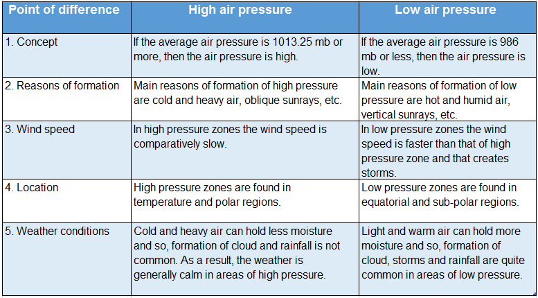
WBBSE Solutions For Class 7 Geography Chapter 3 Air Pressure Difference between high and low pressure of air


Chapter 3 Air Pressure Short Analytical Type Questions

Question 1. Why don’t we feel the air pressure? 
Answer:

We Dont feel the air pressure:

Air exerts 1013.25 mb pressure on an adult human body. Human beings are used to this pressure because the air entering the human body through pores, mouth and windpipe exerts pressure outwards equalising it with the surrounding atmospheric pressure.

So, we do not feel this huge amount of pressure exerted on our bodies.

Question 2. Describe an experiment for air pressure.
Answer:

An experiment for air pressure:

A plastic bottle is taken and filled ¾ with water. If we squeeze the bottle tightly, we will see that the shape gets distorted. If we remove the pressure, the bottle regains its original shape.

WBBSE Solutions For Class 7 Geography Chapter 3 Air Pressure Experiment for air pressure

Now, the mouth of the bottle is shut while squeezing the bottle. If we remove our hand now, we will see that the bottle remains in that state. The bottle does not regain its shape till it is uncapped again.

This is because, when the bottle is squeezed, some air escape out and the pressure inside the bottle becomes less than the atmospheric pressure outside. Due to the higher atmospheric pressure outside the bottle, it does not regain its shape.

Question 3. Prove that air exerts pressure in the upward direction.
Answer:

Air exerts pressure in the upward direction:

The fact that air exerts pressure in the upward direction can be proved through the following experiment.
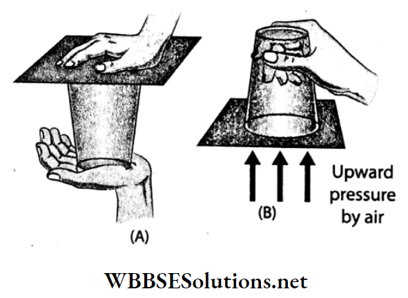
WBBSE Solutions For Class 7 Geography Chapter 3 Air Pressure Experiment to prove that air exerts pressure in the upward direction.

Procedure:

  1. A glass is filled with water to the brim. Now the glass top is completely covered with a postcard.
  2. Now the glass is quickly inverted after keeping the palm lightly on the postcard. Then slowly the hand is removed from the postcard.

Observation:

The postcard does not fall off even when the hand is removed from the inverted glass.

Inference:

The water in the glass exerts downward pressure and at the same time, the outside air exerts upward pressure on the postcard. The upward pressure of the air is much more than that of the downward water pressure and so, the postcard does not fall off.

Since the upward air pressure does not allow the postcard to fall off, hence, it is proved that air exerts upward pressure.

Question 4. A vessel made of a thin sheet of tin with a small opening in It is partially filled with water and heated over a burner. While the water boils, the vapour goes out of the tin vessel. After some time, the opening of the tin vessel is closed with a cork and removed from the burner. What happens after the tin has cooled down?
Answer:

Initially the air pressure inside the tin vessel and the outside atmospheric pressure was equal, so the vessel remained in the normal state. When the water started boiling, the vapour coming out of the vessel removed the air inside along with it.

Then, as the opening of the tin vessel was closed with a cork, air from outside could no longer flow inside. When the vessel cooled down, the atmospheric pressure inside the tin vessel became lower than the outside atmospheric pressure.

As a result, the thin sheets of tin contracted inwards. This happens only due to the presence of atmospheric pressure.

Question 5. Can you boil water at room temperature without heating the vessel? If you can, how?
Answer:

Water is kept in a closed vessel at room temperature and an air-suction pump is attached to it. Now, the air from the vessel is sucked out gradually. We will see that the water starts boiling without being heated.

With a decrease in pressure, the boiling point of any liquid also decreases. Now as the pressure exerted on water in this condition is very low, the boiling point of water becomes equal to the room temperature and the water starts boiling.

Question 6. How does atmospheric pressure vary?
Answer:

Air pressure is not equal everywhere. As gravitational force is highest at sea level, the distance between air molecules decreases and the density of air increases. So, atmospheric pressure is highest here.

The gravitational force decreases with an increase in altitude. As a result, the distance between the air: molecules increases and the density of the air decreases, resulting in a decrease in the atmospheric pressure.

Question 7. Describe a barometer.
Answer:

Barometer:

Barometer was invented by a scientist named Torricelli in the year 1643. The variation of air pressure can be measured with it’s help.

In this instrument, a cylindrical tube filled with mercury is kept upside down in a container filled with mercury. At normal atmospheric pressure, the height of the mercury column in the tube is 76 cm.

With the decrease in atmospheric pressure, the height of the mercury column decreases and vice-versa. Thus, this instrument is used to predict weather conditions and measure altitude.

Question 8. How is the barometer used to predict the weather?
Answer:

Barometer readings help us to predict the weather condition of any place.

WBBSE Solutions For Class 7 Geography Chapter 3 Air Pressure barmeter used to weather prediction

Question 9. Pressure is higher at the sea level and decreases with an increase in altitude. -Explain.
Answer:

Pressure is higher at the sea level and decreases with an increase in altitude:

Closer the molecules of air to one another, the denser is the air and the higher is its pressure. At sea level, the gravitational pull of the Earth is the highest.

Moreover, the upper layers of the air exert pressure on the lower layer and so, the molecules become closely spaced and the density increases. Along with this, the pressure of the air also increases.

However, the density of the upper layers is rarer as the molecules are sparsely placed. As a result, the pressure decreases with an increase in altitude.

Question 10. What is meant by the vertical distribution of atmospheric pressure?
Answer:

Vertical distribution of atmospheric pressure:

Average atmospheric pressure at sea level is 1 kg per sq cm or 1013.25 mb or 760 mm of mercury column or 76 cm of mercury column or 29.92 inches of mercury column.

With the gradual increase in altitude from sea level, the volume and weight of air decrease. And thus atmospheric pressure decreases at a rate of 34 mb for every 300 metres of ascent.

Rate of variation of air pressure with altitude-
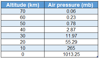
WBBSE Solutions For Class 7 Geography Chapter 3 Air Pressure rate of variation of air pressure with altitude

Source: MC Knight, Tom L (1990): Physical Geography, A Landscape, California (USA).

Question 11. What is the relation between atmospheric temperature and pressure?
Answer:

Relation between atmospheric temperature and pressure:

Atmospheric pressure is inversely dependent upon atmospheric temperature in the following ways-

  1. When a column of air gets heated up, its volume increases and expands. This expansion of air results in a decrease in pressure. So, when the temperature of air increases, pressure decreases.
  2. When the temperature of a column of air decreases, it contracts. With gradual contraction its density and pressure increase. So, pressure increases, with a decrease in temperature.

Question 12. Why do mountaineers use oxygen
Answer:

Mountaineers use oxygen:

The atmospheric pressure is very high near the Earth’s surface and gradually decreases upwards. With the decrease in atmospheric pressure i.e. as the air becomes thinner, the amount of oxygen in it decreases.

It causes difficulties in breathing. As the air pressure at the top of high mountains is very less, mountaineers use oxygen cylinders to help them breathe properly.

Question 13. What is the effect of water vapour on atmospheric pressure?
Answer:

The effect of water vapour on atmospheric pressure:

Humid air (i.e. air with a high amount of water vapour) is comparatively lighter and its pressure is also less. So, regions with high water Descending- vapour content in the air experience low pressure.

On the other hand, if the amount of water vapour present in the air is very less, it is called dry air and high pressure exists there.

So, the atmospheric pressure is very low in the equatorial regions, while high pressure prevails in the polar regions due to a deficiency of water vapour.

Question 14. Name the atmospheric pressure belts.
Answer:

Atmospheric pressure belts:

In some definite regions on the Earth’s surface, high pressure or low pressure is observed throughout the year. These definite regions of atmospheric pressure surround the Earth in the form of belts.

These are called atmospheric pressure belts. There are seven atmospheric belts on the Earth’s surface. These are-

  1. Equatorial low pressure belt (0° -5° north and south of the Equator),
  2. Sub-tropical high-pressure belt in the northern hemisphere (25° -35° north latitude),
  3. Sub-tropical high-pressure belt in the southern hemisphere (25°-35° south latitude),
  4. Sub-polar low-pressure belt near the Arctic circle in the northern hemisphere (60°-90° north latitude),
  5. Sub-polar low-pressure belt near the Antarctic circle in the southern hemisphere (60°-90° south latitude),
  6. Arctic high-pressure belt at the North Pole (90° north latitude), and
  7. Antarctic high-pressure belt at the South Pole (90° south latitude).
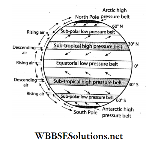
WBBSE Solutions For Class 7 Geography Chapter 3 Air Pressure Atmospheric pressure belts

Question 15. Why is the atmospheric pressure less in the equatorial region?
Answer:

The atmospheric pressure is less in the equatorial regions due to the following factors-

1. High temperature:

The Equatorial region experiences vertical rays of the sun throughout the year. So the temperature is very high. It causes upward movement of air by the process of convection. Hot air is light so its pressure is low.

2. Excessive humidity:

The water area is more than the land area at the Equator, which leads to excess addition of water vapour in the atmosphere around this region. The air pressure of humid air is lower than dry air.

3. Highest rotational speed:

The highest rotational speed of the Earth at the Equator causes the deflection of wind. Thus low pressure prevails over the equatorial regions.

Question 16. What is the equatorial low-pressure belt or doldrums?
Answer:

Atmospheric pressure cells:

Due to the intense low pressure along the equatorial region, the winds are always warm and moist and move upwards. As there is no horizontal movement of wind in this region throughout the year, calm conditions prevail.

So, this pressure belt is called the equatorial low-pressure belt or doldrums.

Question 17. What are atmospheric pressure cells?
Answer:

Atmospheric pressure cells:

There exists a difference in air temperature and air pressure between the land areas and the water areas.

Sometimes these atmospheric pressure belts do not surround the Earth continuously in the east-west direction but get divided into small parts or regions. These small regions of air pressure are called pressure cells.

The number of pressure cells is higher in the northern hemisphere than in the southern hemisphere as the latter has a continuous stretch of waterbody for an extensive area which leads to the formation of pressure belts rather than pressure cells over it.
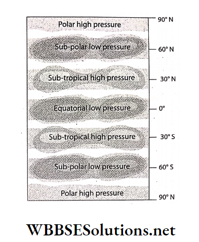
WBBSE Solutions For Class 7 Geography Chapter 3 Air Pressure Atmospheric pressure cells

Question 18. What are the characteristics of isobars?
Answer:

The characteristics of isobars are as follows-

  1. Isobars are the black sinuous lines drawn on a weather map joining places of equal atmospheric pressure.
  2. Normal values of isobars over the Earth vary between 980 mb to 1050 MB. It is expressed in millibar.
  3. It is always shown according to the sea level pressure.
  4. They never intersect or touch one another.
  5. When the isobar lines are very close to one another, the pressure difference is high and the speed of the wind is also high.

Question 19. What do you mean by high pressure and low pressure?
Answer:

High pressure and low pressure:

Standard atmospheric pressure is 1013.25 MB. Air pressure, ranging between 986 mb-1013mb, is considered as normal air
pressure. If the average air pressure is more than 1013.25 mb, it is known as high pressure.

When the air gets cooled and compressed, the density increases, i.e. the number of molecules in a specific volume of air increases and air pressure also increases, creating high pressure.

If the average air pressure is less than 986 MB, it is known as low pressure. When the temperature of air increases, the molecules of air become dynamic and move apart from one another.

As a result, the air gradually expands and becomes lighter and rises upwards, the density of air decreases, i.e. the number of molecules in a specific volume of air decreases and the air pressure also decreases, creating low pressure.
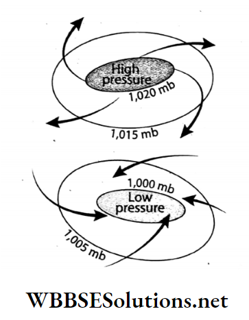
WBBSE Solutions For Class 7 Geography Chapter 3 Air Pressure High pressure and low pressure

Question 20. What are the characteristics of air pressure?
Answer:

The main characteristics of air pressure are as follows-

1. Relation with altitude: Air pressure decreases with an increase in altitude and increases with a decrease in altitude. Pressure decreases by about 34 mb for every 300 metres of ascent.

2. Relation with temperature: Air pressure decreases with an increase in temperature and vice-versa.

3. Relation with water vapour: The pressure of air saturated with water vapour is low. So, the atmospheric pressure is low during the monsoon season.

4. Occurrence of the storm: Sudden fall in air pressure may cause storms.

5. Standard atmospheric pressure: The mean atmospheric pressure is about 1013.25 mb at sea level.

6. High pressure and low pressure: Pressure that registers at more than 1013.25 mb is called high pressure and less than 986 mb is called low pressure.

7. Relation with isobar: If the isobars are closely spaced, it indicates a rapid change of air pressure.

Question 21. What are the importance of winds?
Answer:

The importance of winds are-

  1. They regulate the heat balance between different regions on the Earth.
  2. Many natural weather phenomena like clouds, rains, etc. occur due to winds.
  3. Winds regulate the balance between the high and low-pressure zones.

Question 22. Mention the different names of cyclones.
Answer:

Cyclones are known by different names in different parts of the world depending on which ocean it has formed over.
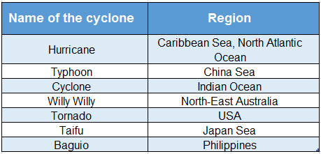
WBBSE Solutions For Class 7 Geography Chapter 3 Air Pressure Different names of cyclone and regions

Question 23. What is Kalbaisakhi or Nor’westers?
Answer:

Kalbaisakhi or Nor’westers:

East India, especially West Bengal and its surrounding regions experience torrential rains from thunderstorms and sometimes hailstorms in summer due to the cyclonic winds coming from the northwest direction.

These thunderstorms are called Nor’westers or Kalbaisakhi, as they arrive mainly in the months of April and May. The latter name means “calamity of the month of Baisakh”.

Question 24. State the effect of atmospheric pressure on the day-to-day lives of the people living in Darjeeling.
Answer:

The effect of atmospheric pressure on the day-to-day lives of the people living in Darjeeling

Darjeeling is located at an altitude of 2042 metres above sea level. At this altitude, the atmospheric pressure is lower than that of the plains i.e. approximately 795 MB.

Due to low atmospheric pressure, water boils at a temperature of about 93.6°C which lengthens the time taken for food to be cooked. Thus, this creates problems in day-to-day activities.

Question 25. State the effect of atmospheric pressure on the day-to-day lives of the people living in the coastal areas of Puri.
Answer:

The effect of atmospheric pressure on the day-to-day lives of the people living in the coastal areas of Puri.

The average temperature and atmospheric pressure in the coastal areas of Puri is around 20°C (although the book mentions 20°C, the temperature is 27° C) and 1000 MB respectively throughout the year.

At this pressure level, food can be easily cooked and there is no difficulty. So, there is no problem in boiling food. This condition is favourable for carrying out normal day-to-day human activities.

Question 26. What are the applications of air pressure in our day-to-day life?
Answer:

The applications of air pressure that we observe in our daily life are-

  1. Water can be lifted with the help of a pump due to air pressure.
  2. We can drink any liquid with a straw due to air pressure.
  3. Liquids can be filled in syringes, sprayers can be filled with coloured water during Holi, and ink can be drawn into a dropper only due to air pressure.

Question 27. What are the effects of air pressure?
Answer:

The effects of air pressure are as follows-

1. Effect on the respiratory system:

As the pressure of air is very low at high altitudes, we need to breathe faster while climbing mountains. For this reason, mountaineers carry oxygen cylinders with them.

2. Effect on health:

At very high altitudes, where the air pressure is very low, the pressure of the blood molecules inside our body increases drastically and may result in bleeding from our ears, nose, eyes, etc.

3. Effect on weather conditions:

Severe cyclones and rain occur in intense low-pressure regions.

4. Effect on air:

Air pressure influences the direction of airflow, the temperature of the air, etc.

Chapter 3 Air Pressure Short Answer Type Questions

Question 1. What is the reason for the existence of atmospheric pressure on Earth?
Answer:

The reason for the existence of atmospheric pressure on Earth:

As air itself has weight and exerts pressure on the Earth’s surface, there is the existence of atmospheric pressure. The Earth has a huge mass and hence exerts a strong gravitational force.

Due to this strong gravity, it can hold onto this large atmosphere.

Question 2. What is meant by normal or standard atmospheric pressure?
Answer:

The pressure exerted at sea level by 76 cm of mercury column at 0°C temperature, at 45° North latitudes, is called the standard atmospheric pressure. It is equal to 1 kg per sq cm or 1013.25 mb.

Question 3. We use straws for drinking cold drinks. How does the liquid come up through the oes the straw?
Answer:

While drinking cold drinks, one end of the straw is in our mouth while the other is dipped into the liquid. When we suck the air out of the straw, low pressure is created inside it.

The atmospheric pressure acting on the liquid surface pushes the liquid up through the straw.

Question 4. When a syringe is dipped into water and the piston is pulled up, why does water come up through the mouth of the syringe? Or, How does water come up into a syringe?
Answer:

A low pressure is created inside the syringe when we pull the piston of a syringe while dipping its mouth into the water. The atmospheric pressure acting on the water surface pushes the water up into the syringe.

Question 5. One of your neighbours is going to climb Mount Everest. How can you make him aware of the dangers he might face?
Answer:

Mount Everest is the highest mountain in the world (8848 metres). At this height, the atmospheric pressure is rd of the pressure at sea level, i.e. 330 millibars.

As the air pressure is very low there, it becomes difficult to breathe. So, I will advise him to carry an oxygen cylinder while climbing.

Also, as the air pressure is very low at such a high altitude, our blood pressure rises. So often, mountaineers experience bleeding from the nose, eyes, ears, etc. I will also warn him about this.

Question 6. If you visit Gomukh Ice Cave and put your hand in the boiling water, your hand does not burn.-Why?
Answer:

Gomukh is located at a very high altitude above sea level (about 3900 metres). At this height, the pressure of air is very low and thus, water boils at a temperature much lower than 100° C.

So, when you touch that boiling water, your hand does not burn.

Question 7. Why is it difficult to cook food in hilly regions?
Answer:

The atmospheric pressure decreases with an increase in altitude. We know that, boiling point increases with an increase in the air pressure.

But, as air pressure is less in hilly regions, the food materials start to boil at a temperature less than 100°C, taking more time for the food to get cooked.

Question 8. Why does food get cooked faster in a pressure cooker?
Answer:

While cooking in a pressure cooker, the pressure of the water vapour is increased to boil water at a temperature higher than 100°C. As the temperature rises, the food gets boiled faster and, so gets cooked quickly.

Question 9. It is always advised to cook rice in a covered vessel.-Why?
Answer:

If rice is cooked in a covered vessel, the water vapour cannot leak out of the vessel. This vapour pressure inside the vessel becomes more than the atmospheric pressure.

Due to this excess vapour pressure, the rice inside starts to boil at a temperature more than 100°C and gets cooked quickly.

Question 10. While filling up air in a balloon or a cycle tyre, if more air is filled by chance, it bursts.-Explain why?
Answer:

The elastic nature of the balloon or a cycle tyre, allows a little more air to be filled. But if excessive air is filled by chance, the surplus pressure cannot be withstood by the walls of the balloon or the cycle tyre and so, it bursts.

Question 11. Why is atmospheric pressure low during the monsoon season?
Answer:

Saturated air (i.e. air with a maximum limit of water vapour) is lighter than dry air. Thus the atmospheric pressure decreases with an increase in the amount of water vapour in the air.

In the monsoon season, the amount of water vapour in the air is very high. So, the atmospheric pressure is very low.

Question 12. Why is the atmospheric pressure high in the polar regions?
Answer:

In both polar regions, the sunrays fall obliquely and so, do not adequately heat up the surface and the air above it. So, the polar air remains cold and keeps on contracting.

With the gradual contraction of air, the air density increases along with its pressure. Thus, atmospheric pressure is high in the polar regions.

Question 13. What are isobars?
Answer:

Isobars:

The imaginary lines drawn on a map joining places with equal atmospheric pressure at a particular time are known as isobars. In a weather map, the isobars are expressed in millibars with the help of black, sinuous lines.

Question 14. What do you mean by air current?
Answer:

Air Current:

The vertical movement of air from a region of high pressure to a region of low pressure is called air current. When the air at any place gets heated up, it expands, gets lighter and moves upwards vertically.

Cold air from the surrounding regions rushes in to take its place. This vertical or nearly vertical movement of air causes air current.

Question 15. Define a cyclone.
Answer:

Cyclone:

A cyclone is a system of winds around an area of low pressure surrounded by high-pressure areas. This is usually characterised by inward spiralling winds that rotate anti-clockwise in the northern hemisphere and clockwise in the southern hemisphere.

These cyclonic winds bring heavy rain and cause huge loss of life and property in the areas over which they blow.
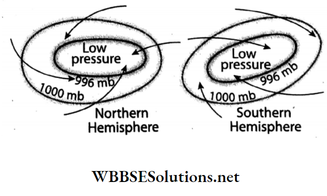
WBBSE Solutions For Class 7 Geography Chapter 3 Air Pressure Cyclone

Question 16. Why does the weather become calm before the storm?
Answer:

Storms are usually formed due to high temperatures. In some regions, the air gets hotter and lighter and moves upwards. An intense low-pressure zone forms over the region. At this time, there is no horizontal flow of air.

So, the weather becomes calm before the storm. Cold air from the surrounding region rushes in the form of storms to fill in the region of low pressure.

Chapter 3 Air Pressure Multiple Choice Questions Choose The Correct Option

Question 1. The blanket of air surrounding the Earth is called-

  1. Atmosphere
  2. Hydrosphere
  3. Lithosphere

Answer: 1. Atmosphere

Question 2. The force exerted by the air per unit area on the Earth’s surface is called atmospheric-

  1. Pressure
  2. Humidity
  3. Density

Answer: 1. Pressure

Question 3. Normal atmospheric pressure at sea level is approximate-

  1. 1000 MB
  2. 1020.5 MB
  3. 1013.25 MB

Answer: 3. 1013.25 MB

Question 4. Air exerts pressure on the Earth’s surface due to the-

  1. Transparency of air
  2. Gravitational attraction of the earth
  3. Gaseous nature of air

Answer: 2. Gravitational attraction of the earth

Question 5. Atmospheric pressure falls by for every 110 metres of ascent.

  1. 1 cm of mercury
  2. 1 mm of mercury
  3. 1 MB.

Answer: 1. 1 cm of mercury

Question 6. The average air pressure is-

  1. 1 kg per square centimetre
  2. 1 tonne per square centimetre
  3. 1 gram per square centimetre

Answer: 1. 1 kg per square centimetre

Question 7. Normal atmospheric pressure over the Earth varies between-

  1. 980 mb to 1050 mb
  2. 580 mb to 650 mb
  3. 180 mb to 270 mb

Answer: 1. 980 Mb to 1050 Mb

Question 8. Atmospheric pressure is measured by an instrument called-

  1. Thermometer
  2. Barometer
  3. Hygrometer

Answer: 2. Barometer

Question 9. The barometer was invented by-

  1. Torricelli
  2. Galileo
  3. Newton

Answer: 1. Torricelli

Question 10. is used in barometers.

  1. Oil
  2. Water
  3. Mercury

Answer: 3. Mercury

Question 11. Gradual fall in the mercury column in a barometer indicates the probable occurrence of-

  1. Rain
  2. Clear weather
  3. Blue sky

Answer: 1. Rain

Question 12. The principal cause of variation in the atmospheric pressure is-

  1. Air flow
  2. Temperature
  3. Latitude

Answer: 2. Temperature

Question 13. We do not feel the atmospheric pressure, because-

  1. It is balanced by the fluid pressure inside our body
  2. It is less
  3. Our body can tolerate the pressure

Answer: 1. It is balanced by the fluid pressure inside our body

Question 14. Atmospheric pressure on a high mountain range is-

  1. More than that at sea level
  2. Less than that at sea level
  3. Same as that at sea level

Answer: 2. Less than that at sea level

Question 15. At the top of Mount Everest, the atmospheric pressure is-

  1. 330 millibar
  2. 30 millibar
  3. 1000 millibar

Answer: 1. 330 millibar

Question 16. With an increase in altitude the atmospheric pressure-

  1. Increases
  2. Remains the same
  3. Decreases

Answer: 3. Decreases

Question 17. In hilly regions the boiling point of liquids-

  1. Increases
  2. Remains the same
  3. Decreases

Answer: 3. Decreases

Question 18. With an increase in atmospheric pressure, the boiling point of liquids-

  1. Increases
  2. Decreases
  3. Remains The Same

Answer: 1. Increases

Question 19. Water vapour is than air.

  1. Lighter
  2. Heavier
  3. At times lighter or heavier

Answer: 1. Lighter

Question 20. The amount of water vapour present in the air is-

  1. Variable
  2. Same
  3. Increases

Answer: 1. Variable

Question 21. In the monsoon season, atmospheric pressure remains-

  1. High
  2. Low
  3. Very high

Answer: 2. Low

Question 22. The pressure of saturated air is-

  1. Low
  2. High
  3. Moderate

Answer: 1. Low

Question 23. With an increase in pressure, the volume of air-

  1. Increases
  2. Remains The Same
  3. Decreases

Answer: 3. Decreases

Question 24. When air is heated up, the molecules contained within it move-

  1. Faster
  2. At the same speed
  3. Slower

Answer: 1. Faster

Question 25. When hot air cools down, its density-

  1. Increases
  2. Remains the same
  3. Decreases

Answer: 1. Increases

Question 26. Permanent low-pressure belts prevail over the-

  1. Equatorial Region
  2. Subtropical Region
  3. Polar Region

Answer: 1. Equatorial Region

Question 27. The number of permanent pressure belts on the Earth’s surface are-

  1. 5
  2. 6
  3. 7

Answer: 3. 7

Question 28. The sub-polar low-pressure belt near the Antarctic Circle is observed around the-

  1. 66½° north latitude
  2. 66½° south latitude
  3. 23½° south latitude

Answer: 2. 66½° south latitude

Question 29. lies between 60°-90° N and S Latitudes.

  1. High-pressure belt
  2. Calm pressure belt
  3. Low-pressure belt

Answer: 3. Low-pressure belt

Question 30. forms due to extreme cold conditions in both polar regions.

  1. High-pressure belt
  2. Low-pressure belt
  3. Calm belt

Answer: 1. High-pressure belt

Question 31. In the equatorial region, the atmospheric pressure is-

  1. High
  2. Low
  3. Moderate

Answer: 2. Low

Question 32. The pressure zone prevails over the North Pole is-

  1. High
  2. Low
  3. Moderate

Answer: 1. High

Question 33. Low-pressure belt lies between-

  1. 5°N-5°S latitude
  2. 20°-30°N and S latitude
  3. 30°-40°N and S latitude

Answer: 1. 5°N-5°S latitude

Question 34. Sub-tropical high-pressure belts exist between-

  1. 25°-35°N and S latitudes
  2. 5°-10°N and S latitudes
  3. 30°-60°N and S latitudes

Answer: 1. 25°-35°N and S latitudes

Question 35. Polar high-pressure belts form between-

  1. 90°N and S latitudes
  2. 25°-35°N and S latitudes
  3. 30°-60°N and S latitudes

Answer: 1. 90°N and S latitudes

Question 36. The number of pressure cells observed in the northern hemisphere is that in the southern hemisphere.

  1. More than
  2. Same as
  3. Less than

Answer: 1. More than

Question 37. The size of pressure cells is elongated in the-

  1. Southern hemisphere
  2. Eastern hemisphere
  3. Northern hemisphere

Answer: 1. Southern hemisphere

Question 38. The line joining places of equal pressure on the Earth’s surface is called-

  1. Contour
  2. Isotherm
  3. Isobar

Answer: 3. Isobar

Question 39. The isobars stretch along-

  1. East-west direction
  2. North-south direction
  3. North-west direction

Answer: 1. East-west direction

Question 40. Closely-spaced isobars indicate the presence of-

  1. High-Velocity Winds
  2. Low-Velocity Winds
  3. Feeble Winds

Answer: 1. High-Velocity Winds

Question 41. Winds blowing from high-pressure zones

  1. Cold in nature
  2. Hot in nature
  3. Light in nature

Answer: 1. Cold in nature

Question 42. The tropical cyclones which form over the China Sea are called-

  1. Typhoon
  2. Tornado
  3. Willy Willy

Answer: 1. Typhoon

Question 43. The tropical cyclones which form over north-west Australia are called-

  1. Willy Willy
  2. Tornado
  3. Hurricane

Answer: 1. Willy Willy

Question 44. The whirlwinds that form on the Indian Ocean are known as-

  1. Cyclones
  2. Hurricanes
  3. Typhoons

Answer: 1. Cyclones

Question 45. The average air temperature at the top of Mount Everest is-

  1. -20°C to -35°C
  2. -200°C to -350°C
  3. 20°C to 35°C

Answer: 1. -20°C to -35°C

Question 46. In Puri, the atmospheric pressure is approximate-

  1. 1000 millibar
  2. 330 millibar
  3. 30 millibar

Answer: 1. 1000 millibar

Question 47. The speed of air is measured in units of-

  1. Millibar
  2. Kilogram
  3. Knot

Answer: 3. Knot

Chapter 3 Air Pressure Very Short Answer Type Questions Fill In The Blanks

Question 1. The unit for measuring air pressure is _______.
Answer: Millibar

Question 2. The instrument used for measuring atmospheric pressure is known as _______.
Answer: Barometer

Question 3. For measuring the temperature, a _______ is used with the barometer.
Answer: Thermometer

Question 4. The average atmospheric pressure at sea level is _______ mb.
Answer: 1013.25

Question 5. The average air pressure at sea level is _______ inches of mercury.
Answer: 29.92

Question 6. Air pressure is _______ in the mines than at sea level.
Answer: Higher

Question 7. In nature, pressure _______ with an increase in air temperature and pressure with a decrease in air temperature.
Answer: Decreases, increases

Question 8. _______ winds are heavy so, their pressure is high.
Answer: Cold

Question 9. Air pressure _______ with an increase in altitude from sea level.
Answer: Decreases

Question 10. With the increase in density of air, pressure _______.
Answer: Increases

Question 11. Mountaineers use _______ cylinders at high altitudes.
Answer: Oxygen

Question 12. With the increase in temperature, the pressure of air _______.
Answer: decreases

Question 13. The total number of pressure belts observed over the Earth’s surface are _______.
Answer: 7

Question 14. Equatorial low-pressure belts exist between _______ to _______ parallels of latitudes.
Answer: 5° N, 5°S

Question 15. In the equatorial region, _______ pressure belts are formed.
Answer: Low

Question 16. Sub-polar low-pressure belts are observed approximately over _______ latitudes.
Answer: 66½°N and S

Question 17. Sub-tropical high-pressure belt near the Tropic of Cancer is located between _______ latitudes.
Answer: 25° N-35° N

Question 18. The number of pressure cells are more in the _______ hemisphere.
Answer: Northern

Question 19. Air pressure decreases in the _______ season.
Answer: Summer

Question 20. In the month of July, _______ belt is formed in the interior parts of the continent of Asia.
Answer: Low pressure

Question 21. The principal cause of airflow is the difference in _______ between two places.
Answer: Pressure

Question 22. Air flows from _______ pressure zones to pressure zones.
Answer: High, low

Question 23. Air pressure less than 986 mb is called _______.
Answer: Low pressure

Question 24. The difference in air pressure between any two places determines the _______ between those two places.
Answer: Pressure gradient

Write True Or False

Question 1. Atmospheric pressure is 1.5 kg per sq. cm.
Answer: False

Question 2. Sub-tropical high-pressure belts lie between 30°-40° N and S parallel of latitudes.
Answer: True

Question 3. The atmosphere exerts a pressure of 5500 millibars on an adult human body.
Answer: False

Question 4. The atmospheric pressure increases with the increase in the amount of water vapour in the air.
Answer: False

Question 5 Air pressure increases by 34 millibars approximately for every 300 metres of ascent.
Answer: False

Question 6. Air pressure is measured by a wind vane.
Answer: False

Question 7. The weight of air per unit area is called air pressure.
Answer: True

Question 8. Air pressure increases with the rise in air temperature.
Answer: False

Question 9. The pressure of wet air is less than dry air.
Answer: True

Question 10. The polar high-pressure belts lie at the North and South Poles.
Answer: True

Question 11. The unit of measuring air pressure is millibar.
Answer: True

Question 12. As the air near the Earth’s surface is dense, the pressure is lowest in this zone.
Answer: False

Question 13. Air pressure at sea level is approximately 1003.25 mb.
Answer: False

Question 14. There are 3 low-pressure belts and 4 high-pressure belts on the Earth’s surface.
Answer: True

Question 15. A sudden fall on the mercury column of a barometer indicates the probable occurrence of storm.
Answer: True

Question 16. The cyclones formed in the USA are called Hurricanes.
Answer: False

Question 17. Barometer can also be used to measure altitude.
Answer: True

Question 18. The latitudinal extension of air pressure cells is less in the northern hemisphere.
Answer: False

Question 19. Intense low pressure exists at the centre of a cyclone.
Answer: True

Question 20. The speed of air is measured with the help of a barometer.
Answer: False

Chapter 3 Air Pressure Find The Relation

Question 1. Higher air pressure: Sea level:: Lesser air pressure: ___________.
Answer: Mountainous region

Question 2. Air temperature: Isotherm:: Air pressure: ___________.
Answer: Isobar

Question 3. High pressure: Clear and calm weather:: Low pressure: ___________.
Answer: Stormy and turbulent weather

Match The Columns

1. WBBSE Solutions For Class 7 Geography Chapter 3 Air Pressure match the columns
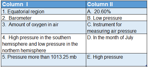
Answer: 1. B, 2. C, 3. A, 4. D, 5. E

2.WBBSE Solutions For Class 7 Geography Chapter 3 Air Pressure match the columns.

Answer: 1. B, 2. A, 3. D, 4. E, 5. C

Answer In One Or Two Words

Question 1. What is the name of the force exerted by any air mass on the Earth’s surface?
Answer: Air pressure.

Question 2. What is the average pressure of air at sea level?
Answer: 1013.25 MB.

Question 3. Name the instrument used to measure atmospheric pressure.
Answer: Barometer.

Question 4. Who invented the barometer in the year 1643?
Answer: Evangelista Torricelli.

Question 5. What type of weather is indicated by the sudden fall of mercury in a barometer?
Answer: Stormy weather.

Question 6. How much does air pressure decrease for every 110-metre rise in altitude?
Answer: 1 cm of mercury column.

Question 7. What type of relationship exists between temperature and air pressure?
Answer: Inversely proportional.

Question 8. What is the relation between altitude and atmospheric pressure?
Answer: Inversely proportional.

Question 9. What type of pressure is created as water vapour mixes with the air?
Answer: Low pressure.

Question 10. Name the high-pressure and low-pressure centres surrounding the Earth.
Answer: Pressure belts.

Question 11. How many permanent high-pressure belts exist on Earth?
Answer: 4 (Four).

Question 12. Which pressure belt is formed surrounding the Equator?
Answer: Equatorial low-pressure belt.

Question 13. Which pressure belt is formed surrounding the Tropic of Cancer and the Tropic of Capricorn?
Answer: Sub-tropical high-pressure belt.

Question 14. Name the pressure zone that is formed between 70°-90° parallels of latitudes.
Answer: Polar high-pressure belt.

Question 15. Name the imaginary line that connects all places with equal atmospheric pressure.
Answer: Isobar.

Question 16. What are the areas with lesser atmospheric pressure than the standard atmospheric pressure known as?
Answer: Low-pressure area.

Question 17. What are the areas with higher atmospheric pressure than the standard atmospheric pressure known as?
Answer: High-pressure area.

Question 18. Name the horizontal movement of air from the high-pressure to the low-pressure zone.
Answer: Wind.

Question 19. Name the spiralling winds that move at high velocity from high-pressure regions to low-pressure regions.
Answer: Cyclonic winds.

Question 20. Name the type of whirlwind that originates over the China Sea.
Answer: Typhoon.

Question 21. Name the type of whirlwind that is found in the United States of America.
Answer: Tornado.

Question 22. Name the type of whirlwind originating over the Indian Ocean.
Answer: Cyclone.

Question 23. Name the whirlwind originating over the Caribbean Sea.
Answer: Hurricane.

Chapter 3 Air Pressure Miscellaneous Type Questions Find The Odd One Out

Question 1. Typhoon: Southerly winds: Tornado: Cyclone
Answer: Southerly winds (not a type of cyclone)

Question 2. High pressure: Air current: Low pressure: Temperature
Answer: Air current (not related to air pressure)

Question 3. Water vapour: Loo: Low pressure: Whirlwind
Answer: Loo (not directly related to air pressure)

Question 4. Trade wind: Westerlies Polar wind: Sea breeze
Answer: Sea breeze (not a planetary wind)

Chapter 3 Air Pressure Correct The Following

Question 1. Air pressure is 1 kilogram for every square foot.
Answer: Ton

Question 2. Air pressure increases with an increase in altitude.
Answer: Decreases

Question 3. Air exerts pressure downwards.
Answer: In all directions

Question 4. Torricelli invented the thermometer.
Answer: Barometer

Question 5. The instrument used to measure air pressure is a hygrometer.
Answer: Barometer

Question 6. Moist air is more than dry air at the same temperature.
Answer: Less

Who Am I?

Question 1. I flow from the high-pressure zone to the low-pressure zone. Who am I?
Answer: Air

Question 2. I move with tremendous velocity from centres of high pressure to centres of low pressure with a circular motion. Who am I?
Answer: Cyclone

Question 3. Atmospheric pressure is measured with my help. Who am I?
Answer: Barometer

Question 4. I invented the barometer. Who am I?
Answer: Torricelli

Question 5. I am the unit of measurement of air pressure. Who am I?
Answer: Millibar

Question 6. The air becomes lighter when I mix with it. Who am I?
Answer: Water vapour

Question 7. I am an imaginary line joining all the places on the Earth’s surface with equal atmospheric pressure. Who am I?
Answer: Isobar

Question 8. I am used to determining the air pressure in a barometer. Who am I?
Answer: Mercury

Question 9. I exert a pressure of 1013.25 mb at sea level. Who am I?
Answer: Air

Question 10. In hilly regions, it is difficult to cook rice and pulses due to my deficiency. Who am I?
Answer: Air pressure

Question 11. It is difficult to breathe in the hilly regions of high altitude due to my deficiency. Mountaineers carry me with themselves. Who am I?
Answer: Oxygen

Chapter 3 Air Pressure Scrambled words

1. ESPRRESU
2. MEROTERBA
3. LLIRBAMI
4. AROBIS
5. CARIHURNE
6. ONTYPHO

Answers:

1. PRESSURE
2. BAROMETER
3. MILLIBAR
4. ISOBAR
5. HURRICANE
6. TYPHOON

Fill Up The Blanks In The Knowledge Hive

Question 1. Fill up the knowledge hive with information about barometers.
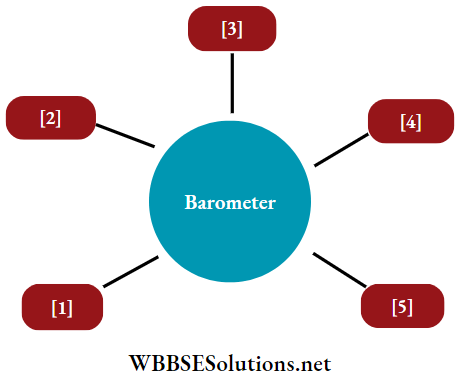
WBBSE Solutions For Class 7 Geography Chapter 3 Air Pressure Barometer

Answers:

1. This instrument is used to measure air pressure.
2. Torricelli invented the mercury barometer in the year 1643.
3. Barometers are of various types- Fortin’s, Aneroid, etc.
4. To ensure the accuracy of the reading of the mercury height, a vernier scale is attached to the top of the mercury column in a Fortin barometer.
5. Apart from measuring atmospheric pressure, it is also utilised for weather forecasts and measuring altitude.


Answer With Reference To The Illustration

Question 1. Which of the following is a low-pressure and high-pressure diagram? Identify the direction of wind flow.
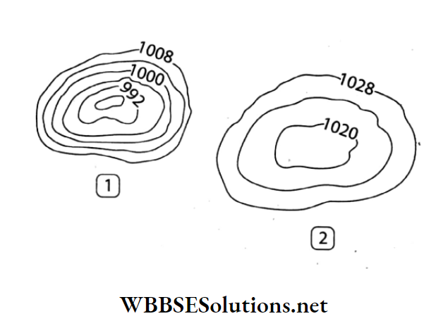
WBBSE Solutions For Class 7 Geography Chapter 3 Air Pressure High pressure and low pressure.

Answers:

1. Low-pressure diagram
2. High-pressure diagram
3. Wind flow from 2 to 1

Question 2. Do you have any idea what the winding black lines in the adjacent diagram are?
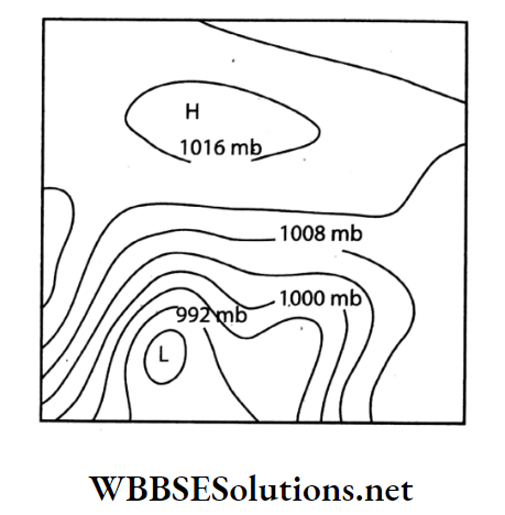
 

WBBSE Solutions For Class 7 Geography Chapter 3 Air Pressure Winding black lines in the adjacent diagram

Answers:

The winding black lines in the adjacent diagram are called isobars. These imaginary lines join the places with equal air pressure at a particular time.

Chapter 3 Air Pressure Crossword

Question 1.
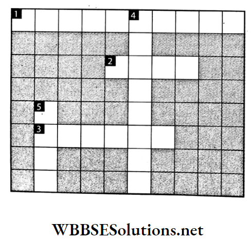
WBBSE Solutions For Class 7 Geography Chapter 3 Air Pressure Crossword

Clues

Down:

4. Instrument used to determine the direction of the wind.
5. Results from air pressure difference.

Across:

1. Tropical storm over Australia.
2. Unit of wind speed.
3. Line joining places having equal atmospheric pressure.

Answers:

Down: 4. WIND VANE 5. WIND
Across: 1. WILLY WILLY, 2. KNOT, 3. ISOBAR

Question 2.


WBBSE Solutions For Class 7 Geography Chapter 3 Air Pressure Crossword.

Clues

Down:

4. Instrument used to measure atmospheric pressure.
5. Rate at which air moves from high pressure to low pressure.

Across:

1. Instrument used to measure wind speed.
2. Unit of atmospheric pressure.
3. Tropical storm originating over the Indian Ocean.

Answers:

Down: 4. BAROMETER, 5. WIND SPEED
Across: 1. ANEMOMETER, 2. MILLIBAR, 3. CYCLONE

Chapter 3 Air Pressure Advanced Questions And Answers

Question 1. The people living on the plains get tired easily when they go to the hilly regions. Why?
Answer:

The people living on the plains get tired easily when they go to the hilly regions.

As the density of air is less in the hilly regions, the amount of oxygen is also less. This low oxygen content in the atmosphere of hilly regions not only causes breathing problems but also makes people coming from plains feel tired easily.

Question 2. How can we use a barometer in the determination of altitude?
Answer:

We Can use a barometer in the determination of altitude

Atmospheric pressure changes with altitude resulting in a difference in atmospheric pressure between two places lying at different altitudes.

We can calculate this difference in altitude by measuring the difference in atmospheric pressure between two places with the help of a barometer.

Question 3. What are the characteristics of a cyclone?
Answer:

The characteristics of a cyclone are as follows-

  1. Low pressure exists in the centre, surrounded by high pressure.
  2. The cyclonic winds spiral in an anti-clockwise direction in the northern hemisphere and a clockwise direction in the southern hemisphere.
  3. In the centre of a cyclone, there are hot and upward-moving winds.
  4. In a cyclone, the speed of the wind is very high, often resulting in strong and destructive winds.
  5. This phenomenon, although powerful, is usually short-lived.

Question 4. State the difference between pressure belts and pressure cells.
Answer:

The differences between pressure belts and pressure cells are-

WBBSE Solutions For Class 7 Geography Chapter 3 Air Pressure Difference between Pressure belts and presure cells


Chapter 3 Air Pressure Formative Interpretation And Application

This Segment will test whether the students have understood the topics, or whether they are just memorising them.

Question 1. Why do astronauts wear special spacesuits that are filled with air?
Answer:

As there is no air in space, the nerves and blood vessels can explode due to the pressure exerted by air from inside the body of the astronauts.

So, they wear special spacesuits which are filled with air before going to space. So that there is a balance of air pressure.

Question 2. Take a large, empty bottle with an open mouth. Crumple a paper to form a small ball so that the size of the ball is half the diameter of the mouth of the bottle. Now hold the bottle in a horizontal position and try to blow the ball into it. See what happens. Ask your friends to try the same. However strong you may be blowing, the ball does not enter the bottle. Why?
Answer:

A bottle is placed on the table. A paper is crumpled to make a small ball. If we try to blow in the paper ball through the mouth of the bottle then it is observed that the paper ball does not enter the bottle.

It will just move around the mouth of the bottle as if some force is not allowing it to go in. This happens because of the difference of pressure inside and outside the bottle.

It has been experimentally proved that the air pressure is always low where the wind speed is high. According to the diagram, the air pressure between the face and the paper ball is higher than the air pressure between the paper ball and the mouth of the bottle.

Thus the air pressure between the paper ball and the mouth of the person becomes lower than the air pressure between the bottle mouth and the paper ball. So for this reason, however strong we may be blowing, the ball does not enter the bottle.

WBBSE Solutions For Class 7 Geography Chapter 3 Air Pressure Experiment to prove variation in air pressure

Question 3. Close a plastic bottle, partly filled with water, with a thin piece of polythene or a cork. Insert a narrow tube of pipe through the cap of the bottle and blow a few times, strongly, into the pipe. See what happens.
Answer:

If we put our mouths on the tube and blow a few times inside the bottle, we can see that some bubbles are formed in the water and these rise up to the top.

This is because if we blow in a narrow tube, the air from the mouth enters through the tube and forms a bubble. These bubbles, made of air, being lighter than water come up on the water.

WBBSE Solutions For Class 7 Geography Chapter 3 Air Pressure Experiment to from bubbles

Question 4. It was a scorching hot day today. The sun was beating down hard all day. Srijan usually plays in the field after returning from school. But his mother didn’t let him go out today, because dark clouds were looming in the sky. Not a single leaf stirred. Suddenly a storm broke. The wind was lashing hard on the doors and the window panes. Soon after, it started to rain. Such a lull occurs before a storm. The wind hardly blows then. Why?
Answer:

During the daytime, the Earth’s surface is heated intensely by sun rays. Due to high temperature, the air of that place becomes warm, and light and rises up.

In this way, the air adjacent to the Earth’s surface gradually gets heated up and rises. The place becomes airless to some extent. As a result, a deep low-pressure area is formed.

Air does not flow horizontally until the heavy air of the surrounding areas rushes to the low-pressure area. That is why before the storm, the surrounding area is calm, and not a single leaf of a tree moves.

When the relatively cold and heavy air gushes in to the low pressure area, the storm is created.

Question 5. Jhinuk went to Gomukh with her parents during the puja vacation. The ice cave of Gomukh is the source of the River Ganga, situated high in the Himalayas (almost 3900 m in height). The place was indeed beautiful but the food did not suit her. Rice and pulses could not be boiled well out here. Father said this was common in the high mountainous region. The air pressure being less in high mountainous regions, water starts to boil at low temperatures. Why does this happen?
Answer:

Generally air pressure decreases with increasing altitude. So the air pressure is quite low at Gomukh in the Himalayas at an altitude of 3900 metres. That is why the boiling point of water decreases in the highlands.

When the pressure in the atmosphere is low, water boils at a temperature below 100°C. So food does not boil well. That is why it is difficult to cook rice and pulses in hilly areas.

Question 6.
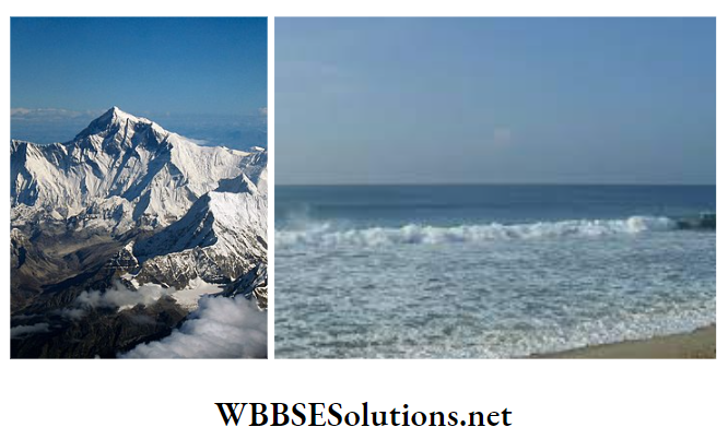
WBBSE Solutions For Class 7 Geography Chapter 3 Air Pressure Mount Everest and The beach of puri


WBBSE Solutions For Class 7 Geography Chapter 3 Air Pressure Mount everest and The beach of puri

How is the weather likely to be in these two places? If you travel from Puri beach to Mount Everest, what changes in your daily life are likely to happen?
Answer:

The weather of Puri beach is comfortable or moderate i.e. neither too hot nor too cold. The weather of Mount Everest, on the other hand, is very cool.

The changes that come to everyday life when one goes to Mount Everest from the beach of Puri are-

  1. One has to take winter clothes to go to the place from 27° C to -9° C.
  2. Due to the height of Mount Everest, the air pressure will be low, so food will not get boiled well without a pressure cooker.
  3. For low air pressure bleeding from the nose and mouth, respiratory problems may occur. That is why the oxygen cylinder must be carried with.

Aesthetics And Creativity

This segment will check the aesthetic sense and creativity of the students.

Question 1. Put some paper inside a tumbler so that it sticks to the bottom of the tumbler and does not fall off even when you turn the tumbler upside down. Now turn the tumbler upside down and immerse it in a big bucket of water. You would naturally expect the paper inside the tumbler to get wet, isn’t it?

Pull the tumbler out and check if the paper is wet. Now immerse the tumbler into a bucket full of water. This time the paper gets soaked.

Why doesn’t the paper get wet when the tumbler is immersed in an upside-down position? Think about it.

You can now challenge your friends to immerse the tumbler completely in a bucket full of water and still keep the paper dry!
Answer:

When the bottom of a tumbler is filled with rolled-up papers and immersed upside-down in a bucket full of water, it will be observed that some water flows into the tumbler.

But till the time this water level reaches the papers, the papers will not get soaked. At this time, an upward thrust is felt on the tumbler. The tumbler was immersed in an upside-down position, so, some air remained trapped between the water level and the bottom of the tumbler.

As more and more pressure is exerted on the tumbler, for it to immerse fully, the air trapped inside the tumbler gets compressed. So, the air pressure inside the tumbler increases with compression.

WBBSE Solutions For Class 7 Geography Chapter 3 Air Pressure experiment with paper balls and tumbler

This pressure gradually starts changing the shape of the paper inside the tumbler. So, if the tumbler is immersed partially and then removed, it will be observed that the papers do not get soaked.

But instead of removing the tumbler, if more pressure is exerted on the tumbler to immerse it, then it will be observed that the papers would get soaked at a particular point.

This particular point would be attained when the air pressure outside the tumbler becomes greater than the pressure inside the tumbler.

Question 2. Keep a scale at the edge of a table so that the greater part of the scale hangs outside. A little touch on the outer part makes the scale fall off the table.

Now spread a newspaper over the part of the scale on the table and then lightly strike the outer part of the scale. See what happens now!
Answer:

First, as the major part of the scale was hanging outside the table, the air pressure acting on the part of the scale on the table top was very less. So, it will fall even with a small tap on its hanging edge.

Now, when a newspaper is spread over the part of the scale on the table, the surface area on which the air pressure is acting on increases and the scale does not fall so easily.
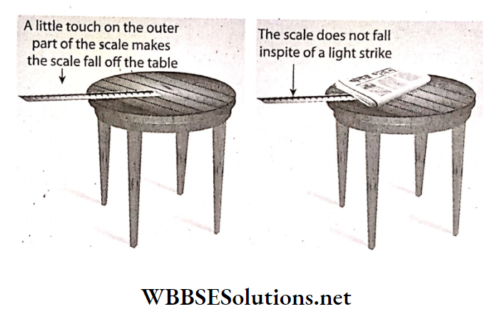
WBBSE Solutions For Class 7 Geography Chapter 3 Air Pressure Experiment to prove variation in air pressure.


Question 3. A plastic water bottle is partly filled with nearly boiling water and the stopper is sealed. You will see that after some time the bottle gets crushed. What is the reason?
Answer:

A plastic water bottle is partly filled with nearly boiling water and kept for a few hours. After some time we will see that the bottle gets a little crushed.

This is because as soon as the bottle is filled with hot water, the inside air heats up and goes out a bit. Then the water inside and the rest of the air slowly cool and compress, creating a vacuum inside the bottle.

As a result, the air pressure inside the bottle is much lower than the outside air pressure. So the bottle gets crushed under the influence of lateral pressure of the outside air.

WBBSE Solutions For Class 7 Geography Chapter 3 Air Pressure Experiment to prove variation in air pressure..

Question 4. Collect photographs and information about any storm in your district, state or country of the recent past from the newspapers and magazines. Make a collage with them. Paste it in your exercise book and show it to your friends in the classroom.
Answer:

WBBSE Solutions For Class 7 Geography Chapter 3 Air Pressure newspapers and magazines

WBBSE Solutions For Class 7 Geography

WBBSE Solutions For Class 7 Geography